NERC Data Catalogue Service
G-BASE (Geochemical Baseline Survey of the Environment) for south west England - stream sediments and shallow (5-20cm) soils
Default
Identification info
- Alternative title
- G-BASE for SW England
- Metadata Language
- English (en)
- Dataset Reference Date ()
- 1968
0115 936 3276
0115 936 3276
0115 936 3276
0115 936 3276
- Maintenance and update frequency
- annually
- GEMET - INSPIRE themes, version 1.0
- BGS Thesaurus of Geosciences
-
- UK Location (INSPIRE)
- Soil chemistry
- Geology
- Geochemistry
- Stream sampling
- Keywords ()
- Keywords
-
- NERC_DDC
- Limitations on Public Access
- otherRestrictions
- Other constraints
- no limitations
- Other constraints
- The dataset is made freely available for access, e.g. via the Internet. Either no third party data / information is contained in the dataset or BGS has secured written permission from the owner(s) of any third party data / information contained in the dataset to make the dataset freely accessible.
- Use constraints
- otherRestrictions
- Other constraints
- The copyright of materials derived from the British Geological Survey's work is vested in the Natural Environment Research Council [NERC]. No part of this work may be reproduced or transmitted in any form or by any means, or stored in a retrieval system of any nature, without the prior permission of the copyright holder, via the BGS Intellectual Property Rights Manager. Use by customers of information provided by the BGS, is at the customer's own risk. In view of the disparate sources of information at BGS's disposal, including such material donated to BGS, that BGS accepts in good faith as being accurate, the Natural Environment Research Council (NERC) gives no warranty, expressed or implied, as to the quality or accuracy of the information supplied, or to the information's suitability for any use. NERC/BGS accepts no liability whatever in respect of loss, damage, injury or other occurence however caused.
- Other constraints
- The dataset is made available to external clients under BGS Digital Data Licence terms and conditions. Revert to the IPR Section (iprdigital@bgs.ac.uk ) if further advice is required with regard to permitted usage.
- Spatial representation type
- grid
- Denominator
- 50000
- Topic category
-
- Geoscientific information
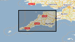
- Extent
-
Cornwall [id=43750]
- Dataset Reference Date ()
- 2009
- Extent
-
DEVON [id=164700]
- Dataset Reference Date ()
- 1979
))
- Begin date
- 2012
- Additional information
- Stream sediment samples were collected during June - September 2012, soils between June 2012 -March 2013. Geochemical sampling was carried out according to International Geochemical Sampling methods described by IGCP 259.
Distribution Information
- Data format
-
-
Web delivery of colour enhanced geochemical images.
()
-
Via TELLUS SW Project Portal
(
1.0
)
-
Digital data - Excel Workbook/Access Database
(
1.0
)
-
Web delivery of colour enhanced geochemical images.
()
- Resource Locator
-
G-BASE Homepage
This page provides details on one of the BGS's major science budget funded projects the Geochemical Baseline Survey of the Environment (G-BASE).
- Resource Locator
-
Tellus SW project web portal
Tellus South West project is a collaborative, environmental survey and research project funded by the Natural Environment Research Council (NERC) and carried out by a partnership of the British Geological Survey (BGS), the Centre for Ecology and Hydrology (CEH), the British Antarctic Survey (BAS) and the University of Exeter Camborne School of Mines. The multidisciplinary data collected will be managed by the NERC data centres at BGS and CEH. The following data for the south-west region will be delivered by the project. airborne magnetic and airborne radiometric survey (available now) soil and stream sediment geochemistry (G-BASE) (coming soon) airborne LiDAR survey: DTM and DSM (available now) habitat surveys (coming soon) multispectral and thermal imaging, Tamar Valley (available 2015)
- Resource Locator
-
G-BASE Homepage
This page provides details on one of the BGS's major science budget funded projects the Geochemical Baseline Survey of the Environment (G-BASE).
- Resource Locator
-
Tellus SW project web portal
Tellus South West project is a collaborative, environmental survey and research project funded by the Natural Environment Research Council (NERC) and carried out by a partnership of the British Geological Survey (BGS), the Centre for Ecology and Hydrology (CEH), the British Antarctic Survey (BAS) and the University of Exeter Camborne School of Mines. The multidisciplinary data collected will be managed by the NERC data centres at BGS and CEH. The following data for the south-west region will be delivered by the project. airborne magnetic and airborne radiometric survey (available now) soil and stream sediment geochemistry (G-BASE) (coming soon) airborne LiDAR survey: DTM and DSM (available now) habitat surveys (coming soon) multispectral and thermal imaging, Tamar Valley (available 2015)
- Quality Scope
- dataset
- Other
- dataset
Report
- Dataset Reference Date ()
- 2011
- Explanation
- See the referenced specification
- Degree
Report
- Dataset Reference Date ()
- 2010-12-08
- Explanation
- See http://eur-lex.europa.eu/LexUriServ/LexUriServ.do?uri=OJ:L:2010:323:0011:0102:EN:PDF
- Degree
- Statement
- Data generated from the analyses of stream sediment and soil samples, by XRFS (X-ray fluorescence spectrometry), collected during 2012 and 2013. Data quality control and conditioning procedures carried out in accordance with adopted and documented G-BASE protocol. 'G-BASE data conditioning procedures for stream sediment and soil chemical analyses' BGS Internal Report IR/05/150. Following the data QC process, all analytical data are loaded to the corporate Geochemistry Database. Digital geochemical images were generated in ArcGIS 10.1 using an Inverse Distance Weighting (IDW) interpolation algorithm with a cell size of 500m and a variable search radius with a maximum proximity distance of up to 10000m. Detailed Information on sampling and analytical methods are provided in the following published geochemical atlas: Regional geochemistry of Wales and west-central England: stream sediment and soil. Keyworth, Nottingham. British Geological Survey (2000). ISBN 0 85272 378 4.
Metadata
- File identifier
- 0214897c-7597-41ad-e054-002128a47908 XML
- Metadata Language
- English (en)
- Resource type
- dataset
- Metadata Date
- 2024-04-23
- Metadata standard name
- UK GEMINI
- Metadata standard version
- 2.3