NERC Data Catalogue Service
Late Glacial Sea Level Minima in the Western British Isles (NERC Grant NE/H024069/1)
Due to differential loading of ice on Britain and Ireland the glacial isostatic adjustment (GIA) response and therefore sea-level record will vary with distance from the centre of the British Irish Ice Sheet. GIA models are tested against geological observations, however there is a paucity of observations below -10m depth and the lateglacial period when the BIIS retreated leading to a rapid response of both sea-level and GIA. The aim of the project was to use geophysical data, ground truthed by core material, to find evidence of lateglacial sea-level minima in the Irish and Celtic Sea to refine these GIA models. Cruise log and digital copies of the core information (location, water depth, core length) taken onboard the research cruise CE12008 on the RV Celtic Explorer. A GeoReseource 6m vibrocorer was used to collect sediment samples. Cores where taken at multiple sites and from southern and eastern Ireland: Bantry Bay, Dunmanus Bay, Waterford,Offshore County Louth and Dundalk Bay, offshore Isle of Man; offshore Wales: Cardingan Bay; and offshore Northern Ireland: Kilkeel and Dundrum Bay, Belfast Lough.
Default
Identification info
- Metadata Language
- English (en)
- Dataset Reference Date ()
- 2016-07-22
- Maintenance and update frequency
- notApplicable
- GEMET - INSPIRE themes, version 1.0
- BGS Thesaurus of Geosciences
-
- Carbon dating
- Sea level
- NGDC Deposited Data
- Drill core
- Core analysis
- Foraminifera
- Mollusca
- Keywords ()
- Keywords
-
- NERC_DDC
- Limitations on Public Access
- otherRestrictions
- Other constraints
- no limitations
- Other constraints
- The dataset is made freely available for access, e.g. via the Internet. Either no third party data / information is contained in the dataset or BGS has secured written permission from the owner(s) of any third party data / information contained in the dataset to make the dataset freely accessible.
- Use constraints
- otherRestrictions
- Other constraints
- The copyright of materials derived from the British Geological Survey's work is vested in the Natural Environment Research Council [NERC]. No part of this work may be reproduced or transmitted in any form or by any means, or stored in a retrieval system of any nature, without the prior permission of the copyright holder, via the BGS Intellectual Property Rights Manager. Use by customers of information provided by the BGS, is at the customer's own risk. In view of the disparate sources of information at BGS's disposal, including such material donated to BGS, that BGS accepts in good faith as being accurate, the Natural Environment Research Council (NERC) gives no warranty, expressed or implied, as to the quality or accuracy of the information supplied, or to the information's suitability for any use. NERC/BGS accepts no liability whatever in respect of loss, damage, injury or other occurence however caused.
- Other constraints
- Available under the Open Government Licence subject to the following acknowledgement accompanying the reproduced NERC materials "Contains NERC materials ©NERC [year]"
- Topic category
-
- Geoscientific information
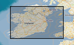
- Extent
-
CELTIC SEA [id=2001353]
- Dataset Reference Date ()
- 2010
- Extent
-
IRISH SEA [id=2001430]
- Dataset Reference Date ()
- 2010
N
S
E
W
))
- Begin date
- 2011-03-01
- End date
- 2014-07-31
- Additional information
- NERC grant split award, lead grant NE/H024301/1, associated grant NE/H024069/1
Spatial Reference System
No information provided.
Distribution Information
- Data format
-
- Resource Locator
- http://doi.org/10.1016/j.margeo.2015.08.021
- Resource Locator
- http://www.bgs.ac.uk/services/ngdc/accessions/index.html#item75409
- Resource Locator
- http://www.bgs.ac.uk/services/ngdc/accessions/index.html#item59889
- Resource Locator
- http://doi.org/10.1016/j.margeo.2015.08.021
- Resource Locator
- http://www.bgs.ac.uk/services/ngdc/accessions/index.html#item75409
- Resource Locator
- http://www.bgs.ac.uk/services/ngdc/accessions/index.html#item59889
- Quality Scope
- dataset
- Other
- dataset
Report
- Dataset Reference Date ()
- 2011
- Explanation
- See the referenced specification
- Degree
Report
- Dataset Reference Date ()
- 2010-12-08
- Explanation
- See http://eur-lex.europa.eu/LexUriServ/LexUriServ.do?uri=OJ:L:2010:323:0011:0102:EN:PDF
- Degree
- Statement
- Cores were collected in 2012 on the RV Celtic Explorer, cruise number CE12008. Core were collected using a GeoResources 6m barrel, 11 cm diameter virbrocorer. Each core was split, visually logged, photographed and sampled for radiocarbon dating. We used monospecific foraminifera and paired mollusc for dating. The radiocarbon dates were process and analysed at NERC radiocarbon facility in East Kilbride. Foraminifera assemblage counts were sample from selected cores. The samples were volumetrically measured, sieved through 500µm and 63µm sieves with the 500-63µm fraction used for the foraminifera analysis. The samples were picked wet.
Metadata
- File identifier
- 376ecc98-aa29-62bd-e054-002128a47908 XML
- Metadata Language
- English (en)
- Resource type
- dataset
- Metadata Date
- 2024-04-24
- Metadata standard name
- UK GEMINI
- Metadata standard version
- 2.3
British Geological Survey
Environmental Science Centre,Keyworth
,
NOTTINGHAM
,
NOTTINGHAMSHIRE
,
NG12 5GG
,
United Kingdom
+44 115 936 3100