NERC Data Catalogue Service
Corinth Rift horizon and fault seismic interpretations (NERC grant NE/J006564/1)
Fault and Horizon interpretations are provided for the Offshore Corinth Rift. The majority of the interpretations were based on 2D profiles from seismic reflection surveys collected by the R/V Maurice-Ewing in 2003, M.V. Vassilios in 1996 and 2003, and the R/V AEGEAO. Interpreted faults include major rift border faults as well as minor syn-rift faulting. Interpreted horizons include basement, a basin wide unconformity and five inferred transgressive surfaces based on variations in seismic character. Details of the fault and stratigraphic framework can be found in Nixon et al. (2016). Rapid spatiotemporal variations in rift structure during development of the Corinth Rift, central Greece. Tectonics, 35, 1225-1248.’ Published paper, Nixon, C. W., et al. (2016), Rapid spatiotemporal variations in rift structure during development of the Corinth Rift, central Greece, Tectonics, 35, 1225–1248, doi:10.1002/2015TC004026
Default
Identification info
- Metadata Language
- English (en)
- Dataset Reference Date ()
- 2016-05
University of Southampton
-
Lisa McNeill
(
Professor of Tectonics
)
National Oceanography Centre, European Way
,
Southampton
,
SO14 3ZH
,
United Kingdom
University of Bergen
-
Casey Nixon
(
Department of Earth Science
)
PO BOX 7803
,
Bergen
,
55020
,
Norway
- Maintenance and update frequency
- notApplicable
- GEMET - INSPIRE themes, version 1.0
- BGS Thesaurus of Geosciences
-
- Faults
- Stratigraphy
- NGDC Deposited Data
- Seismic interpretation
- Stratigraphic horizon
- Keywords ()
- Keywords
-
- NERC_DDC
- Limitations on Public Access
- otherRestrictions
- Other constraints
- intellectualPropertyRights
- Use constraints
- otherRestrictions
- Other constraints
- The copyright of materials derived from the British Geological Survey's work is vested in the Natural Environment Research Council [NERC]. No part of this work may be reproduced or transmitted in any form or by any means, or stored in a retrieval system of any nature, without the prior permission of the copyright holder, via the BGS Intellectual Property Rights Manager. Use by customers of information provided by the BGS, is at the customer's own risk. In view of the disparate sources of information at BGS's disposal, including such material donated to BGS, that BGS accepts in good faith as being accurate, the Natural Environment Research Council (NERC) gives no warranty, expressed or implied, as to the quality or accuracy of the information supplied, or to the information's suitability for any use. NERC/BGS accepts no liability whatever in respect of loss, damage, injury or other occurence however caused.
- Other constraints
- There are no restrictions on the use that may be made of the dataset, although an appropriate copyright acknowledgement must be made when any part of the dataset is reproduced. Either no third party data / information is contained in the dataset or BGS has secured written permission from the owner of any third party data / information contained in the dataset to make the dataset freely available without any use constraints - inclusion of any third party data / information will affect the copyright acknowledgement that needs to be made.
- Topic category
-
- Geoscientific information
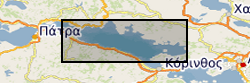
- Extent
-
GR
- Dataset Reference Date ()
- 2009
- Extent
-
GRC
- Dataset Reference Date ()
- 2009
- Extent
-
GREECE [id=356000]
- Dataset Reference Date ()
- 1979
N
S
E
W
))
- End date
- 2015-01
- Additional information
- NERC grant NE/J006564/1
Distribution Information
- Data format
-
- Resource Locator
-
BGS Homepage
(
HTTP
)
The BGS Homepage is an entry point to the BGS data services.
- Resource Locator
-
BGS Homepage
(
HTTP
)
The BGS Homepage is an entry point to the BGS data services.
- Quality Scope
- dataset
- Other
- dataset
Report
- Dataset Reference Date ()
- 2011
- Explanation
- See the referenced specification
- Degree
Report
- Dataset Reference Date ()
- 2010-12-08
- Explanation
- See http://eur-lex.europa.eu/LexUriServ/LexUriServ.do?uri=OJ:L:2010:323:0011:0102:EN:PDF
- Degree
- Statement
- Horizons and Faults were interpreted from a network of 2D seismic reflection data in Petrel between January 2013 and January 2014. Further lineage information may be available in the associated paper, Nixon et al. (2016). Rapid spatiotemporal variations in rift structure during development of the Corinth Rift, central Greece. Tectonics, 35, 1225-1248 doi:10.1002/2015TC004026
Metadata
- File identifier
- 416c5aad-2517-508c-e054-002128a47908 XML
- Metadata Language
- English (en)
- Resource type
- dataset
- Metadata Date
- 2024-04-14
- Metadata standard name
- UK GEMINI
- Metadata standard version
- 2.3
British Geological Survey
Environmental Science Centre,Keyworth
,
NOTTINGHAM
,
NOTTINGHAMSHIRE
,
NG12 5GG
,
United Kingdom
+44 115 936 3100