NERC Data Catalogue Service
Gro for GooD Catchment Characteristics Kwale County Kenya (NERC Grant NE/M008894/1)
The file consists of data sets from Kwale County, Kenya that describe biophysical characteristics of the catchment overlaid as layers. These include Basin, Sub-basins extent, Soil, DEM, Landuse, Slope, Rivers, Outlets and Monitoring Points. The data are in raster, shapefile, polygon, polyline and point format.
Default
Identification info
- Metadata Language
- English (en)
- Dataset Reference Date ()
- 2017-10-19
University of Oxford
-
Nancy Gladstone
(
Smith School of Enterprise and the Environment
)
Oxford
,
OX1 3QY
,
Jomo Kenyatta University of Agriculture and Technology
-
John Gathenya
(
Department of Soil, Water and Environmental Engineering
)
Nairobi
,
Kenya
,
- Maintenance and update frequency
- notApplicable
- GEMET - INSPIRE themes, version 1.0
- BGS Thesaurus of Geosciences
-
- NGDC Deposited Data
- Surface waters
- Catchment
- Keywords ()
- Keywords
-
- NERC_DDC
- Limitations on Public Access
- otherRestrictions
- Other constraints
- no limitations
- Other constraints
- The dataset is made freely available for access, e.g. via the Internet. Either no third party data / information is contained in the dataset or BGS has secured written permission from the owner(s) of any third party data / information contained in the dataset to make the dataset freely accessible.
- Use constraints
- otherRestrictions
- Other constraints
- The copyright of materials derived from the British Geological Survey's work is vested in the Natural Environment Research Council [NERC]. No part of this work may be reproduced or transmitted in any form or by any means, or stored in a retrieval system of any nature, without the prior permission of the copyright holder, via the BGS Intellectual Property Rights Manager. Use by customers of information provided by the BGS, is at the customer's own risk. In view of the disparate sources of information at BGS's disposal, including such material donated to BGS, that BGS accepts in good faith as being accurate, the Natural Environment Research Council (NERC) gives no warranty, expressed or implied, as to the quality or accuracy of the information supplied, or to the information's suitability for any use. NERC/BGS accepts no liability whatever in respect of loss, damage, injury or other occurence however caused.
- Other constraints
- Available under the Open Government Licence subject to the following acknowledgement accompanying the reproduced NERC materials "Contains NERC materials ©NERC [year]"
- Spatial representation type
- vector
- Topic category
-
- Geoscientific information
- Extent
-
KE
- Dataset Reference Date ()
- 2009
- Extent
-
KEN
- Dataset Reference Date ()
- 2009
- Extent
-
KENYA [id=687000]
- Dataset Reference Date ()
- 1979
N
S
E
W
))
- Begin date
- 1990-01-01
- End date
- 2015-12-31
- Additional information
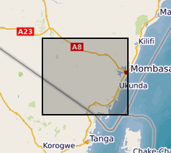
- xMin,yMin 47869.9695, 9491995.1231 : xMax,yMax 567375.2423, 9547808.6490 UTM X/Y Arc1960 (Kwale County, Kenya)
Distribution Information
- Data format
-
-
shapefile (.shp)
()
-
ESRI files
()
-
database files (.adf)
()
-
data files (.dat)
()
-
shapefile (.shp)
()
- Resource Locator
- https://upgro.org/consortium/gro-for-good/
- Resource Locator
- http://reshare.ukdataservice.ac.uk/853667/
- Resource Locator
- https://www.bgs.ac.uk/services/ngdc/accessions/index.html#item81690
- Resource Locator
- https://upgro.org/consortium/gro-for-good/
- Resource Locator
- http://reshare.ukdataservice.ac.uk/853667/
- Resource Locator
- https://www.bgs.ac.uk/services/ngdc/accessions/index.html#item81690
- Quality Scope
- dataset
- Other
- dataset
Report
- Dataset Reference Date ()
- 2011
- Explanation
- See the referenced specification
- Degree
Report
- Dataset Reference Date ()
- 2010-12-08
- Explanation
- See http://eur-lex.europa.eu/LexUriServ/LexUriServ.do?uri=OJ:L:2010:323:0011:0102:EN:PDF
- Degree
- Statement
- The data sets were processed in Arc GIS (ESRI ArcMap) environment through projection and re-projection to Arc 1960 datum UTM Zone 37S to describe the biophysical characteristics of the area. The basin and sub-basin boundary layers were obtained by delineation in Arc GIS based on 90m DEM, outlets and monitoring points within the river catchment. Soil (from KENSOTER) and Landuse layers based on Landsat (also in archive) were projected, overlaid and clipped to basin and sub-basin boundary. Catchment slope layer was developed based on the 90m DEM (also in archive). Based on KENSOTER database http://data.isric.org/geonetwork/srv/eng/catalog.search#/metadata/73e27136-9efe-49e4-af35-fd98b841d467; Landsat imagery courtesy of the U.S. Geological Survey (Visit the USGS at https://usgs.gov ) and Shuttle Radar Topography Mission (SRTM) 90m Digital Elevation Data (Jarvis A., H.I. Reuter, A. Nelson, E. Guevara, 2008, Hole-filled seamless SRTM data V4, International Centre for Tropical Agriculture (CIAT), available from http://srtm.csi.cgiar.org ).
Metadata
- File identifier
- 5cfe78c4-1461-5e24-e054-002128a47908 XML
- Metadata Language
- English (en)
- Resource type
- dataset
- Metadata Date
- 2024-04-23
- Metadata standard name
- UK GEMINI
- Metadata standard version
- 2.3
British Geological Survey
Environmental Science Centre,Keyworth
,
NOTTINGHAM
,
NOTTINGHAMSHIRE
,
NG12 5GG
,
United Kingdom
+44 115 936 3100