NERC Data Catalogue Service
Collapsible deposits dataset (5km Hex-Grid) version 8
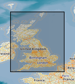
The 5km Hex GS Collapsible Deposits dataset shows a generalised view of the GeoSure Collapsible Deposits v8 dataset to a hexagonal grid resolution of 64.95km coverage area (side length of 5km). This dataset indicates areas of potential ground movement in a helpful and user-friendly format. The rating is based on a highest level of susceptibility identified within that Hex area: Low (1), Moderate (2), Significant (3). Areas of localised significant rating are also indicated. The summarising process via spatial statistics at this scale may lead to under or over estimation of the extent of a hazard. The supporting GeoSure reports can help inform planning decisions and indicate causes of subsidence. The reports can help inform planning decisions and indicate causes of subsidence. The Collapsible Ground dataset provides an assessment of the potential for a geological deposit to collapse (to subside rapidly) as a consequence of a metastable microfabric in loessic material. Such metastable material is prone to collapse when it is loaded (as by construction of a building, for example) and then saturated by water (as by rising groundwater, for example). Collapse may cause damage to overlying property. The methodology is based on the BGS Digital Map (DiGMapGB-50) and expert knowledge of the origin and behaviour of the formations so defined. It provides complete coverage of Great Britain, subject to revision in line with changes in DiGMapGB lithology codes and methodological improvements.
Default
Identification info
- Metadata Language
- English (en)
- Dataset Reference Date ()
- 2019-03-27
British Geological Survey
-
Enquiries
0115 936 3276
Environmental Science Centre, Nicker Hill, Keyworth
,
NOTTINGHAM
,
NOTTINGHAMSHIRE
,
NG12 5GG
,
United Kingdom
0115 936 3143
0115 936 3276
British Geological Survey
-
Enquiries
0115 936 3276
Environmental Science Centre, Nicker Hill, Keyworth
,
NOTTINGHAM
,
NOTTINGHAMSHIRE
,
NG12 5GG
,
United Kingdom
0115 936 3143
0115 936 3276
- Maintenance and update frequency
- asNeeded
- GEMET - INSPIRE themes, version 1.0
- BGS Thesaurus of Geosciences
-
- Collapsing soils
- Geohazards
- data.gov.uk (non-INSPIRE)
- Natural hazards
- Keywords ()
- Keywords
-
- NERC_DDC
- Limitations on Public Access
- otherRestrictions
- Other constraints
- no limitations
- Other constraints
- The dataset is made freely available for access, e.g. via the Internet. Either no third party data / information is contained in the dataset or BGS has secured written permission from the owner(s) of any third party data / information contained in the dataset to make the dataset freely accessible.
- Use constraints
- otherRestrictions
- Other constraints
- The copyright of materials derived from the British Geological Survey's work is vested in the Natural Environment Research Council [NERC]. No part of this work may be reproduced or transmitted in any form or by any means, or stored in a retrieval system of any nature, without the prior permission of the copyright holder, via the BGS Intellectual Property Rights Manager. Use by customers of information provided by the BGS, is at the customer's own risk. In view of the disparate sources of information at BGS's disposal, including such material donated to BGS, that BGS accepts in good faith as being accurate, the Natural Environment Research Council (NERC) gives no warranty, expressed or implied, as to the quality or accuracy of the information supplied, or to the information's suitability for any use. NERC/BGS accepts no liability whatever in respect of loss, damage, injury or other occurence however caused.
- Other constraints
- Available under the Open Government Licence subject to the following acknowledgement accompanying the reproduced NERC materials "Contains NERC materials ©NERC [year]"
- Topic category
-
- Geoscientific information
- Extent
-
GBN
- Dataset Reference Date ()
- 2009
- Extent
-
GREAT BRITAIN [id=139600]
- Dataset Reference Date ()
- 1979
N
S
E
W
))
- Begin date
- 1835
- End date
- 2019-01-07
Distribution Information
- Data format
-
-
ESRI Shapefile
()
-
ESRI Shapefile
()
- Resource Locator
- https://www.bgs.ac.uk/products/geosure/geosureHex.html
- Resource Locator
- https://www.bgs.ac.uk/products/geosure/geosureHex.html
- Quality Scope
- dataset
- Other
- dataset
Report
- Dataset Reference Date ()
- 2011
- Explanation
- See the referenced specification
- Degree
Report
- Dataset Reference Date ()
- 2010-12-08
- Explanation
- See http://eur-lex.europa.eu/LexUriServ/LexUriServ.do?uri=OJ:L:2010:323:0011:0102:EN:PDF
- Degree
- Statement
- Based on the GeoSure Collapsible Deposits Methodology as defined in BGS project documentation GeoSure V8. User Guide V8 available from BGS Enquiries.
Metadata
- File identifier
- 85119252-3faf-5a2a-e054-002128a47908 XML
- Metadata Language
- English (en)
- Resource type
- dataset
- Metadata Date
- 2024-04-24
- Metadata standard name
- UK GEMINI
- Metadata standard version
- 2.3
British Geological Survey
Environmental Science Centre, Keyworth
,
NOTTINGHAM
,
NOTTINGHAMSHIRE
,
NG12 5GG
,
United Kingdom
+44 115 936 3100