NERC Data Catalogue Service
Gro for GooD Water Quality Monitoring (NERC grant NE/M008894/1)
The file contain groundwater level/depth (WL), Groundwater and Surface Water Quality data (EC (micro-siemens per centimetre or µS/cm), Temperature (degrees C) and pH) for 49 points under fortnightly monitoring relevant to Gro for GooD research project in Kwale County, Kenya. Blank - Data not available. Note this is same dataset as NGDC record number 118189 with extended time series. Gro for GooD: Groundwater Risk Management for Growth and Development
Default
Identification info
- Metadata Language
- English (en)
- Dataset Reference Date ()
- 2019-08-07
University of Oxford
-
Nancy Gladstone
(
Smith School of Enterprise and the Environment
)
Oxford
,
OX1 3QY
,
- Maintenance and update frequency
- notApplicable
- GEMET - INSPIRE themes, version 1.0
- BGS Thesaurus of Geosciences
-
- NGDC Deposited Data
- Groundwater
- Water quality
- Ground water level
- Keywords ()
- Keywords
-
- NERC_DDC
- Limitations on Public Access
- otherRestrictions
- Other constraints
- no limitations
- Other constraints
- The dataset is made freely available for access, e.g. via the Internet. Either no third party data / information is contained in the dataset or BGS has secured written permission from the owner(s) of any third party data / information contained in the dataset to make the dataset freely accessible.
- Use constraints
- otherRestrictions
- Other constraints
- The copyright of materials derived from the British Geological Survey's work is vested in the Natural Environment Research Council [NERC]. No part of this work may be reproduced or transmitted in any form or by any means, or stored in a retrieval system of any nature, without the prior permission of the copyright holder, via the BGS Intellectual Property Rights Manager. Use by customers of information provided by the BGS, is at the customer's own risk. In view of the disparate sources of information at BGS's disposal, including such material donated to BGS, that BGS accepts in good faith as being accurate, the Natural Environment Research Council (NERC) gives no warranty, expressed or implied, as to the quality or accuracy of the information supplied, or to the information's suitability for any use. NERC/BGS accepts no liability whatever in respect of loss, damage, injury or other occurence however caused.
- Other constraints
- Available under the Open Government Licence subject to the following acknowledgement accompanying the reproduced NERC materials "Contains NERC materials ©NERC [year]"
- Spatial representation type
- vector
- Topic category
-
- Geoscientific information
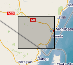
N
S
E
W
))
- Begin date
- 2016-01-23
- End date
- 2018-12-26
Distribution Information
- Data format
-
-
MS Excel
()
-
MS Excel
()
- Resource Locator
- https://www.bgs.ac.uk/services/ngdc/accessions/index.html#item129588
- Resource Locator
- https://www.bgs.ac.uk/services/ngdc/accessions/index.html#item129588
- Quality Scope
- dataset
- Other
- dataset
Report
- Dataset Reference Date ()
- 2011
- Explanation
- See the referenced specification
- Degree
Report
- Dataset Reference Date ()
- 2010-12-08
- Explanation
- See http://eur-lex.europa.eu/LexUriServ/LexUriServ.do?uri=OJ:L:2010:323:0011:0102:EN:PDF
- Degree
- Statement
- The collection of the data was done fortnightly using a Heron Dipper instrument (Water Level), and a Hanna meter instrument for groundwater and surface water quality (pH, EC and Temperature). Before the Hanna meter was used for water quality testing, the instrument was first calibrated for pH using pH7 (HI 7007) and pH4 (HI7004) solutions and for Electrical Conductivity, EC using conductivity solution (HI70031) to ensure accuracy of the measured parameters. To measure groundwater level, a Heron Dipper was lowered into the well and the groundwater level (table) measured with reference to ground level.
Metadata
- File identifier
- 9037db87-78d2-1d9e-e054-002128a47908 XML
- Metadata Language
- English (en)
- Resource type
- dataset
- Metadata Date
- 2024-07-25
- Metadata standard name
- UK GEMINI
- Metadata standard version
- 2.3
British Geological Survey
Environmental Science Centre,Keyworth
,
NOTTINGHAM
,
NOTTINGHAMSHIRE
,
NG12 5GG
,
United Kingdom
+44 115 936 3100