NERC Data Catalogue Service
Time series inorganic groundwater data for the Oju/Obi area of Eastern Nigeria from 1997 and 1998. Rainfall chloride time series data from selected rain gauges from 1997. Clay mineralogy data from selected boreholes in Oju and Obi.
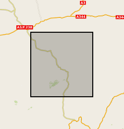
Oju/Obi is a remote part of Eastern Nigeria. There are severe water shortages during the 4-5 month dry season. The hydrogeology of the area is complex, and groundwater is difficult to find. In an attempt to understand and quantify the available groundwater resources within the area, DFID commissioned BGS from 1997 – 2000 to carry out a hydrogeological review of the area and devise appropriate and effective methods for siting wells and boreholes assessing groundwater resources and how best these resources could be developed. The field study involved the collection of time series data including groundwater chemistry and rainfall Cl along with mineralogical information. These results are being used by WaterAid, Local and regional Government to help local communities develop sustainable water supplies.
Default
Identification info
- Metadata Language
- English (en)
- Dataset Reference Date ()
- 2000
British Geological Survey
-
Enquiries
01491 692345
Maclean Building, Crowmarsh Gifford
,
WALLINGFORD
,
OXON
,
OX10 8BB
,
United Kingdom
01491 838800
01491 692345
British Geological Survey
-
Enquiries
01491 692345
Maclean Building, Crowmarsh Gifford
,
WALLINGFORD
,
OXON
,
OX10 8BB
,
United Kingdom
01491 838800
01491 692345
- Maintenance and update frequency
- notPlanned
- GEMET - INSPIRE themes, version 1.0
- BGS Thesaurus of Geosciences
-
- Water supply
- Groundwater
- Mineralogy
- data.gov.uk (non-INSPIRE)
- Keywords ()
- Keywords
-
- NERC_DDC
- Limitations on Public Access
- otherRestrictions
- Other constraints
- no limitations
- Other constraints
- The dataset is made freely available for access, e.g. via the Internet. Either no third party data / information is contained in the dataset or BGS has secured written permission from the owner(s) of any third party data / information contained in the dataset to make the dataset freely accessible.
- Use constraints
- otherRestrictions
- Other constraints
- The copyright of materials derived from the British Geological Survey's work is vested in the Natural Environment Research Council [NERC]. No part of this work may be reproduced or transmitted in any form or by any means, or stored in a retrieval system of any nature, without the prior permission of the copyright holder, via the BGS Intellectual Property Rights Manager. Use by customers of information provided by the BGS, is at the customer's own risk. In view of the disparate sources of information at BGS's disposal, including such material donated to BGS, that BGS accepts in good faith as being accurate, the Natural Environment Research Council (NERC) gives no warranty, expressed or implied, as to the quality or accuracy of the information supplied, or to the information's suitability for any use. NERC/BGS accepts no liability whatever in respect of loss, damage, injury or other occurence however caused.
- Other constraints
- Available under the Open Government Licence subject to the following acknowledgement accompanying the reproduced NERC materials "Contains NERC materials ©NERC [year]"
- Topic category
-
- Geoscientific information
- Extent
-
NG
- Dataset Reference Date ()
- 2009
- Extent
-
NGA
- Dataset Reference Date ()
- 2009
- Extent
-
NIGERIA [id=629000]
- Dataset Reference Date ()
- 1979
N
S
E
W
))
- Begin date
- 1997-04-01
- End date
- 2000-02-05
Spatial Reference System
No information provided.
Distribution Information
- Data format
-
-
Ms Excel
()
-
PDF
()
-
MS Word
()
-
Ms Excel
()
- Resource Locator
- Data
- Resource Locator
- Data
- Quality Scope
- dataset
- Other
- dataset
Report
- Dataset Reference Date ()
- 2011
- Explanation
- See the referenced specification
- Degree
Report
- Dataset Reference Date ()
- 2010-12-08
- Explanation
- See http://eur-lex.europa.eu/LexUriServ/LexUriServ.do?uri=OJ:L:2010:323:0011:0102:EN:PDF
- Degree
- Statement
- Samples were collected from selected groundwater sources and rain gauges for a hydrogeological review of the area. Mineralogical samples were taken from the first 10 m of selected boreholes. X-Ray diffraction was used to determine clay mineralogy. A subset of samples were analysed for whole rock particle size analysis.
Metadata
- File identifier
- 973c611b-abc0-1fd9-e054-002128a47908 XML
- Metadata Language
- English (en)
- Resource type
- dataset
- Metadata Date
- 2024-04-24
- Metadata standard name
- UK GEMINI
- Metadata standard version
- 2.3
British Geological Survey
Maclean Building, Crowmarsh Gifford
,
Wallingford
,
Oxfordshire
,
OX10 8BB
,
+44 115 936 3100