NERC Data Catalogue Service
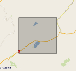
Processed InSAR images over Fentale Volcano, Main Ethiopian Rift (NERC grant NE/L01372X/1)
This data set contains 119 unwrapped and geocoded inteferograms derived from Cosmo-SkyMed (CSK) SAR scenes aquired over the Northen Main Ethiopian Rift between June 2014 and December 2015. This data set also contains displacement time series derived from processed CSK and Sentinel-1 inteferograms at the locations specified in the accompanying README files
Default
Identification info
- Metadata Language
- English (en)
- Dataset Reference Date ()
- 2019-11-06
University of Bristol
-
Ophelia George
(
Geophysics Laboratory and Field Manager, School of Earth Sciences
)
Wills Memorial Building
,
Bristol
,
BS8 1RJ
,
University of Bristol
-
Professor Juliet Biggs
(
Earth Sciences
)
Wills Memorial Building
,
Bristol
,
BS8 1RJ
,
- Maintenance and update frequency
- notApplicable
- GEMET - INSPIRE themes, version 1.0
- BGS Thesaurus of Geosciences
-
- Geodesy
- NGDC Deposited Data
- Deformation (structural geology)
- Rift valleys
- Volcanism
- Volcanoes
- Rift zone
- Keywords ()
- Keywords
-
- NERC_DDC
- Limitations on Public Access
- otherRestrictions
- Other constraints
- no limitations
- Other constraints
- The dataset is made freely available for access, e.g. via the Internet. Either no third party data / information is contained in the dataset or BGS has secured written permission from the owner(s) of any third party data / information contained in the dataset to make the dataset freely accessible.
- Use constraints
- otherRestrictions
- Other constraints
- The copyright of materials derived from the British Geological Survey's work is vested in the Natural Environment Research Council [NERC]. No part of this work may be reproduced or transmitted in any form or by any means, or stored in a retrieval system of any nature, without the prior permission of the copyright holder, via the BGS Intellectual Property Rights Manager. Use by customers of information provided by the BGS, is at the customer's own risk. In view of the disparate sources of information at BGS's disposal, including such material donated to BGS, that BGS accepts in good faith as being accurate, the Natural Environment Research Council (NERC) gives no warranty, expressed or implied, as to the quality or accuracy of the information supplied, or to the information's suitability for any use. NERC/BGS accepts no liability whatever in respect of loss, damage, injury or other occurence however caused.
- Other constraints
- Available under the Open Government Licence subject to the following acknowledgement accompanying the reproduced NERC materials "Contains NERC materials ©NERC [year]"
- Topic category
-
- Geoscientific information
N
S
E
W
))
- Begin date
- 2014-06-27
- End date
- 2015-12-22
- Code
- WGS 84 (EPSG::4326)
Distribution Information
- Data format
-
-
Ascii files, .ts, .rsc
()
-
pdf
()
-
ISCE output image file, .unw
()
-
Ascii files, .ts, .rsc
()
- Resource Locator
- Data
- Resource Locator
- Data
- Quality Scope
- dataset
- Other
- dataset
Report
- Dataset Reference Date ()
- 2011
- Explanation
- See the referenced specification
- Degree
Report
- Dataset Reference Date ()
- 2010-12-08
- Explanation
- See http://eur-lex.europa.eu/LexUriServ/LexUriServ.do?uri=OJ:L:2010:323:0011:0102:EN:PDF
- Degree
- Statement
- Pairs of SAR acquisitions were combined to form interferograms using ISCE software. Inteferegrams were based on the temporal and perpendicular baselines less than 300 days and 500 m respectively. Further details on the processing steps are provided in the accompanying README files.
Metadata
- File identifier
- 974d4873-051e-5e62-e054-002128a47908 XML
- Metadata Language
- English (en)
- Resource type
- dataset
- Metadata Date
- 2024-04-24
- Metadata standard name
- UK GEMINI
- Metadata standard version
- 2.3
British Geological Survey
Environmental Science Centre,Keyworth
,
NOTTINGHAM
,
NOTTINGHAMSHIRE
,
NG12 5GG
,
United Kingdom
+44 115 936 3100