NERC Data Catalogue Service
Index To The National Geological Records Centre Accessions Collection.
Index to acquisitions and donations of all types of geological record data. This information has been received from a variety of external organisations including public bodies and commercial concerns. The Oracle index was set up in 1988 and holds basic index information about the donor and the donation. The index has been expanded in 2009 to include other sections of BGS and covers all their donations. The majority are from Great Britain.
Default
Identification info
- Metadata Language
- English (en)
- Dataset Reference Date ()
- 1988
British Geological Survey
-
Enquiries
0115 936 3276
The Lyell Centre, Research Avenue South
,
EDINBURGH
,
LOTHIAN
,
EH14 4AP
,
United Kingdom
0115 936 3142
0115 936 3276
British Geological Survey
-
Enquiries
0115 936 3276
The Lyell Centre, Research Avenue South
,
EDINBURGH
,
LOTHIAN
,
EH14 4AP
,
United Kingdom
0115 936 3142
0115 936 3276
British Geological Survey
-
Enquiries
0115 936 3276
Environmental Science Centre, Nicker Hill, Keyworth
,
NOTTINGHAM
,
NOTTINGHAMSHIRE
,
NG12 5GG
,
United Kingdom
0115 936 3143
0115 936 3276
British Geological Survey
-
Enquiries
0115 936 3276
Environmental Science Centre, Nicker Hill, Keyworth
,
NOTTINGHAM
,
NOTTINGHAMSHIRE
,
NG12 5GG
,
United Kingdom
0115 936 3143
0115 936 3276
British Geological Survey
-
Enquiries
0115 936 3276
Environmental Science Centre, Nicker Hill, Keyworth
,
NOTTINGHAM
,
NOTTINGHAMSHIRE
,
NG12 5GG
,
United Kingdom
0115 936 3143
0115 936 3276
- Maintenance and update frequency
- daily
- GEMET - INSPIRE themes, version 1.0
- BGS Thesaurus of Geosciences
-
- Engineering geology
- Site investigations
- Maps
- Hydrogeology
- Boreholes
- UK Location (INSPIRE)
- Reports
- Keywords ()
- Keywords
-
- NERC_DDC
- Limitations on Public Access
- otherRestrictions
- Other constraints
- For BGS internal use only. Subject to usual BGS terms and conditions.
- Use constraints
- otherRestrictions
- Other constraints
- The copyright of materials derived from the British Geological Survey's work is vested in the Natural Environment Research Council [NERC]. No part of this work may be reproduced or transmitted in any form or by any means, or stored in a retrieval system of any nature, without the prior permission of the copyright holder, via the BGS Intellectual Property Rights Manager. Use by customers of information provided by the BGS, is at the customer's own risk. In view of the disparate sources of information at BGS's disposal, including such material donated to BGS, that BGS accepts in good faith as being accurate, the Natural Environment Research Council (NERC) gives no warranty, expressed or implied, as to the quality or accuracy of the information supplied, or to the information's suitability for any use. NERC/BGS accepts no liability whatever in respect of loss, damage, injury or other occurence however caused.
- Other constraints
- Either: (i) the dataset is made freely available, e.g. via the Internet, for a restricted category of use (e.g. educational use only); or (ii) the dataset has not been formally approved by BGS for access and use by external clients under licence, but its use may be permitted under alternative formal arrangements; or (iii) the dataset contains 3rd party data or information obtained by BGS under terms and conditions that must be consulted in order to determine the permitted usage of the dataset. Refer to the BGS staff member responsible for the creation of the dataset if further advice is required. He / she should be familiar with the composition of the dataset, particularly with regard to 3rd party IPR contained in it, and any resultant use restrictions. This staff member should revert to the IPR Section (ipr@bgs.ac.uk ) for advice, should the position not be clear.
- Spatial representation type
- grid
- Denominator
- 10000
- Topic category
-
- Geoscientific information
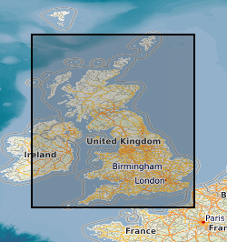
- Extent
-
GBN
- Dataset Reference Date ()
- 2009
- Extent
-
GREAT BRITAIN [id=139600]
- Dataset Reference Date ()
- 1979
N
S
E
W
))
- Begin date
- 1988
- Additional information
- Data are continuously removed from the collection therefore all except the most recently received material will have been processed.
Distribution Information
- Data format
-
-
DIGITAL
()
-
DIGITAL
()
- Resource Locator
- BGS Homepage
- Resource Locator
- BGS Homepage
- Quality Scope
- dataset
Report
- Dataset Reference Date ()
- 2011
- Explanation
- See the referenced specification
- Degree
Report
- Dataset Reference Date ()
- 2010-12-08
- Explanation
- See http://eur-lex.europa.eu/LexUriServ/LexUriServ.do?uri=OJ:L:2010:323:0011:0102:EN:PDF
- Degree
- Statement
- The original data are donations of geological data , index data from these were then transferred to an Oracle database.
Metadata
- File identifier
- 9df8df51-62dd-37a8-e044-0003ba9b0d98 XML
- Metadata Language
- English (en)
- Resource type
- dataset
- Metadata Date
- 2024-07-26
- Metadata standard name
- UK GEMINI
- Metadata standard version
- 2.3
British Geological Survey
The Lyell Centre, Research Avenue South
,
EDINBURGH
,
LOTHIAN
,
EH14 4AP
,
United Kingdom
+44 131 667 1000