NERC Data Catalogue Service
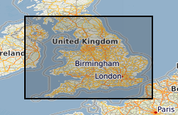
Aquifer Properties, Database Of Physical Properties Of Aquifers In England And Wales.
Default
Identification info
- Metadata Language
- English (en)
- Dataset Reference Date ()
- 1960
01491 692345
01491 692345
- Maintenance and update frequency
- irregular
- GEMET - INSPIRE themes, version 1.0
- BGS Thesaurus of Geosciences
-
- Aquifer properties
- Hydrogeology
- Permeability
- Pump tests
- UK Location (INSPIRE)
- Groundwater
- Porosity
- Hydrology
- Keywords ()
- Keywords
-
- NERC_DDC
- Limitations on Public Access
- otherRestrictions
- Other constraints
- Data are sold as package with printed report. Data are copyright and provision to third parties without agreement and/or licensing is limited.
- Use constraints
- otherRestrictions
- Other constraints
- The copyright of materials derived from the British Geological Survey's work is vested in the Natural Environment Research Council [NERC]. No part of this work may be reproduced or transmitted in any form or by any means, or stored in a retrieval system of any nature, without the prior permission of the copyright holder, via the BGS Intellectual Property Rights Manager. Use by customers of information provided by the BGS, is at the customer's own risk. In view of the disparate sources of information at BGS's disposal, including such material donated to BGS, that BGS accepts in good faith as being accurate, the Natural Environment Research Council (NERC) gives no warranty, expressed or implied, as to the quality or accuracy of the information supplied, or to the information's suitability for any use. NERC/BGS accepts no liability whatever in respect of loss, damage, injury or other occurence however caused.
- Other constraints
- Either: (i) the dataset is made freely available, e.g. via the Internet, for a restricted category of use (e.g. educational use only); or (ii) the dataset has not been formally approved by BGS for access and use by external clients under licence, but its use may be permitted under alternative formal arrangements; or (iii) the dataset contains 3rd party data or information obtained by BGS under terms and conditions that must be consulted in order to determine the permitted usage of the dataset. Refer to the BGS staff member responsible for the creation of the dataset if further advice is required. He / she should be familiar with the composition of the dataset, particularly with regard to 3rd party IPR contained in it, and any resultant use restrictions. This staff member should revert to the IPR Section (ipr@bgs.ac.uk ) for advice, should the position not be clear.
- Spatial representation type
- vector
- Denominator
- 10000
- Topic category
-
- Geoscientific information
- Extent
-
ENG
- Dataset Reference Date ()
- 2009
- Extent
-
ENGLAND [id=150000]
- Dataset Reference Date ()
- 1979
- Extent
-
WALES [id=170000]
- Dataset Reference Date ()
- 1979
- Extent
-
WLS
- Dataset Reference Date ()
- 2009
))
- Begin date
- 1960
- Additional information
- Date of some data capture may be unknown, but this does not materially affect data validity. Ongoing update of database subject to funding and is project driven. Density of data in proportion to drilling densities, from 1 per km2 to less than 1 per 100 km2. The summary data are included as CD-ROMS with printed copies of the Aquifer Property Manual publications. The database in Allen et al contains data on the Major Aquifers, Jones et al contains the summary data for both major and minor aquifers. The software formats used on the CD-ROMs may be outdated and Excel versions of the data can be supplied it to purchasers of the manuals on request. Detailed data are available in various formats by special arrangement. PUBLICATION: BIBLIOGRAPHICAL REFERENCES ALLEN, D J, BREWERTON, LJ, COLEBY, LM, GIBBS, BR, LEWIS, MA, MACDDONALD, AM, WAGSTAFF, SJ, AND WILLIARNS, AT. 1997. THE PHYSICAL PROPERTIES OF MAJOR AQUIFERS IN ENGLAND AND WALES. BRITISH GEOLOGICAL REPORT WD/97/34 312PP. ENVIRONMENT AGENCY R&D PUBLICATION 8. JONES, H.K.; MORRIS, B.L.; CHENEY, C.S.; BREWERTON, L.J.; MERRIN, P.D.; LEWIS, M.A.; MACDONALD, A.M. ; COLEBY, L.M.; TALBOT, J.C.; MCKENZIE, A.A.; BIRD, M.J.; CUNNINGHAM, J.E.; ROBINSON, V.. 2000 THE PHYSICAL PROPERTIES OF MINOR AQUIFERS IN ENGLAND AND WALES. BRITISH GEOLOGICAL SURVEY, 234PP. (WD/00/004, ENVIRONMENT AGENCY R&D PUBLICATION 68)
Distribution Information
- Data format
-
-
PAPER - Paper reports.
()
-
Microsoft Excel
(
Current version
)
-
Microsoft Access
(
Access 97
)
-
PAPER - Paper reports.
()
- Resource Locator
-
BGS Homepage
(
HTTP
)
The BGS Homepage is an entry point to the BGS data services.
- Resource Locator
-
BGS Homepage
(
HTTP
)
The BGS Homepage is an entry point to the BGS data services.
- Quality Scope
- dataset
- Other
- dataset
Report
- Dataset Reference Date ()
- 2011
- Explanation
- See the referenced specification
- Degree
Report
- Dataset Reference Date ()
- 2010-12-08
- Explanation
- See http://eur-lex.europa.eu/LexUriServ/LexUriServ.do?uri=OJ:L:2010:323:0011:0102:EN:PDF
- Degree
- Statement
- The data were compiled from original paper records collected by the EA for abstraction licensing, and by BGS for research. Data were subject to review and were assessed by project staff for completeness and interpretation accuracy. The original data were collated to give 'best' estimates for each parameter in individual boreholes and, where boreholes fell within a 100 metre radius, for groups of boreholes. Only the collated data is normally released.
Metadata
- File identifier
- 9df8df51-632a-37a8-e044-0003ba9b0d98 XML
- Metadata Language
- English (en)
- Resource type
- dataset
- Metadata Date
- 2024-04-21
- Metadata standard name
- UK GEMINI
- Metadata standard version
- 2.3