NERC Data Catalogue Service
The BGS Lexicon of Named Rock Units.
Default
Identification info
- Metadata Language
- English (en)
- Dataset Reference Date ()
- 1993
0115 936 3276
0115 936 3276
0115 936 3276
0115 936 3276
- Maintenance and update frequency
- daily
- GEMET - INSPIRE themes, version 1.0
- BGS Thesaurus of Geosciences
-
- Lithologic unit
- UK Location (INSPIRE)
- Rock stratigraphic unit
- Stratigraphic nomenclature
- Keywords ()
- Keywords
-
- NERC_DDC
- Limitations on Public Access
- otherRestrictions
- Other constraints
- Freely available via the Internet. Copyright control on use.
- Use constraints
- otherRestrictions
- Other constraints
- The copyright of materials derived from the British Geological Survey's work is vested in the Natural Environment Research Council [NERC]. No part of this work may be reproduced or transmitted in any form or by any means, or stored in a retrieval system of any nature, without the prior permission of the copyright holder, via the BGS Intellectual Property Rights Manager. Use by customers of information provided by the BGS, is at the customer's own risk. In view of the disparate sources of information at BGS's disposal, including such material donated to BGS, that BGS accepts in good faith as being accurate, the Natural Environment Research Council (NERC) gives no warranty, expressed or implied, as to the quality or accuracy of the information supplied, or to the information's suitability for any use. NERC/BGS accepts no liability whatever in respect of loss, damage, injury or other occurence however caused.
- Other constraints
- Either: (i) the dataset is made freely available, e.g. via the Internet, for a restricted category of use (e.g. educational use only); or (ii) the dataset has not been formally approved by BGS for access and use by external clients under licence, but its use may be permitted under alternative formal arrangements; or (iii) the dataset contains 3rd party data or information obtained by BGS under terms and conditions that must be consulted in order to determine the permitted usage of the dataset. Refer to the BGS staff member responsible for the creation of the dataset if further advice is required. He / she should be familiar with the composition of the dataset, particularly with regard to 3rd party IPR contained in it, and any resultant use restrictions. This staff member should revert to the IPR Section (ipr@bgs.ac.uk ) for advice, should the position not be clear.
- Spatial representation type
- grid
- Denominator
- 10000
- Topic category
-
- Geoscientific information
- Extent
-
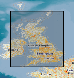
GB
- Dataset Reference Date ()
- 2009
- Extent
-
UK [id=139300]
- Dataset Reference Date ()
- 1979
- Extent
-
UKM
- Dataset Reference Date ()
- 2009
))
- Begin date
- 1786
- End date
- 2024
- Additional information
- Includes information imported from earlier databases. Continuously refined and developed to reflect current state of knowledge. The data are incomplete as they are constantly being refined, a flagging system indicates the completeness of individual entries. Detailed definitions only cover land area. A range of Spatial Detail is available. Detailed information available for specific stratotypes. General information for whole UK. There is a degree of logical consistency for entries flagged as 'Formal' or 'Informal'. Other records have varying degrees of logical consistency.
- Code
- WGS 84 (EPSG::4326)
Distribution Information
- Data format
-
-
MS Excel
()
-
.nt
()
-
MS Excel
()
- Resource Locator
-
BGS Lexicon Linked Data Service
(
WWW:LINK-1.0-http--link
)
BGS Lexicon Linked Data Service
- Resource Locator
-
The BGS Lexicon of Named Rock Units Search Tool
(
WWW:LINK-1.0-http--link
)
The BGS Lexicon of Named Rock Units Search Tool
- Resource Locator
-
BGS Vocablaries Linked Data File Download
(
WWW:DOWNLOAD-1.0-http--download
)
BGS Github vocablaries repo which makes .nt files available for download.
- Resource Locator
-
BGS Lexicon of Named Rock Units Homepage
(
WWW:LINK-1.0-http--link
)
BGS Lexicon of Named Rock Units Homepage
- Resource Locator
-
BGS Lexicon Linked Data Service
(
WWW:LINK-1.0-http--link
)
BGS Lexicon Linked Data Service
- Resource Locator
-
The BGS Lexicon of Named Rock Units Search Tool
(
WWW:LINK-1.0-http--link
)
The BGS Lexicon of Named Rock Units Search Tool
- Resource Locator
-
BGS Vocablaries Linked Data File Download
(
WWW:DOWNLOAD-1.0-http--download
)
BGS Github vocablaries repo which makes .nt files available for download.
- Resource Locator
-
BGS Lexicon of Named Rock Units Homepage
(
WWW:LINK-1.0-http--link
)
BGS Lexicon of Named Rock Units Homepage
- Quality Scope
- dataset
- Other
- dataset
Report
- Dataset Reference Date ()
- 2011
- Explanation
- See the referenced specification
- Degree
Report
- Dataset Reference Date ()
- 2010-12-08
- Explanation
- See http://eur-lex.europa.eu/LexUriServ/LexUriServ.do?uri=OJ:L:2010:323:0011:0102:EN:PDF
- Degree
- Statement
- Includes information imported from earlier databases. Formal records have good lineage and can be traced back to original signed paper records completed by BGS mapping geologists and can be verified by Lexicon Curator and Lexicon Manager.
Metadata
- File identifier
- 9df8df51-638e-37a8-e044-0003ba9b0d98 XML
- Metadata Language
- English (en)
- Resource type
- dataset
- Metadata Date
- 2024-07-26
- Metadata standard name
- UK GEMINI
- Metadata standard version
- 2.3