NERC Data Catalogue Service
Mineral Veins Of The Southern Pennine Orefield
3200 mineral veins (i.e. lead, fluorspar) of the Southern Pennine Orefield within the Peak District National Park captured as a single dataset in 1983 from BGS 1:10 560 published maps with additional veins from referenced literature. The data covers a small, very limited area. Also includes several pipe and flat deposits. Also includes mapped faults. The dataset is approximately 99.5% complete. Uses for the data include economic geology, mineral resources, mine hazards. Veins are numbered but not named.
Default
Identification info
- Metadata Language
- English (en)
- Dataset Reference Date ()
- 1983
British Geological Survey
-
Enquiries
0115 936 3276
Environmental Science Centre, Nicker Hill, Keyworth
,
NOTTINGHAM
,
NOTTINGHAMSHIRE
,
NG12 5GG
,
United Kingdom
0115 936 3143
0115 936 3276
British Geological Survey
-
Enquiries
0115 936 3276
Environmental Science Centre, Nicker Hill, Keyworth
,
NOTTINGHAM
,
NOTTINGHAMSHIRE
,
NG12 5GG
,
United Kingdom
0115 936 3143
0115 936 3276
British Geological Survey
-
Enquiries
0115 936 3276
Environmental Science Centre, Nicker Hill, Keyworth
,
NOTTINGHAM
,
NOTTINGHAMSHIRE
,
NG12 5GG
,
United Kingdom
0115 936 3143
0115 936 3276
British Geological Survey
-
Enquiries
0115 936 3276
Environmental Science Centre, Nicker Hill, Keyworth
,
NOTTINGHAM
,
NOTTINGHAMSHIRE
,
NG12 5GG
,
United Kingdom
0115 936 3143
0115 936 3276
- Maintenance and update frequency
- notPlanned
- GEMET - INSPIRE themes, version 1.0
- BGS Thesaurus of Geosciences
-
- Minerals
- Veins
- UK Location (INSPIRE)
- Keywords ()
- Keywords
-
- NERC_DDC
- Limitations on Public Access
- otherRestrictions
- Other constraints
- Represents best available digital data on Southern Pennine veins as mapped by diverse sources (mainly BGS field mapping)
- Use constraints
- otherRestrictions
- Other constraints
- The copyright of materials derived from the British Geological Survey's work is vested in the Natural Environment Research Council [NERC]. No part of this work may be reproduced or transmitted in any form or by any means, or stored in a retrieval system of any nature, without the prior permission of the copyright holder, via the BGS Intellectual Property Rights Manager. Use by customers of information provided by the BGS, is at the customer's own risk. In view of the disparate sources of information at BGS's disposal, including such material donated to BGS, that BGS accepts in good faith as being accurate, the Natural Environment Research Council (NERC) gives no warranty, expressed or implied, as to the quality or accuracy of the information supplied, or to the information's suitability for any use. NERC/BGS accepts no liability whatever in respect of loss, damage, injury or other occurence however caused.
- Other constraints
- Either: (i) the dataset is made freely available, e.g. via the Internet, for a restricted category of use (e.g. educational use only); or (ii) the dataset has not been formally approved by BGS for access and use by external clients under licence, but its use may be permitted under alternative formal arrangements; or (iii) the dataset contains 3rd party data or information obtained by BGS under terms and conditions that must be consulted in order to determine the permitted usage of the dataset. Refer to the BGS staff member responsible for the creation of the dataset if further advice is required. He / she should be familiar with the composition of the dataset, particularly with regard to 3rd party IPR contained in it, and any resultant use restrictions. This staff member should revert to the IPR Section (ipr@bgs.ac.uk ) for advice, should the position not be clear.
- Spatial representation type
- grid
- Denominator
- 10000
- Topic category
-
- Geoscientific information
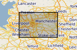
- Extent
-
PENNINES & ADJACENT AREAS [id=153000]
- Dataset Reference Date ()
- 1979
N
S
E
W
))
- Begin date
- 1985
- End date
- 1986
Distribution Information
- Data format
-
-
MS EXCEL - Excel spreadsheet
()
-
ARCVIEW - .shp files
()
-
MS EXCEL - Excel spreadsheet
()
- Resource Locator
-
BGS Homepage
(
HTTP
)
The BGS Homepage is an entry point to the BGS data services.
- Resource Locator
-
BGS Homepage
(
HTTP
)
The BGS Homepage is an entry point to the BGS data services.
- Quality Scope
- dataset
- Other
- dataset
Report
- Dataset Reference Date ()
- 2011
- Explanation
- See the referenced specification
- Degree
Report
- Dataset Reference Date ()
- 2010-12-08
- Explanation
- See http://eur-lex.europa.eu/LexUriServ/LexUriServ.do?uri=OJ:L:2010:323:0011:0102:EN:PDF
- Degree
- Statement
- The South Pennine Orefield mineral vein dataset was digitised from 46 1:10560 and 1:10000 BGS geological maps. It was part of the multidisciplinary study that was eventually published as a book entitled ‘Metallogenic models and exploration criteria for buried carbonate-hosted ore deposits - a multidisciplinary study in eastern England’ (Plant, J A and Jones, D G (editors) (Keyworth, Nottingham: British Geological Survey; London: Institution of Mining and Metallurgy). The data consists of numerous pairs of Eastings and Northings which were 'stream digitised' from the maps over a 3 month period and included digitised veins, 'pipes' and faults. These were hand-joined veins across map sheet boundaries by editing each end XY pair to match across the boundary. The data set was added to by some additional veins from published sketch maps in the Peak District Historical Society Bulletins but the majority were from BGS maps. The data was stored on a VAX archive tape and eventually translated into Word and then Excel and finally an ESRI shapefile version was created. No further work has been done on this dataset since its collection and translation and it contains no attribute information beyond the distinction between faults, pipes and veins.
Metadata
- File identifier
- 9df8df51-63ea-37a8-e044-0003ba9b0d98 XML
- Metadata Language
- English (en)
- Resource type
- dataset
- Metadata Date
- 2024-04-21
- Metadata standard name
- UK GEMINI
- Metadata standard version
- 2.3
British Geological Survey
Environmental Science Centre,Keyworth
,
NOTTINGHAM
,
NOTTINGHAMSHIRE
,
NG12 5GG
,
United Kingdom
+44 115 936 3100