NERC Data Catalogue Service
Aeromagnetic Survey Of Great Britain And Northern Ireland
Digitised version of aeromagnetic survey records of Great Britain comprising a record for each digitised point, supported by survey and 'ends and bends' based line indexes. Original records include flight line records, worksheets, contour sheets and air photos provided by contractors at completion of each survey. Worksheets digitised by BGS during 1980's Smith and Royles 1989.
Default
Identification info
- Metadata Language
- English (en)
- Dataset Reference Date ()
- 1987
British Geological Survey
-
Enquiries
0115 936 3276
The Lyell Centre, Research Avenue South
,
EDINBURGH
,
LOTHIAN
,
EH14 4AP
,
United Kingdom
0115 936 3142
0115 936 3276
British Geological Survey
-
Enquiries
0115 936 3276
The Lyell Centre, Research Avenue South
,
EDINBURGH
,
LOTHIAN
,
EH14 4AP
,
United Kingdom
0115 936 3142
0115 936 3276
British Geological Survey
-
Enquiries
0115 936 3276
Environmental Science Centre, Nicker Hill, Keyworth
,
NOTTINGHAM
,
NOTTINGHAMSHIRE
,
NG12 5GG
,
United Kingdom
0115 936 3143
0115 936 3276
British Geological Survey
-
Enquiries
0115 936 3276
Environmental Science Centre, Nicker Hill, Keyworth
,
NOTTINGHAM
,
NOTTINGHAMSHIRE
,
NG12 5GG
,
United Kingdom
0115 936 3143
0115 936 3276
British Geological Survey
-
Enquiries
0115 936 3276
Environmental Science Centre, Nicker Hill, Keyworth
,
NOTTINGHAM
,
NOTTINGHAMSHIRE
,
NG12 5GG
,
United Kingdom
0115 936 3143
0115 936 3276
- Maintenance and update frequency
- notPlanned
- GEMET - INSPIRE themes, version 1.0
- BGS Thesaurus of Geosciences
-
- UK Location (INSPIRE)
- Geophysics
- Geophysical surveys
- Aerial magnetic surveys
- Geology
- Magnetic surveys
- Scottish SDI
- Aerial geophysical surveys
- Keywords ()
- Keywords
-
- NERC_DDC
- Limitations on Public Access
- otherRestrictions
- Use constraints
- otherRestrictions
- Other constraints
- The copyright of materials derived from the British Geological Survey's work is vested in the Natural Environment Research Council [NERC]. No part of this work may be reproduced or transmitted in any form or by any means, or stored in a retrieval system of any nature, without the prior permission of the copyright holder, via the BGS Intellectual Property Rights Manager. Use by customers of information provided by the BGS, is at the customer's own risk. In view of the disparate sources of information at BGS's disposal, including such material donated to BGS, that BGS accepts in good faith as being accurate, the Natural Environment Research Council (NERC) gives no warranty, expressed or implied, as to the quality or accuracy of the information supplied, or to the information's suitability for any use. NERC/BGS accepts no liability whatever in respect of loss, damage, injury or other occurence however caused.
- Other constraints
- Either: (i) the dataset is made freely available, e.g. via the Internet, for a restricted category of use (e.g. educational use only); or (ii) the dataset has not been formally approved by BGS for access and use by external clients under licence, but its use may be permitted under alternative formal arrangements; or (iii) the dataset contains 3rd party data or information obtained by BGS under terms and conditions that must be consulted in order to determine the permitted usage of the dataset. Refer to the BGS staff member responsible for the creation of the dataset if further advice is required. He / she should be familiar with the composition of the dataset, particularly with regard to 3rd party IPR contained in it, and any resultant use restrictions. This staff member should revert to the IPR Section (ipr@bgs.ac.uk ) for advice, should the position not be clear.
- Spatial representation type
- textTable
- Topic category
-
- Geoscientific information
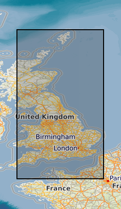
- Extent
-
GB
- Dataset Reference Date ()
- 2009
- Extent
-
UK CONTINENTAL SHELF [id=121701]
- Dataset Reference Date ()
- 1979
- Extent
-
UK [id=139300]
- Dataset Reference Date ()
- 1979
- Extent
-
UKM
- Dataset Reference Date ()
- 2009
N
S
E
W
))
- Begin date
- 1955
- End date
- 1965
- Additional information
- Bounding rectangle approx 70% covered. Flight line separation varies between 2km and 0.4km. Line spacing 2km, but 0.4km in SW England. Fuducial Location, Doppler Offshore. Mostly digitised from 1:63360 (+1:253440 and 1:25000) scale worksheets. 305m (+457m,549m,152m) flying height. Surveys flown over 10 years. Some variation in flying heights, line separation etc
Distribution Information
- Data format
-
-
DIGITAL - Digitised point records with X,Y,Flight height, Mag Value
()
-
DIGITAL - Digitised point records with X,Y,Flight height, Mag Value
()
- Resource Locator
- http://www.bgs.ac.uk/products/geophysics/aeromagneticRegional.html
- Resource Locator
- http://www.bgs.ac.uk/products/geophysics/aeromagneticRegional.html
- Quality Scope
- dataset
- Other
- dataset
Report
- Dataset Reference Date ()
- 2011
- Explanation
- See the referenced specification
- Degree
Report
- Dataset Reference Date ()
- 2010-12-08
- Explanation
- See http://eur-lex.europa.eu/LexUriServ/LexUriServ.do?uri=OJ:L:2010:323:0011:0102:EN:PDF
- Degree
- Statement
- Flight line records, worksheets, contour sheets and air photos provided by contractors at completion of each survey. Worksheets digitised by BGS during 1980's Smith and Royles 1989.
Metadata
- File identifier
- 9df8df51-63f3-37a8-e044-0003ba9b0d98 XML
- Metadata Language
- English (en)
- Resource type
- dataset
- Metadata Date
- 2024-04-24
- Metadata standard name
- UK GEMINI
- Metadata standard version
- 2.3
British Geological Survey
Environmental Science Centre, Keyworth
,
NOTTINGHAM
,
NOTTINGHAMSHIRE
,
NG12 5GG
,
United Kingdom
+44 115 936 3100