NERC Data Catalogue Service
GeoSure Collapsible Deposits
The GeoSure datasets and related reports from the British Geological Survey provide information about potential ground movement due to six types of natural geological hazard, in a helpful and user-friendly format. The reports can help inform planning decisions and indicate causes of subsidence. The Collapsible Ground dataset provides an assessment of the potential for a geological deposit to collapse (to subside rapidly) as a consequence of a metastable microfabric in loessic material. Such metastable material is prone to collapse when it is loaded (as by construction of a building, for example) and then saturated by water (as by rising groundwater, for example). Collapse may cause damage to overlying property. The methodology is based on BGS DiGMapGB-50 (Digital Map) and expert knowledge of the origin and behaviour of the formations so defined. It provides complete coverage of Great Britain, subject to revision in line with changes in DiGMapGB lithology codes and methodological improvements. The storage formats of the data are ESRI and MapInfo but other formats can be supplied.
Default
Identification info
- Metadata Language
- English (en)
- Dataset Reference Date ()
- 2005-05-09
British Geological Survey
-
Enquiries
0115 936 3276
Environmental Science Centre, Nicker Hill, Keyworth
,
NOTTINGHAM
,
NOTTINGHAMSHIRE
,
NG12 5GG
,
United Kingdom
0115 936 3143
0115 936 3276
British Geological Survey
-
Enquiries
0115 936 3276
Environmental Science Centre, Nicker Hill, Keyworth
,
NOTTINGHAM
,
NOTTINGHAMSHIRE
,
NG12 5GG
,
United Kingdom
0115 936 3143
0115 936 3276
British Geological Survey
-
Enquiries
0115 936 3276
Environmental Science Centre, Nicker Hill, Keyworth
,
NOTTINGHAM
,
NOTTINGHAMSHIRE
,
NG12 5GG
,
United Kingdom
0115 936 3143
0115 936 3276
- Maintenance and update frequency
- asNeeded
- GEMET - INSPIRE themes, version 1.0
- BGS Thesaurus of Geosciences
-
- Natural hazards
- UK Location (INSPIRE)
- Keywords ()
- Keywords
-
- NERC_DDC
- Limitations on Public Access
- otherRestrictions
- Use constraints
- otherRestrictions
- Other constraints
- The copyright of materials derived from the British Geological Survey's work is vested in the Natural Environment Research Council [NERC]. No part of this work may be reproduced or transmitted in any form or by any means, or stored in a retrieval system of any nature, without the prior permission of the copyright holder, via the BGS Intellectual Property Rights Manager. Use by customers of information provided by the BGS, is at the customer's own risk. In view of the disparate sources of information at BGS's disposal, including such material donated to BGS, that BGS accepts in good faith as being accurate, the Natural Environment Research Council (NERC) gives no warranty, expressed or implied, as to the quality or accuracy of the information supplied, or to the information's suitability for any use. NERC/BGS accepts no liability whatever in respect of loss, damage, injury or other occurence however caused.
- Other constraints
- The dataset is made available to external clients under BGS Digital Data Licence terms and conditions. Revert to the IPR Section (iprdigital@bgs.ac.uk ) if further advice is required with regard to permitted usage.
- Spatial representation type
- vector
- Denominator
- 50000
- Topic category
-
- Geoscientific information
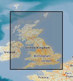
- Extent
-
ENG
- Dataset Reference Date ()
- 2009
- Extent
-
ENGLAND [id=150000]
- Dataset Reference Date ()
- 1979
- Extent
-
SCOTLAND [id=140000]
- Dataset Reference Date ()
- 1979
- Extent
-
SCT
- Dataset Reference Date ()
- 2009
- Extent
-
WALES [id=170000]
- Dataset Reference Date ()
- 1979
- Extent
-
WLS
- Dataset Reference Date ()
- 2009
N
S
E
W
))
- Additional information
- Geotechnical data abstracted from NGDC site investigation collection and entered into the BGS geotechnical database. Methodology may be revised in the light of new knowledge or customer feedback. Changes in DiGMapGB-50 base data will require periodic or continuous revision. ADDITIONAL_INFO 1 = Complete GB National Coverage, subject to revision in line with changes in DiGMapGB-50 lithology codes. Based on 1:50 000 DiGMapGB-50 linework. Methodology consistent throughout. Otherwise subject to logical consistency of DiGMapGB-50.
Distribution Information
- Data format
-
-
ESRI Shapefile
(
Current BGS version
)
-
ESRI Shapefile
(
Current BGS version
)
- Resource Locator
- BGS GeoSure Homepage
- Resource Locator
- BGS GeoSure Homepage
- Quality Scope
- dataset
Report
- Dataset Reference Date ()
- 2011
- Explanation
- See the referenced specification
- Degree
Report
- Dataset Reference Date ()
- 2010-12-08
- Explanation
- See http://eur-lex.europa.eu/LexUriServ/LexUriServ.do?uri=OJ:L:2010:323:0011:0102:EN:PDF
- Degree
- Statement
- Methodology devised by GeoHazard project. Latest version and earlier versions are held in project files.
Metadata
- File identifier
- 9df8df52-d605-37a8-e044-0003ba9b0d98 XML
- Metadata Language
- English (en)
- Resource type
- dataset
- Metadata Date
- 2024-04-24
- Metadata standard name
- UK GEMINI
- Metadata standard version
- 2.3
British Geological Survey
Environmental Science Centre, Keyworth
,
NOTTINGHAM
,
NOTTINGHAMSHIRE
,
NG12 5GG
,
United Kingdom
+44 115 936 3100