NERC Data Catalogue Service
GeoSure Shrink Swell Deposits
The GeoSure data sets and reports from the British Geological Survey provide information about potential ground movement or subsidence in a helpful and user-friendly format. The reports can help inform planning decisions and indicate causes of subsidence. The methodology is based on BGS DiGMap (Digital Map) and expert knowledge of the behaviour of the formations so defined. This dataset provides an assessment of the potential for a geological deposit to shrink and swell. Many soils contain clay minerals that absorb water when wet (making them swell), and lose water as they dry (making them shrink). This shrink-swell behaviour is controlled by the type and amount of clay in the soil, and by seasonal changes in the soil moisture content (related to rainfall and local drainage). The rock formations most susceptible to shrink-swell behaviour are found mainly in the south-east of Britain. Clay rocks elsewhere in the country are older and have been hardened by burial deep in the earth and are less able to absorb water. The BGS has carried out detailed geotechnical and mineralogical investigations into rock types known to shrink, and are modelling their properties across the near surface. This research underpins guidance contained in the national GeoSure dataset, and is the basis for our responses to local authorities, companies and members of the public who require specific information on the hazard in their areas. The BGS is undertaking a wide-ranging research programme to investigate this phenomenon by identifying those areas most at risk and developing sustainable management solutions. Complete Great Britain national coverage is available. The storage formats of the data are ESRI and MapInfo but other formats can be supplied.
Default
Identification info
- Metadata Language
- English (en)
- Dataset Reference Date ()
- 2005-05-09
British Geological Survey
-
Enquiries
0115 936 3276
Environmental Science Centre, Nicker Hill, Keyworth
,
NOTTINGHAM
,
NOTTINGHAMSHIRE
,
NG12 5GG
,
United Kingdom
0115 936 3143
0115 936 3276
British Geological Survey
-
Enquiries
0115 936 3276
Environmental Science Centre, Nicker Hill, Keyworth
,
NOTTINGHAM
,
NOTTINGHAMSHIRE
,
NG12 5GG
,
United Kingdom
0115 936 3143
0115 936 3276
British Geological Survey
-
Enquiries
0115 936 3276
Environmental Science Centre, Nicker Hill, Keyworth
,
NOTTINGHAM
,
NOTTINGHAMSHIRE
,
NG12 5GG
,
United Kingdom
0115 936 3143
0115 936 3276
- Maintenance and update frequency
- asNeeded
- GEMET - INSPIRE themes, version 1.0
- BGS Thesaurus of Geosciences
-
- Natural hazards
- UK Location (INSPIRE)
- Scottish SDI
- Keywords ()
- Keywords
-
- NERC_DDC
- Limitations on Public Access
- otherRestrictions
- Use constraints
- otherRestrictions
- Other constraints
- The copyright of materials derived from the British Geological Survey's work is vested in the Natural Environment Research Council [NERC]. No part of this work may be reproduced or transmitted in any form or by any means, or stored in a retrieval system of any nature, without the prior permission of the copyright holder, via the BGS Intellectual Property Rights Manager. Use by customers of information provided by the BGS, is at the customer's own risk. In view of the disparate sources of information at BGS's disposal, including such material donated to BGS, that BGS accepts in good faith as being accurate, the Natural Environment Research Council (NERC) gives no warranty, expressed or implied, as to the quality or accuracy of the information supplied, or to the information's suitability for any use. NERC/BGS accepts no liability whatever in respect of loss, damage, injury or other occurence however caused.
- Other constraints
- The dataset is made available to external clients under BGS Digital Data Licence terms and conditions. Revert to the IPR Section (iprdigital@bgs.ac.uk ) if further advice is required with regard to permitted usage.
- Spatial representation type
- vector
- Denominator
- 50000
- Topic category
-
- Geoscientific information
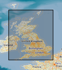
- Extent
-
ENG
- Dataset Reference Date ()
- 2009
- Extent
-
ENGLAND [id=150000]
- Dataset Reference Date ()
- 1979
- Extent
-
SCOTLAND [id=140000]
- Dataset Reference Date ()
- 1979
- Extent
-
SCT
- Dataset Reference Date ()
- 2009
- Extent
-
WALES [id=170000]
- Dataset Reference Date ()
- 1979
- Extent
-
WLS
- Dataset Reference Date ()
- 2009
N
S
E
W
))
- Additional information
- Geotechnical data abstracted from NGDC site investigation collection and entered into the BGS geotechnical database. Methodology may be revised in the light of new knowledge or customer feedback. Changes in DiGMapGB-50 base data will require periodic or continuous revision. ADDITIONAL_INFO 1 = Complete GB National Coverage, subject to revision in line with changes in DiGMapGB-50 lithology codes. Based on 1:50 000 DiGMapGB-50 linework. Methodology consistent throughout. Otherwise subject to logical consistency of DiGMapGB-50.
Distribution Information
- Data format
-
-
ESRI Shapefile
(
Current BGS version
)
-
ESRI Shapefile
(
Current BGS version
)
- Resource Locator
- BGS GeoSure Homepage
- Resource Locator
- BGS GeoSure Homepage
- Quality Scope
- dataset
Report
- Dataset Reference Date ()
- 2011
- Explanation
- See the referenced specification
- Degree
Report
- Dataset Reference Date ()
- 2010-12-08
- Explanation
- See http://eur-lex.europa.eu/LexUriServ/LexUriServ.do?uri=OJ:L:2010:323:0011:0102:EN:PDF
- Degree
- Statement
- Methodology devised by GeoHazard project. Latest version and earlier versions are held in project files.
Metadata
- File identifier
- 9df8df52-d608-37a8-e044-0003ba9b0d98 XML
- Metadata Language
- English (en)
- Resource type
- dataset
- Metadata Date
- 2024-04-21
- Metadata standard name
- UK GEMINI
- Metadata standard version
- 2.3
British Geological Survey
Environmental Science Centre, Keyworth
,
NOTTINGHAM
,
NOTTINGHAMSHIRE
,
NG12 5GG
,
United Kingdom
+44 115 936 3100