NERC Data Catalogue Service
Historic Land Use associated with Mineral Planning Permissions for England
Default
Identification info
- Metadata Language
- English (en)
- Dataset Reference Date ()
- 2008-07-01
0115 936 3276
0115 936 3276
0115 936 3276
- Maintenance and update frequency
- notApplicable
- GEMET - INSPIRE themes, version 1.0
- BGS Thesaurus of Geosciences
-
- Mineral deposits
- Land use planning
- UK Location (INSPIRE)
- Keywords ()
- Keywords
-
- NERC_DDC
- Limitations on Public Access
- otherRestrictions
- Other constraints
- license
- Use constraints
- otherRestrictions
- Other constraints
- The copyright of materials derived from the British Geological Survey's work is vested in the Natural Environment Research Council [NERC]. No part of this work may be reproduced or transmitted in any form or by any means, or stored in a retrieval system of any nature, without the prior permission of the copyright holder, via the BGS Intellectual Property Rights Manager. Use by customers of information provided by the BGS, is at the customer's own risk. In view of the disparate sources of information at BGS's disposal, including such material donated to BGS, that BGS accepts in good faith as being accurate, the Natural Environment Research Council (NERC) gives no warranty, expressed or implied, as to the quality or accuracy of the information supplied, or to the information's suitability for any use. NERC/BGS accepts no liability whatever in respect of loss, damage, injury or other occurence however caused.
- Other constraints
- The dataset is made available to external clients under BGS Digital Data Licence terms and conditions. Revert to the IPR Section (iprdigital@bgs.ac.uk ) if further advice is required with regard to permitted usage.
- Spatial representation type
- vector
- Denominator
- 25000
- Topic category
-
- Geoscientific information
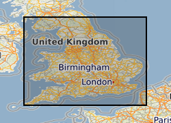
- Extent
-
GB
- Dataset Reference Date ()
- 2009
- Extent
-
UK [id=139300]
- Dataset Reference Date ()
- 1979
- Extent
-
UKM
- Dataset Reference Date ()
- 2009
))
- Begin date
- 1930
- End date
- 1980
- Additional information
- Whilst this dataset covers England only, it is expected that a similar dataset will be made available that covers Wales.
Distribution Information
- Data format
-
-
Shape file
(
Any version
)
-
Shape file
(
Any version
)
- Resource Locator
-
BGS Homepage
(
HTTP
)
The BGS Homepage is an entry point to the BGS data services.
- Resource Locator
-
BGS Homepage
(
HTTP
)
The BGS Homepage is an entry point to the BGS data services.
- Quality Scope
- dataset
Report
- Dataset Reference Date ()
- 2011
- Explanation
- See the referenced specification
- Degree
Report
- Dataset Reference Date ()
- 2010-12-08
- Explanation
- See http://eur-lex.europa.eu/LexUriServ/LexUriServ.do?uri=OJ:L:2010:323:0011:0102:EN:PDF
- Degree
- Statement
- A shapefile covering England comprising land use polygons taken from historical MHLG Minerals Planning Permissions Maps. The shapefile represents merged shapefiles digitised from individual 1:25000 scale maps. Information on the map key has been used to attribute the polygons with the folloeing land use categories: wet areas, derelict areas, restored quarry (filled and unfilled), and tip heaps & spoil heaps.
Metadata
- File identifier
- 9df8df52-d6c7-37a8-e044-0003ba9b0d98 XML
- Metadata Language
- English (en)
- Resource type
- dataset
- Metadata Date
- 2024-04-24
- Metadata standard name
- UK GEMINI
- Metadata standard version
- 2.3