NERC Data Catalogue Service
Marine Quaternary Map - UK Waters - 1:1M scale
This is a digital version of the paper based 1:1M scale Offshore Quaternary map, North and South sheets. Customers should be aware that, given the age of the paper based maps, the digital version is not quality assured and BGS can accept no liability for the information held on the digital map. In addition, published 1:250,000 Quaternary maps are available. These contain more detailed subdivision of the Quaternary succession. The original paper based map covers the UK Continental shelf. The paper map is symbolised using lithology and chronology. The lithological boundaries were compiled from the data published in the BGS 1:250,000 Quaternary Geology map series and from revised interpretation of core and borehole data. Core and borehole sites are commonly 5 to 20 km apart, thus the lithological divisions are generalised. The formations and sequences identified by BGS have been grouped into Quaternary age ranges. The geological codes assigned to the digital version of the map have been compiled using the key information held on the paper map. The LEX-ROCK style codes combine the lithology and chronology and have been subject to the standard BGS approval process.
Default
Identification info
- Metadata Language
- English (en)
- Dataset Reference Date ()
- 2008-12-22
- Maintenance and update frequency
- notApplicable
- GEMET - INSPIRE themes, version 1.0
- BGS Thesaurus of Geosciences
-
- MEDIN
- UK Location (INSPIRE)
- Marine geology
- Keywords ()
- Keywords
-
- NERC_DDC
- Limitations on Public Access
- otherRestrictions
- Other constraints
- license
- Use constraints
- otherRestrictions
- Other constraints
- The copyright of materials derived from the British Geological Survey's work is vested in the Natural Environment Research Council [NERC]. No part of this work may be reproduced or transmitted in any form or by any means, or stored in a retrieval system of any nature, without the prior permission of the copyright holder, via the BGS Intellectual Property Rights Manager. Use by customers of information provided by the BGS, is at the customer's own risk. In view of the disparate sources of information at BGS's disposal, including such material donated to BGS, that BGS accepts in good faith as being accurate, the Natural Environment Research Council (NERC) gives no warranty, expressed or implied, as to the quality or accuracy of the information supplied, or to the information's suitability for any use. NERC/BGS accepts no liability whatever in respect of loss, damage, injury or other occurence however caused.
- Other constraints
- The dataset is made available to external clients under BGS Digital Data Licence terms and conditions. Revert to the IPR Section (iprdigital@bgs.ac.uk ) if further advice is required with regard to permitted usage.
- Spatial representation type
- vector
- Denominator
- 1000000
- Topic category
-
- Geoscientific information
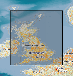
- Extent
-
NORTHWEST EUROPEAN CONTINENTAL SHELF [id=121700]
- Dataset Reference Date ()
- 1979
N
S
E
W
))
- Begin date
- 2008
- End date
- 2008
Distribution Information
- Data format
-
-
ESRI shape file
()
-
ESRI shape file
()
- Resource Locator
- BGS Homepage
- Resource Locator
- BGS Homepage
- Quality Scope
- dataset
- Other
- dataset
Report
- Dataset Reference Date ()
- 2011
- Explanation
- See the referenced specification
- Degree
Report
- Dataset Reference Date ()
- 2010-12-08
- Explanation
- See http://eur-lex.europa.eu/LexUriServ/LexUriServ.do?uri=OJ:L:2010:323:0011:0102:EN:PDF
- Degree
- Statement
- This is a digital 1:1M scale offshore quaternary map. It was digitised from paper maps by Carto North to DigMap standards. This shapefile contains attributed polygons. Attribution follows LEX_ROCK standards.