NERC Data Catalogue Service
Wellmaster Hydrogeological Database.
Default
Identification info
- Metadata Language
- English (en)
- Dataset Reference Date ()
- 1998
01491 692345
01491 692345
01491 692345
01491 692345
- Maintenance and update frequency
- daily
- GEMET - INSPIRE themes, version 1.0
- BGS Thesaurus of Geosciences
-
- Water chemistry
- Hydrogeology
- Aquifers
- General geology
- Geology
- Water
- Wells
- Groundwater
- UK Location (INSPIRE)
- Keywords ()
- Keywords
-
- NERC_DDC
- Limitations on Public Access
- otherRestrictions
- Use constraints
- otherRestrictions
- Other constraints
- The copyright of materials derived from the British Geological Survey's work is vested in the Natural Environment Research Council [NERC]. No part of this work may be reproduced or transmitted in any form or by any means, or stored in a retrieval system of any nature, without the prior permission of the copyright holder, via the BGS Intellectual Property Rights Manager. Use by customers of information provided by the BGS, is at the customer's own risk. In view of the disparate sources of information at BGS's disposal, including such material donated to BGS, that BGS accepts in good faith as being accurate, the Natural Environment Research Council (NERC) gives no warranty, expressed or implied, as to the quality or accuracy of the information supplied, or to the information's suitability for any use. NERC/BGS accepts no liability whatever in respect of loss, damage, injury or other occurence however caused.
- Other constraints
- Either: (i) the dataset is made freely available, e.g. via the Internet, for a restricted category of use (e.g. educational use only); or (ii) the dataset has not been formally approved by BGS for access and use by external clients under licence, but its use may be permitted under alternative formal arrangements; or (iii) the dataset contains 3rd party data or information obtained by BGS under terms and conditions that must be consulted in order to determine the permitted usage of the dataset. Refer to the BGS staff member responsible for the creation of the dataset if further advice is required. He / she should be familiar with the composition of the dataset, particularly with regard to 3rd party IPR contained in it, and any resultant use restrictions. This staff member should revert to the IPR Section (ipr@bgs.ac.uk ) for advice, should the position not be clear.
- Spatial representation type
- vector
- Denominator
- 10000
- Topic category
-
- Geoscientific information
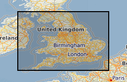
- Extent
-
ENG
- Dataset Reference Date ()
- 2009
- Extent
-
ENGLAND [id=150000]
- Dataset Reference Date ()
- 1979
- Extent
-
SCOTLAND [id=140000]
- Dataset Reference Date ()
- 1979
- Extent
-
SCT
- Dataset Reference Date ()
- 2009
- Extent
-
WALES [id=170000]
- Dataset Reference Date ()
- 1979
- Extent
-
WLS
- Dataset Reference Date ()
- 2009
))
Vertical extent
- Minimum value
- 0.0000
- Maximum value
- 500.0000
Vertical datum
- Additional information
- The digital database contains information derived from the National Water Well Record collection, which consists of paper records of water well information collected by BGS or submitted by water well drillers. Data content varies from record to record, depending on the information contained within the paper record. Water wells are only included if notified to BGS, and information is mainly dated from the construction of the well, with only limited data on subsequent usage or current status.
Distribution Information
- Data format
-
-
ORACLE Relational Database
(
Current BGS version
)
-
Microsoft Access Database
(
Current version
)
-
ORACLE Relational Database
(
Current BGS version
)
- Resource Locator
-
GeoIndex
The GeoIndex allows users to search for information about BGS data collections covering the UK and other areas world wide. Access is free, the interface is easy to use, and it has been developed to enable users to check coverage of different types of data and find out some background information about the data. More detailed information can be obtained by further enquiry to specified contacts, and ordering can be carried out via the web site.
- Resource Locator
- http://www.bgs.ac.uk/products/hydrogeology/WellMaster.html
- Resource Locator
-
GeoIndex
The GeoIndex allows users to search for information about BGS data collections covering the UK and other areas world wide. Access is free, the interface is easy to use, and it has been developed to enable users to check coverage of different types of data and find out some background information about the data. More detailed information can be obtained by further enquiry to specified contacts, and ordering can be carried out via the web site.
- Resource Locator
- http://www.bgs.ac.uk/products/hydrogeology/WellMaster.html
- Quality Scope
- dataset
Report
- Dataset Reference Date ()
- 2011
- Explanation
- See the referenced specification
- Degree
Report
- Dataset Reference Date ()
- 2010-12-08
- Explanation
- See http://eur-lex.europa.eu/LexUriServ/LexUriServ.do?uri=OJ:L:2010:323:0011:0102:EN:PDF
- Degree
- Statement
- Digitisation of water well archive data, and incorporation of some data digitised in the 1980s by the BGS Metric Well Inventory Project
Metadata
- File identifier
- 9df8df52-d7a1-37a8-e044-0003ba9b0d98 XML
- Metadata Language
- English (en)
- Resource type
- dataset
- Metadata Date
- 2024-07-25
- Metadata standard name
- UK GEMINI
- Metadata standard version
- 2.3