NERC Data Catalogue Service
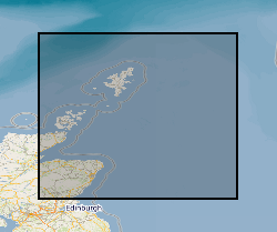
Distribution Of UK North Sea Lithostratigraphic Units
Default
Identification info
- Metadata Language
- English (en)
- Dataset Reference Date ()
- 1994
0115 936 3276
0115 936 3276
0115 936 3276
0115 936 3276
- Maintenance and update frequency
- irregular
- GEMET - INSPIRE themes, version 1.0
- BGS Thesaurus of Geosciences
-
- Cretaceous
- Jurassic
- UK Location (INSPIRE)
- Grabens
- Rock stratigraphic unit
- Keywords ()
- Keywords
-
- NERC_DDC
- Limitations on Public Access
- otherRestrictions
- Use constraints
- otherRestrictions
- Other constraints
- The copyright of materials derived from the British Geological Survey's work is vested in the Natural Environment Research Council [NERC]. No part of this work may be reproduced or transmitted in any form or by any means, or stored in a retrieval system of any nature, without the prior permission of the copyright holder, via the BGS Intellectual Property Rights Manager. Use by customers of information provided by the BGS, is at the customer's own risk. In view of the disparate sources of information at BGS's disposal, including such material donated to BGS, that BGS accepts in good faith as being accurate, the Natural Environment Research Council (NERC) gives no warranty, expressed or implied, as to the quality or accuracy of the information supplied, or to the information's suitability for any use. NERC/BGS accepts no liability whatever in respect of loss, damage, injury or other occurence however caused.
- Other constraints
- Either: (i) the dataset is made freely available, e.g. via the Internet, for a restricted category of use (e.g. educational use only); or (ii) the dataset has not been formally approved by BGS for access and use by external clients under licence, but its use may be permitted under alternative formal arrangements; or (iii) the dataset contains 3rd party data or information obtained by BGS under terms and conditions that must be consulted in order to determine the permitted usage of the dataset. Refer to the BGS staff member responsible for the creation of the dataset if further advice is required. He / she should be familiar with the composition of the dataset, particularly with regard to 3rd party IPR contained in it, and any resultant use restrictions. This staff member should revert to the IPR Section (ipr@bgs.ac.uk ) for advice, should the position not be clear.
- Denominator
- 1000000
- Topic category
-
- Geoscientific information
- Extent
-
NORTHERN NORTH SEA BASIN [id=138100]
- Dataset Reference Date ()
- 1979
))
- Additional information
- The well data on which the map data are based were interpreted over a number of years. End date of capture 01-JAN-2003. Updating is dependent on a source of funding. Additional data is available in published Research Report RR/03/001 (Johnson et al. 2003).
- Code
- ED50 (EPSG::4230)
Distribution Information
- Data format
-
-
DIGITAL - ESRI shapefile, DGN and DXF. Other formats can be considered.
()
-
MAPINFO
()
-
DIGITAL - ESRI shapefile, DGN and DXF. Other formats can be considered.
()
- Resource Locator
-
Research Report
Johnson, Howard; Leslie, Alick Bruce; Wilson, Christian Kverneland; Andrews, Ian; Cooper, Rhys Mark. 2005 Middle Jurassic, Upper Jurassic and Lower Cretaceous of the UK Central and Northern North Sea. Keyworth, Nottingham, British Geological Survey, 27pp. (RR/03/001)
- Quality Scope
- dataset
Report
- Dataset Reference Date ()
- 2011
- Explanation
- See the referenced specification
- Degree
Report
- Dataset Reference Date ()
- 2010-12-08
- Explanation
- See http://eur-lex.europa.eu/LexUriServ/LexUriServ.do?uri=OJ:L:2010:323:0011:0102:EN:PDF
- Degree
- Statement
- The UK Offshore Operators Association (UKOOA) lithostratigraphic classification has been applied consistently
Metadata
- File identifier
- 9df8df52-d7d9-37a8-e044-0003ba9b0d98 XML
- Metadata Language
- English (en)
- Resource type
- dataset
- Metadata Date
- 2024-04-17
- Metadata standard name
- UK GEMINI
- Metadata standard version
- 2.3