NERC Data Catalogue Service
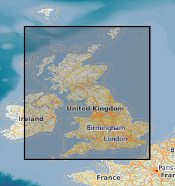
Map based index (GeoIndex) onshore borehole records
This layer of the Map based index (GeoIndex) shows the location of records of boreholes, shafts and wells from all forms of drilling and site investigation work. Some 850,000 records dating back over 200 years and ranging from one to several thousand metres deep. Currently some 50,000 new records are being added to the collection each year. The dataset available via the GeoIndex is a snapshot, taken at a particular date, of the Single Onshore Borehole Index. Although the GeoIndex is updated at regular intervals more information may be available than is shown.
Default
Identification info
- Metadata Language
- English (en)
- Dataset Reference Date ()
- 2000
British Geological Survey
-
Enquiries
0115 936 3276
Environmental Science Centre, Nicker Hill, Keyworth
,
NOTTINGHAM
,
NOTTINGHAMSHIRE
,
NG12 5GG
,
United Kingdom
0115 936 3143
0115 936 3276
British Geological Survey
-
Enquiries
0115 936 3276
Environmental Science Centre, Nicker Hill, Keyworth
,
NOTTINGHAM
,
NOTTINGHAMSHIRE
,
NG12 5GG
,
United Kingdom
0115 936 3143
0115 936 3276
- Maintenance and update frequency
- daily
- GEMET - INSPIRE themes, version 1.0
- BGS Thesaurus of Geosciences
-
- Scottish SDI
- Water wells
- Boreholes
- UK Location (INSPIRE)
- Mine shafts
- Keywords ()
- Keywords
-
- NERC_DDC
- Limitations on Public Access
- otherRestrictions
- Other constraints
- Free access. The usual BGS licensing terms and conditions apply to external use of the data.
- Use constraints
- otherRestrictions
- Other constraints
- The copyright of materials derived from the British Geological Survey's work is vested in the Natural Environment Research Council [NERC]. No part of this work may be reproduced or transmitted in any form or by any means, or stored in a retrieval system of any nature, without the prior permission of the copyright holder, via the BGS Intellectual Property Rights Manager. Use by customers of information provided by the BGS, is at the customer's own risk. In view of the disparate sources of information at BGS's disposal, including such material donated to BGS, that BGS accepts in good faith as being accurate, the Natural Environment Research Council (NERC) gives no warranty, expressed or implied, as to the quality or accuracy of the information supplied, or to the information's suitability for any use. NERC/BGS accepts no liability whatever in respect of loss, damage, injury or other occurence however caused.
- Other constraints
- Either: (i) the dataset is made freely available, e.g. via the Internet, for a restricted category of use (e.g. educational use only); or (ii) the dataset has not been formally approved by BGS for access and use by external clients under licence, but its use may be permitted under alternative formal arrangements; or (iii) the dataset contains 3rd party data or information obtained by BGS under terms and conditions that must be consulted in order to determine the permitted usage of the dataset. Refer to the BGS staff member responsible for the creation of the dataset if further advice is required. He / she should be familiar with the composition of the dataset, particularly with regard to 3rd party IPR contained in it, and any resultant use restrictions. This staff member should revert to the IPR Section (ipr@bgs.ac.uk ) for advice, should the position not be clear.
- Spatial representation type
- vector
- Denominator
- 100000
- Topic category
-
- Geoscientific information
- Extent
-
GBN
- Dataset Reference Date ()
- 2009
- Extent
-
GREAT BRITAIN [id=139600]
- Dataset Reference Date ()
- 1979
N
S
E
W
))
- End date
- 2014-01
- Additional information
- Data is visible at map scales below 1:100000.
Distribution Information
- Data format
-
-
Geographic Information System
()
-
Geographic Information System
()
- Resource Locator
- GeoIndex, onshore borehole records
- Resource Locator
- GeoIndex, onshore borehole records
- Quality Scope
- dataset
- Other
- dataset
Report
- Dataset Reference Date ()
- 2011
- Explanation
- See the referenced specification
- Degree
Report
- Dataset Reference Date ()
- 2010-12-08
- Explanation
- See http://eur-lex.europa.eu/LexUriServ/LexUriServ.do?uri=OJ:L:2010:323:0011:0102:EN:PDF
- Degree
- Statement
- Information for this layer is taken from the Single Onshore Borehole Index (SOBI). This database originated in 1988 from a number of existing tables and from data input from a variety of coding forms. The original records are onshore (or near shore) boreholes, trial pits, shafts and wells held in the BGS archives in either paper, microfilm or digital format, received from a wide variety of external sources.
Metadata
- File identifier
- 9df8df53-2a71-37a8-e044-0003ba9b0d98 XML
- Metadata Language
- English (en)
- Resource type
- dataset
- Metadata Date
- 2024-04-17
- Metadata standard name
- UK GEMINI
- Metadata standard version
- 2.3
British Geological Survey
Environmental Science Centre,Keyworth
,
NOTTINGHAM
,
NOTTINGHAMSHIRE
,
NG12 5GG
,
United Kingdom
+44 115 936 3100