NERC Data Catalogue Service
Map based index (GeoIndex) rock
Default
Identification info
- Metadata Language
- English (en)
- Dataset Reference Date ()
- 2000
0115 936 3276
0115 936 3276
- Maintenance and update frequency
- asNeeded
- GEMET - INSPIRE themes, version 1.0
- BGS Thesaurus of Geosciences
-
- Chemical analysis
- Rock chemistry
- Trace analysis
- UK Location (INSPIRE)
- Scottish SDI
- Major element analysis
- Geochemistry
- X ray fluorescence spectroscopy
- Keywords ()
- Keywords
-
- NERC_DDC
- Limitations on Public Access
- otherRestrictions
- Other constraints
- Free access. The usual BGS licensing terms and conditions apply to external use of the data.
- Use constraints
- otherRestrictions
- Other constraints
- The copyright of materials derived from the British Geological Survey's work is vested in the Natural Environment Research Council [NERC]. No part of this work may be reproduced or transmitted in any form or by any means, or stored in a retrieval system of any nature, without the prior permission of the copyright holder, via the BGS Intellectual Property Rights Manager. Use by customers of information provided by the BGS, is at the customer's own risk. In view of the disparate sources of information at BGS's disposal, including such material donated to BGS, that BGS accepts in good faith as being accurate, the Natural Environment Research Council (NERC) gives no warranty, expressed or implied, as to the quality or accuracy of the information supplied, or to the information's suitability for any use. NERC/BGS accepts no liability whatever in respect of loss, damage, injury or other occurence however caused.
- Other constraints
- Either: (i) the dataset is made freely available, e.g. via the Internet, for a restricted category of use (e.g. educational use only); or (ii) the dataset has not been formally approved by BGS for access and use by external clients under licence, but its use may be permitted under alternative formal arrangements; or (iii) the dataset contains 3rd party data or information obtained by BGS under terms and conditions that must be consulted in order to determine the permitted usage of the dataset. Refer to the BGS staff member responsible for the creation of the dataset if further advice is required. He / she should be familiar with the composition of the dataset, particularly with regard to 3rd party IPR contained in it, and any resultant use restrictions. This staff member should revert to the IPR Section (ipr@bgs.ac.uk ) for advice, should the position not be clear.
- Spatial representation type
- vector
- Denominator
- 250000
- Topic category
-
- Geoscientific information
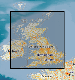
- Extent
-
GBN
- Dataset Reference Date ()
- 2009
- Extent
-
GREAT BRITAIN [id=139600]
- Dataset Reference Date ()
- 1979
))
- End date
- 2014-01
- Additional information
- Data is visible at map scales below 1:250000.
Distribution Information
- Data format
-
-
Geographic Information System
()
-
Geographic Information System
()
- Resource Locator
-
Geochemistry map theme
The wms layer for 'GeoIndex rock' is held within the 'Geochemistry' map theme WMS layer which this URL connects to.
- Resource Locator
- GeoIndex rock samples
- Resource Locator
-
Geochemistry map theme
The wms layer for 'GeoIndex rock' is held within the 'Geochemistry' map theme WMS layer which this URL connects to.
- Resource Locator
- GeoIndex rock samples
- Quality Scope
- dataset
- Other
- dataset
Report
- Dataset Reference Date ()
- 2011
- Explanation
- See the referenced specification
- Degree
Report
- Dataset Reference Date ()
- 2010-12-08
- Explanation
- See http://eur-lex.europa.eu/LexUriServ/LexUriServ.do?uri=OJ:L:2010:323:0011:0102:EN:PDF
- Degree
- Statement
- Rock samples gathered as part of the Mineral Reconnaissance Programme (MRP), the rock samples have been analysed for a variety of major and trace elements. A database was created to hold the information from the analysis and this layer of the GeoIndex is derived from this database.
Metadata
- File identifier
- 9df8df53-2a88-37a8-e044-0003ba9b0d98 XML
- Metadata Language
- English (en)
- Resource type
- dataset
- Metadata Date
- 2024-07-25
- Metadata standard name
- UK GEMINI
- Metadata standard version
- 2.3