NERC Data Catalogue Service
BGS Seabed Sediments 250k version 3.0
Default
Identification info
- Metadata Language
- English (en)
- Dataset Reference Date ()
- 2011-04-01
0115 936 3276
0115 936 3276
- Maintenance and update frequency
- irregular
- GEMET - INSPIRE themes, version 1.0
- BGS Thesaurus of Geosciences
-
- Scottish SDI
- Continental shelf
- GIS
- Sea floor sediments
- MEDIN
- Geology
- Maps
- Digital maps
- Marine geology
- Sea floor
- Data
- Grain size analysis
- Sediments
- UK Location (INSPIRE)
- Keywords ()
- Keywords
-
- NERC_DDC
- Limitations on Public Access
- otherRestrictions
- Other constraints
- license
- Use constraints
- otherRestrictions
- Other constraints
- The copyright of materials derived from the British Geological Survey's work is vested in the Natural Environment Research Council [NERC]. No part of this work may be reproduced or transmitted in any form or by any means, or stored in a retrieval system of any nature, without the prior permission of the copyright holder, via the BGS Intellectual Property Rights Manager. Use by customers of information provided by the BGS, is at the customer's own risk. In view of the disparate sources of information at BGS's disposal, including such material donated to BGS, that BGS accepts in good faith as being accurate, the Natural Environment Research Council (NERC) gives no warranty, expressed or implied, as to the quality or accuracy of the information supplied, or to the information's suitability for any use. NERC/BGS accepts no liability whatever in respect of loss, damage, injury or other occurence however caused.
- Other constraints
- The dataset is made available to external clients under BGS Digital Data Licence terms and conditions. Revert to the IPR Section (iprdigital@bgs.ac.uk ) if further advice is required with regard to permitted usage.
- Spatial representation type
- vector
- Denominator
- 250000
- Topic category
-
- Geoscientific information
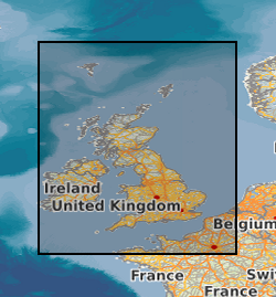
- Extent
-
UK CONTINENTAL SHELF [id=121701]
- Dataset Reference Date ()
- 1979
))
- Begin date
- 2011
- End date
- 2011
- Code
- WGS 84 (EPSG::4326)
Distribution Information
- Data format
-
-
ArcGis .shp
(
Current BGS version
)
-
MapInfo .tab
(
Current BGS version
)
-
Other formats available on request
()
-
ArcGis .shp
(
Current BGS version
)
- Resource Locator
-
BGS Datasets - Seabed sediments 250k Homepage
This page provides further information about the BGS Seabed Sediments 250k dataset, including a user guide, details about licensing and sample data.
- Resource Locator
- Digital Object Identifier (DOI)
- Resource Locator
-
BGS Datasets - Seabed sediments 250k Homepage
This page provides further information about the BGS Seabed Sediments 250k dataset, including a user guide, details about licensing and sample data.
- Resource Locator
- Digital Object Identifier (DOI)
- Quality Scope
- dataset
- Other
- dataset
Report
- Dataset Reference Date ()
- 2011
- Explanation
- See the referenced specification
- Degree
Report
- Dataset Reference Date ()
- 2010-12-08
- Explanation
- See http://eur-lex.europa.eu/LexUriServ/LexUriServ.do?uri=OJ:L:2010:323:0011:0102:EN:PDF
- Degree
- Statement
- The original version of Seabed Sediments at 1:250 000 scale dataset (then known as DiGSBS250k) was digitised from the scanned version of the hard copy,1:250 000 scale offshore geological maps series. Sheets of these series were issued on a regular grid, with each map sheet covering an area of one degree of latitude by two degrees of longitude. Details of the printed map sheet names, numbers and publication dates are available from the BGS online catalogue and the printed maps are still available via the BGS Bookshop. The second version of this dataset was released in 2007 (named at the time DiGSBS250k v.2). The principal objective of this revision was to improve the positional accuracy of the data in the dataset. The third and current version of the Seabed Sediments at 1:250 000 scale dataset was released in 2011 (named as DiGRock250k v.3). This version has been updated using new PSA samples and multibeam data to directly modify the digital version.