NERC Data Catalogue Service
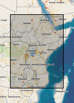
East African Rift Temperature and Heatflow model (EARTH)
Default
Identification info
- Metadata Language
- English (en)
- Dataset Reference Date ()
- 2020-02-14
0115 936 3276
0115 936 3276
- Maintenance and update frequency
- unknown
- GEMET - INSPIRE themes, version 1.0
- BGS Thesaurus of Geosciences
-
- Geothermal heat flow
- Rift faults
- data.gov.uk (non-INSPIRE)
- Rift zone
- Temperature
- Keywords ()
- Keywords
-
- NERC_DDC
- Limitations on Public Access
- otherRestrictions
- Other constraints
- no limitations
- Other constraints
- The dataset is made freely available for access, e.g. via the Internet. Either no third party data / information is contained in the dataset or BGS has secured written permission from the owner(s) of any third party data / information contained in the dataset to make the dataset freely accessible.
- Use constraints
- otherRestrictions
- Other constraints
- The copyright of materials derived from the British Geological Survey's work is vested in the Natural Environment Research Council [NERC]. No part of this work may be reproduced or transmitted in any form or by any means, or stored in a retrieval system of any nature, without the prior permission of the copyright holder, via the BGS Intellectual Property Rights Manager. Use by customers of information provided by the BGS, is at the customer's own risk. In view of the disparate sources of information at BGS's disposal, including such material donated to BGS, that BGS accepts in good faith as being accurate, the Natural Environment Research Council (NERC) gives no warranty, expressed or implied, as to the quality or accuracy of the information supplied, or to the information's suitability for any use. NERC/BGS accepts no liability whatever in respect of loss, damage, injury or other occurence however caused.
- Other constraints
- Available under the Open Government Licence subject to the following acknowledgement accompanying the reproduced NERC materials "Contains NERC materials ©NERC [year]"
- Spatial representation type
- textTable
- Topic category
-
- Geoscientific information
- Extent
-
BDI
- Dataset Reference Date ()
- 2009
- Extent
-
BI
- Dataset Reference Date ()
- 2009
- Extent
-
BURUNDI [id=658000]
- Dataset Reference Date ()
- 1979
- Extent
-
EAST AFRICA [id=680000]
- Dataset Reference Date ()
- 1979
- Extent
-
ER
- Dataset Reference Date ()
- 2009
- Extent
-
ERI
- Dataset Reference Date ()
- 2009
- Extent
-
ERITREA [id=694100]
- Dataset Reference Date ()
- 1979
- Extent
-
ET
- Dataset Reference Date ()
- 2009
- Extent
-
ETH
- Dataset Reference Date ()
- 2009
- Extent
-
ETHIOPIA [id=692000]
- Dataset Reference Date ()
- 1979
- Extent
-
JIBUTI [id=696000]
- Dataset Reference Date ()
- 1979
- Extent
-
KE
- Dataset Reference Date ()
- 2009
- Extent
-
KEN
- Dataset Reference Date ()
- 2009
- Extent
-
KENYA [id=687000]
- Dataset Reference Date ()
- 1979
- Extent
-
MALAWI [id=679000]
- Dataset Reference Date ()
- 1979
- Extent
-
MOZ
- Dataset Reference Date ()
- 2009
- Extent
-
MOZAMBIQUE [id=676000]
- Dataset Reference Date ()
- 1979
- Extent
-
MW
- Dataset Reference Date ()
- 2009
- Extent
-
MWI
- Dataset Reference Date ()
- 2009
- Extent
-
MZ
- Dataset Reference Date ()
- 2009
- Extent
-
RW
- Dataset Reference Date ()
- 2009
- Extent
-
RWA
- Dataset Reference Date ()
- 2009
- Extent
-
RWANDA [id=657000]
- Dataset Reference Date ()
- 1979
- Extent
-
TANZANIA [id=685000]
- Dataset Reference Date ()
- 1979
- Extent
-
UG
- Dataset Reference Date ()
- 2009
- Extent
-
UGA
- Dataset Reference Date ()
- 2009
- Extent
-
UGANDA [id=689000]
- Dataset Reference Date ()
- 1979
- Extent
-
ZAMBIA [id=678000]
- Dataset Reference Date ()
- 1979
- Extent
-
ZM
- Dataset Reference Date ()
- 2009
- Extent
-
ZMB
- Dataset Reference Date ()
- 2009
))
- Begin date
- 2019-04-01
- End date
- 2020-02-14
- Code
- WGS 84 (EPSG::4326)
- Quality Scope
- dataset
- Other
- dataset
Report
- Dataset Reference Date ()
- 2011
- Explanation
- See the referenced specification
- Degree
Report
- Dataset Reference Date ()
- 2010-12-08
- Explanation
- See http://eur-lex.europa.eu/LexUriServ/LexUriServ.do?uri=OJ:L:2010:323:0011:0102:EN:PDF
- Degree
- Statement
- All data has been assimilated into a Arc GIS project.
Metadata
- File identifier
- 9ed81520-0453-65a8-e054-002128a47908 XML
- Metadata Language
- English (en)
- Resource type
- dataset
- Metadata Date
- 2024-04-16
- Metadata standard name
- UK GEMINI
- Metadata standard version
- 2.3