NERC Data Catalogue Service
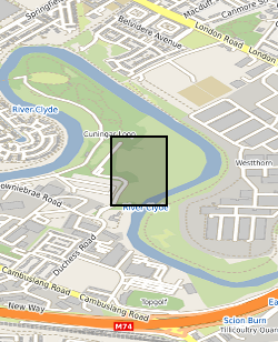
UKGEOS Glasgow summary borehole information (Cuningar Loop)
This summary borehole information release is for ‘as-built’ mine water and environmental baseline monitoring boreholes of the UK Geoenergy Observatories (UKGEOS) Glasgow facility at Cuningar Loop. The information pack from BGS contains a brief report with summary tables of locations, drilled depths, screened intervals and illustrative interpretations, and is accompanied with a spreadsheet and shapefile of the borehole locations and drilled depths. The purpose is to give potential users of the Glasgow Observatory an outline of the as-built infrastructure including condition of the target mine workings, as a summary of the more detailed information packs for each borehole. This dataset was updated in June 2020. Further details can be found in the accompanying report http://nora.nerc.ac.uk/id/eprint/526889
Default
Identification info
- Metadata Language
- English (en)
- Dataset Reference Date ()
- 2020-02-26
- Dataset Reference Date ()
- 2020-07-09
British Geological Survey
-
Enquiries
0115 936 3276
The Lyell Centre, Research Avenue South
,
EDINBURGH
,
LOTHIAN
,
EH14 4AP
,
United Kingdom
0115 936 3142
0115 936 3276
British Geological Survey
-
Enquiries
0115 936 3276
The Lyell Centre, Research Avenue South
,
EDINBURGH
,
LOTHIAN
,
EH14 4AP
,
United Kingdom
0115 936 3142
0115 936 3276
- Maintenance and update frequency
- notPlanned
- GEMET - INSPIRE themes, version 1.0
- BGS Thesaurus of Geosciences
-
- Boreholes
- Monitoring
- Base line data
- Drilling
- Mine waters
- Abrasion
- UK Location (INSPIRE)
- Scottish SDI
- Keywords ()
- Keywords
-
- NERC_DDC
- Limitations on Public Access
- otherRestrictions
- Other constraints
- licenceOGL
- Use constraints
- otherRestrictions
- Other constraints
- The copyright of materials derived from the British Geological Survey's work is vested in the Natural Environment Research Council [NERC]. No part of this work may be reproduced or transmitted in any form or by any means, or stored in a retrieval system of any nature, without the prior permission of the copyright holder, via the BGS Intellectual Property Rights Manager. Use by customers of information provided by the BGS, is at the customer's own risk. In view of the disparate sources of information at BGS's disposal, including such material donated to BGS, that BGS accepts in good faith as being accurate, the Natural Environment Research Council (NERC) gives no warranty, expressed or implied, as to the quality or accuracy of the information supplied, or to the information's suitability for any use. NERC/BGS accepts no liability whatever in respect of loss, damage, injury or other occurence however caused.
- Other constraints
- Available under the Open Government Licence subject to the following acknowledgement accompanying the reproduced NERC materials "Contains NERC materials ©NERC [year]"
- Spatial representation type
- grid
- Topic category
-
- Geoscientific information
- Extent
-
Glasgow [id=1298677]
- Dataset Reference Date ()
- 2002
N
S
E
W
))
- Begin date
- 2019-07-01
- End date
- 2019-12-18
Vertical extent
- Minimum value
- 0.0000
- Maximum value
- 199.0000
Vertical datum
No information provided.
- Additional information
- For more information on the project, visit www.ukgeos.ac.uk.
Distribution Information
- Data format
-
-
MSExcel
()
-
pdf
()
-
.shp
()
-
MSExcel
()
- Resource Locator
- http://www.bgs.ac.uk/services/ngdc/accessions/index.html#item132805
- Resource Locator
- http://nora.nerc.ac.uk/id/eprint/526889
- Resource Locator
- http://www.bgs.ac.uk/services/ngdc/accessions/index.html#item132805
- Resource Locator
- http://nora.nerc.ac.uk/id/eprint/526889
- Quality Scope
- dataset
- Other
- dataset
Report
- Dataset Reference Date ()
- 2011
- Explanation
- See the referenced specification
- Degree
Report
- Dataset Reference Date ()
- 2010-12-08
- Explanation
- See http://eur-lex.europa.eu/LexUriServ/LexUriServ.do?uri=OJ:L:2010:323:0011:0102:EN:PDF
- Degree
- Statement
- This summary information for the eleven UK Geoenergy Observatories (UKGEOS) Glasgow boreholes at Cuningar Loop has been derived from borehole drilling information and BGS drill-site logs of rock chips. Location and platform height information provided by drilling contractor BAM. More information is available in the accompanying metadata report http://nora.nerc.ac.uk/id/eprint/526889.