NERC Data Catalogue Service
Comparative performance of rural water supplies during drought - dataset (NERC grant NE/R000069/1)
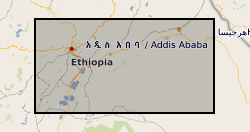
Ethiopia experienced severe drought in 2015-16. Many rural communities experienced declines in the performance of their water supply systems. As a result UNICEF commissioned a real-time monitoring and responsive operation and maintenance programme for point source rural water supplies across Central, Northern and Eastern Ethiopia. The water point monitoring survey was coordinated by UNICEF and conducted by World Vision Ethiopia and Oxfam Ethiopia. Data was collected between January and May 2016. Akvo Flow, a mobile survey tool, was used to collect data using questionnaires which were completed by enumerators and uploaded to central servers in near real time. The dataset includes data on functionality, access, usage and water quantity from 5196 rural water points. UNICEF provided the dataset to BGS. BGS reorganised, cleaned, and conducted quality control and analysis of the dataset. A companion paper has been published with more details of the methodology and results of the monitoring survey,
https://doi.org/10.1038/s41467-020-14839-3
Default
Identification info
- Metadata Language
- English (en)
- Dataset Reference Date ()
- 2020-04-30
University of KwaZulu-Natal
-
S. Kebede
(
School of Agricultural Earth and Environmental Sciences
)
Pietermaritzburg
,
South Africa
British Geological Survey
-
Enquiries
0115 936 3276
The Lyell Centre, Research Avenue South
,
EDINBURGH
,
LOTHIAN
,
EH14 4AP
,
United Kingdom
0115 936 3142
0115 936 3276
British Geological Survey
-
Enquiries
0115 936 3276
The Lyell Centre, Research Avenue South
,
EDINBURGH
,
LOTHIAN
,
EH14 4AP
,
United Kingdom
0115 936 3142
0115 936 3276
- Maintenance and update frequency
- notApplicable
- GEMET - INSPIRE themes, version 1.0
- BGS Thesaurus of Geosciences
-
- Water
- Droughts
- NGDC Deposited Data
- Keywords ()
- Keywords
-
- NERC_DDC
- Limitations on Public Access
- otherRestrictions
- Other constraints
- licenceOGL
- Use constraints
- otherRestrictions
- Other constraints
- The copyright of materials derived from the British Geological Survey's work is vested in the Natural Environment Research Council [NERC]. No part of this work may be reproduced or transmitted in any form or by any means, or stored in a retrieval system of any nature, without the prior permission of the copyright holder, via the BGS Intellectual Property Rights Manager. Use by customers of information provided by the BGS, is at the customer's own risk. In view of the disparate sources of information at BGS's disposal, including such material donated to BGS, that BGS accepts in good faith as being accurate, the Natural Environment Research Council (NERC) gives no warranty, expressed or implied, as to the quality or accuracy of the information supplied, or to the information's suitability for any use. NERC/BGS accepts no liability whatever in respect of loss, damage, injury or other occurence however caused.
- Other constraints
- Available under the Open Government Licence subject to the following acknowledgement accompanying the reproduced NERC materials "Contains NERC materials ©NERC [year]"
- Spatial representation type
- textTable
- Topic category
-
- Geoscientific information
N
S
E
W
))
- Begin date
- 2016-01-26
- End date
- 2016-04-24
- Code
- WGS 84 (EPSG::4326)
Distribution Information
- Data format
-
-
.csv (Comma-separated values file)
()
-
.csv (Comma-separated values file)
()
- Resource Locator
- https://doi.org/10.1038/s41467-020-14839-3
- Resource Locator
- Data
- Resource Locator
- https://doi.org/10.1038/s41467-020-14839-3
- Resource Locator
- Data
- Quality Scope
- dataset
- Other
- dataset
Report
- Dataset Reference Date ()
- 2011
- Explanation
- See the referenced specification
- Degree
Report
- Dataset Reference Date ()
- 2010-12-08
- Explanation
- See http://eur-lex.europa.eu/LexUriServ/LexUriServ.do?uri=OJ:L:2010:323:0011:0102:EN:PDF
- Degree
- Statement
- Akvo Flow, a mobile survey tool, was used to collect the data which was based on questionnaires and completed by enumerators and uploaded to central servers in near real time. Data on functionality, access, usage and quantity was collected from approximately 6000 rural water points over this period. The dataset was provided to BGS by UNICEF. BGS reorganised, cleaned, and conducted quality control and analysis of the dataset. A companion paper has been published, https://doi.org/10.1038/s41467-020-14839-3 with more details of the methodology and results of the monitoring survey.