NERC Data Catalogue Service
Superficial Aquifer Productivity Scotland version 2
The Superficial Aquifer Productivity Scotland dataset forms part of the BGS Hydrogeological Maps of Scotland data product. This product is comprised of three datasets: Bedrock Aquifer Productivity Scotland; Superficial Aquifer Productivity Scotland; and Groundwater Vulnerability Scotland. Aquifer productivity is a measure of the potential of aquifers to sustain a borehole water supply. The Superficial Aquifer Productivity Scotland dataset version 2 (2015) indicates the location and productivity of superficial aquifers across Scotland, and their groundwater flow characteristics. Developed as a tool to support groundwater resource management, the dataset provides a guide to aquifer characteristics at a regional scale, and may be useful to anyone interested in learning more about, assessing or managing groundwater resources across Scotland. The dataset is delivered at 1: 100 000 scale; the resolution of the dataset being 50 m and the smallest detectable feature 100 m.
Default
Identification info
- Metadata Language
- English (en)
- Dataset Reference Date ()
- 2015-10-20
British Geological Survey
-
Enquiries
0115 936 3276
The Lyell Centre, Research Avenue South
,
EDINBURGH
,
LOTHIAN
,
EH14 4AP
,
United Kingdom
0115 936 3142
0115 936 3276
British Geological Survey
-
Enquiries
0115 936 3276
The Lyell Centre, Research Avenue South
,
EDINBURGH
,
LOTHIAN
,
EH14 4AP
,
United Kingdom
0115 936 3142
0115 936 3276
- Maintenance and update frequency
- asNeeded
- GEMET - INSPIRE themes, version 1.0
- BGS Thesaurus of Geosciences
-
- Scottish SDI
- Groundwater
- data.gov.uk (non-INSPIRE)
- Aquifers
- GIS
- Surficial geology
- Keywords ()
- Keywords
-
- NERC_DDC
- Limitations on Public Access
- otherRestrictions
- Other constraints
- license
- Use constraints
- otherRestrictions
- Other constraints
- The copyright of materials derived from the British Geological Survey's work is vested in the Natural Environment Research Council [NERC]. No part of this work may be reproduced or transmitted in any form or by any means, or stored in a retrieval system of any nature, without the prior permission of the copyright holder, via the BGS Intellectual Property Rights Manager. Use by customers of information provided by the BGS, is at the customer's own risk. In view of the disparate sources of information at BGS's disposal, including such material donated to BGS, that BGS accepts in good faith as being accurate, the Natural Environment Research Council (NERC) gives no warranty, expressed or implied, as to the quality or accuracy of the information supplied, or to the information's suitability for any use. NERC/BGS accepts no liability whatever in respect of loss, damage, injury or other occurence however caused.
- Other constraints
- The dataset is made available to external clients under BGS Digital Data Licence terms and conditions. Revert to the IPR Section (iprdigital@bgs.ac.uk ) if further advice is required with regard to permitted usage.
- Spatial representation type
- vector
- Topic category
-
- Geoscientific information
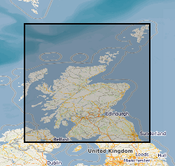
- Extent
-
SCOTLAND [id=140000]
- Dataset Reference Date ()
- 1979
- Extent
-
SCT
- Dataset Reference Date ()
- 2009
N
S
E
W
))
- End date
- 2015-10-20
Distribution Information
- Data format
-
-
ESRI shapefiles
()
-
ESRI shapefiles
()
- Resource Locator
- https://www.bgs.ac.uk/datasets/hydrogeological-maps-of-scotland/
- Resource Locator
- Digital Object Identifier (DOI)
- Resource Locator
- https://www.bgs.ac.uk/datasets/hydrogeological-maps-of-scotland/
- Resource Locator
- Digital Object Identifier (DOI)
- Quality Scope
- dataset
- Other
- dataset
Report
- Dataset Reference Date ()
- 2011
- Explanation
- See the referenced specification
- Degree
Report
- Dataset Reference Date ()
- 2010-12-08
- Explanation
- See http://eur-lex.europa.eu/LexUriServ/LexUriServ.do?uri=OJ:L:2010:323:0011:0102:EN:PDF
- Degree
- Statement
- The aquifer productivity data was developed in ArcGIS using BGS digital geology linework at a scale of 1:50,000: DiGMapGB-50, Version 5.18. Each of the geological formations in the 1:50 000-scale DiGMap superficial deposits geology map was classified according to the likely aquifer productivity. For a small number of map sheets, 1:50 000 scale superficial deposits mapping has not yet been done, and in these cases, superficial deposits linework and attribute data at other scales, including 1:625 000 scale, were merged in. Input datsets include: BGS Geology 50K (formerly known as DiGMapGB-50 (Digital Geological Map of Great Britain at 1:50 000)) (Bedrock) Version 5.18 Permeability Dataset for Great Britain (Superficial) Version 6.0 (British Geological Survey 2010)
Metadata
- File identifier
- b4ecc383-f14e-2fd2-e054-002128a47908 XML
- Metadata Language
- English (en)
- Resource type
- dataset
- Metadata Date
- 2024-04-17
- Metadata standard name
- UK GEMINI
- Metadata standard version
- 2.3
British Geological Survey
The Lyell Centre, Research Avenue South
,
EDINBURGH
,
LOTHIAN
,
EH14 4AP
,
United Kingdom
+44 131 667 1000