NERC Data Catalogue Service
BGS Permeability Index version 8
The BGS Permeability Index dataset shows estimated rates of water movement from the ground surface to the water table. The v8 dataset incorporates the latest geology mapping (BGS Geology 50k). This includes updates to the lithology-coding schema, the LEX_RCS. A 2-part code used to identify the named rock unit from the BGS lexicon of named rock units (LEX) followed by a Rock Classification Scheme (RCS) code which describes the rocks lithological characteristics e.g. texture and composition. Updates to these codes and latest dissolution hazard data sourced from BGS GeoSure: Soluble Rocks have been reviewed and classified as part of the version 8 release. The dataset covers Great Britain and is presented at a scale of 1:50 000, based on the geological data at the same scale. However, in areas where the geology is not mapped to this scale, the next best available scale is used. The BGS Permeability Index can be used to compare the relative permeability of deposits at the regional scale, indicating where highly permeable rocks could allow rapid infiltration to occur, or where less permeable rocks are present and water could pond on the ground surface. The dataset can be used as a component in a wide range of geo-environmental assessments such as natural flood management, Sustainable Drainage Systems, engineering desk studies, slope stability, and aquifer vulnerability. It is for use at the regional scale and is not recommended for use at the site-specific scale.
Default
Identification info
- Metadata Language
- English (en)
- Dataset Reference Date ()
- 2021-01-07
British Geological Survey
-
Enquiries
0115 936 3276
Environmental Science Centre, Nicker Hill, Keyworth
,
NOTTINGHAM
,
NOTTINGHAMSHIRE
,
NG12 5GG
,
United Kingdom
0115 936 3143
0115 936 3276
British Geological Survey
-
Enquiries
0115 936 3276
Environmental Science Centre, Nicker Hill, Keyworth
,
NOTTINGHAM
,
NOTTINGHAMSHIRE
,
NG12 5GG
,
United Kingdom
0115 936 3143
0115 936 3276
British Geological Survey
-
Enquiries
01491 692345
Maclean Building, Crowmarsh Gifford
,
WALLINGFORD
,
OXON
,
OX10 8BB
,
United Kingdom
01491 838800
01491 692345
British Geological Survey
-
Enquiries
01491 692345
Maclean Building, Crowmarsh Gifford
,
WALLINGFORD
,
OXON
,
OX10 8BB
,
United Kingdom
01491 838800
01491 692345
- Maintenance and update frequency
- unknown
- GEMET - INSPIRE themes, version 1.0
- BGS Thesaurus of Geosciences
-
- Ground water movement
- Hydrogeology
- UK Location (INSPIRE)
- Permeability
- Keywords ()
- Keywords
-
- NERC_DDC
- Limitations on Public Access
- otherRestrictions
- Other constraints
- license
- Use constraints
- otherRestrictions
- Other constraints
- The copyright of materials derived from the British Geological Survey's work is vested in the Natural Environment Research Council [NERC]. No part of this work may be reproduced or transmitted in any form or by any means, or stored in a retrieval system of any nature, without the prior permission of the copyright holder, via the BGS Intellectual Property Rights Manager. Use by customers of information provided by the BGS, is at the customer's own risk. In view of the disparate sources of information at BGS's disposal, including such material donated to BGS, that BGS accepts in good faith as being accurate, the Natural Environment Research Council (NERC) gives no warranty, expressed or implied, as to the quality or accuracy of the information supplied, or to the information's suitability for any use. NERC/BGS accepts no liability whatever in respect of loss, damage, injury or other occurence however caused.
- Other constraints
- The dataset is made available to external clients under BGS Digital Data Licence terms and conditions. Revert to the IPR Section (iprdigital@bgs.ac.uk ) if further advice is required with regard to permitted usage.
- Spatial representation type
- vector
- Topic category
-
- Geoscientific information
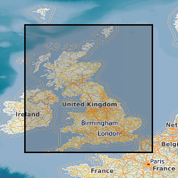
- Extent
-
GBN
- Dataset Reference Date ()
- 2009
- Extent
-
GREAT BRITAIN [id=139600]
- Dataset Reference Date ()
- 1979
N
S
E
W
))
- Begin date
- 1879
- End date
- 2021
Distribution Information
- Data format
-
-
ESRI Shapefile
(
Not enterd
)
-
ESRI Shapefile
(
Not enterd
)
- Resource Locator
- BGS Datasets - Permeability Homepage
- Resource Locator
- Digital Object Identifier (DOI)
- Resource Locator
- BGS Datasets - Permeability Homepage
- Resource Locator
- Digital Object Identifier (DOI)
- Quality Scope
- dataset
- Other
- dataset
Report
- Dataset Reference Date ()
- 2011
- Explanation
- See the referenced specification
- Degree
Report
- Dataset Reference Date ()
- 2010-12-08
- Explanation
- See http://eur-lex.europa.eu/LexUriServ/LexUriServ.do?uri=OJ:L:2010:323:0011:0102:EN:PDF
- Degree
- Statement
- The BGS Permeability Index dataset V8 is derived from the 4 geological themes of BGS Geology 50k: mass-movement, artificial, superficial deposits and bedrock. Each polygon in the BGS Geology 50k is attributed with a 2-part code; LEX-RCS code (rock unit-lithology combination). The LEX-RCS code is assigned (attributed) with 3 further codes to indicate the Predominant Flow Mechanism, and the Maximum and Minimum Permeability. The dataset was produced by dissolving the individual themes of BGS Geology 50k based on LEX-RCS and joining to a Microsoft Access lookup table of all the LEX-RCS combinations with their assigned permeability codes. The first code 'Predominant Flow Mechanism' indicates how fluid will migrate from the ground surface through the unsaturated zone of each rock unit and lithology combination and has three classes: Intergranular, Fracture or Mixed (intergranular and fracture). The second and third codes (Maximum and Minimum Permeability) indicate the range of flow rates likely to be encountered in the unsaturated zone for each rock unit and lithology combination to which five classes have been assigned for the Maximum and Minimum Permeability codes: very high, high, moderate, low, and very low. The Maximum and Minimum Permeability values represent a likely permeability range for the specified rock unit and lithology combination at, and immediately below, its outcrop or subcrop (rather than at any significant depth). The Maximum Permeability represents the fastest potential vertical rate of migration through the unsaturated zone likely to be encountered in the specified rock unit-lithology combination. The Minimum Permeability represents the minimum, and in some cases more normal, bulk rate of vertical movement likely to be encountered. Where a widely variable combination of lithologies occurs within a rock unit this Minimum Permeability value reflects the probable movement rate likely to be encountered in the least permeable horizons. These 3 codes were ascribed solely on the known hydrogeological characteristics of the various lithologies, considering their age, dissolution potential, degree of cementation/induration and fracturing. In unconsolidated deposits, intergranular flow is the predominant flow mechanism. In most consolidated sedimentary rocks, and igneous and metamorphic rocks, fracture flow will occur and hence a wide range of permeability values can occur for any one lithology. The potential for dissolution and degree of cementation, lithological variation and induration are also factors that affect measured values.
Metadata
- File identifier
- ba6dee03-9598-54ec-e054-002128a47908 XML
- Metadata Language
- English (en)
- Resource type
- dataset
- Metadata Date
- 2024-07-25
- Metadata standard name
- UK GEMINI
- Metadata standard version
- 2.3
British Geological Survey
Environmental Science Centre, Keyworth
,
NOTTINGHAM
,
NOTTINGHAMSHIRE
,
NG12 5GG
,
United Kingdom
+44 115 936 3100