NERC Data Catalogue Service
BIRPS (British Institutes Reflection Profiling Syndicate) Banda seismic data (1992-1993)
In 1992, BIRPS joined with the Indonesian Marine Geological Institute to record two long multichannel normal-incidence reflection profiles, one of which is DAMAR, the other TIMOR, and one short profile (API) close to the volcano Gunung Api. The survey provides a modern analogue to tectonics hypothesized to have occurred across the Iapetus suture zone of northern England 450-400 Ma. The Banda Arc of Indonesia near the island of Timor is widely recognized as the premier example of the active subduction of continental crust and lithosphere beneath oceanic lithosphere. The crossing of a modern island arc and close passage to active volcanoes was intended to image reflections associated with magma in the crust and uppermost mantle.
Default
Identification info
- Metadata Language
- English (en)
- Dataset Reference Date ()
- 1992
Natural Enironmental Research Council
Polaris House, North Star Avenue
,
SWINDON
,
WILTSHIRE
,
SN2 1EU
,
British Geological Survey
-
Enquiries
0115 936 3276
The Lyell Centre, Research Avenue South
,
EDINBURGH
,
LOTHIAN
,
EH14 4AP
,
United Kingdom
0115 936 3142
0115 936 3276
British Geological Survey
-
Enquiries
0115 936 3276
The Lyell Centre, Research Avenue South
,
EDINBURGH
,
LOTHIAN
,
EH14 4AP
,
United Kingdom
0115 936 3142
0115 936 3276
- Maintenance and update frequency
- notPlanned
- GEMET - INSPIRE themes, version 1.0
- BGS Thesaurus of Geosciences
-
- Geophysics
- Marine geophysics
- Marine geology
- Geophysical data
- Marine surveys
- Geological surveys
- Sea floor
- Seismic data
- Seismic reflection surveys
- Geological data
- MEDIN
- data.gov.uk (non-INSPIRE)
- Geophysical surveys
- Geology
- Marine seismic surveys
- Seismic surveys
- Keywords ()
- Keywords
-
- NERC_DDC
- Limitations on Public Access
- otherRestrictions
- Use constraints
- otherRestrictions
- Other constraints
- The copyright of materials derived from the British Geological Survey's work is vested in the Natural Environment Research Council [NERC]. No part of this work may be reproduced or transmitted in any form or by any means, or stored in a retrieval system of any nature, without the prior permission of the copyright holder, via the BGS Intellectual Property Rights Manager. Use by customers of information provided by the BGS, is at the customer's own risk. In view of the disparate sources of information at BGS's disposal, including such material donated to BGS, that BGS accepts in good faith as being accurate, the Natural Environment Research Council (NERC) gives no warranty, expressed or implied, as to the quality or accuracy of the information supplied, or to the information's suitability for any use. NERC/BGS accepts no liability whatever in respect of loss, damage, injury or other occurence however caused.
- Other constraints
- Either: (i) the dataset is made freely available, e.g. via the Internet, for a restricted category of use (e.g. educational use only); or (ii) the dataset has not been formally approved by BGS for access and use by external clients under licence, but its use may be permitted under alternative formal arrangements; or (iii) the dataset contains 3rd party data or information obtained by BGS under terms and conditions that must be consulted in order to determine the permitted usage of the dataset. Refer to the BGS staff member responsible for the creation of the dataset if further advice is required. He / she should be familiar with the composition of the dataset, particularly with regard to 3rd party IPR contained in it, and any resultant use restrictions. This staff member should revert to the IPR Section (ipr@bgs.ac.uk ) for advice, should the position not be clear.
- Spatial representation type
- vector
- Denominator
- 250000
- Topic category
-
- Geoscientific information
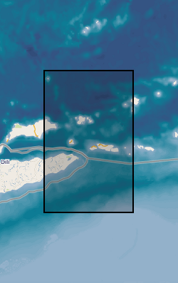
- Extent
-
BANDA SEA [id=2001367]
- Dataset Reference Date ()
- 2010
- Extent
-
Darwin [id=2000071]
- Dataset Reference Date ()
- 1950
- Extent
-
TIMOR [id=566000]
- Dataset Reference Date ()
- 1979
N
S
E
W
))
- Begin date
- 1992-02-05
- End date
- 1993-03
- Additional information
- The following links provide more details regarding the surveys undertaken by BIRPS, some of its history and publications: http://www.earthscrust.org.au/science/startups/birps-su.html; http://bullard.esc.cam.ac.uk/~birps/; SNYDER, D. & HOBBS, R. 1991. The BIRPS Atlas: Deep Seismic Reflection Profiles Around the British Isles. http://books.google.co.uk/books?id=wO2LMRXAbSkC&printsec=frontcover&dq=isbn:0521418283; SNYDER, D. & HOBBS, R. 1999. The BIRPS Atlas II. A Second Decade of Deep Seismic Reflection Profiling. http://www.geolsoc.org.uk/MPB42; All the final stack BIRPS data are on the Virtual Seismic Atlas hosted by Leeds University. The following link lists all the BIRPS profiles ever acquired http://see-atlas.leeds.ac.uk:8080/search/advancedSearch.jsp?N=0&Ntk=all&Ntx=mode+matchall&Nty=1&Ntt=BIRPS
- Code
- WGS 84 (EPSG::4326)
Distribution Information
- Data format
-
-
SEG Y
()
-
SEG Y
()
- Resource Locator
- Virtual Seismic Atlas
- Resource Locator
- Virtual Seismic Atlas
- Quality Scope
- dataset
- Other
- dataset
Report
- Dataset Reference Date ()
- 2011
- Explanation
- See the referenced specification
- Degree
Report
- Dataset Reference Date ()
- 2010-12-08
- Explanation
- See http://eur-lex.europa.eu/LexUriServ/LexUriServ.do?uri=OJ:L:2010:323:0011:0102:EN:PDF
- Degree
- Statement
- Deep multichannel seismic data were acquired and processed. M/V GECO-kappa survey ship was used towing 92-channel hydrophone streamer. An airgun array of 7324 cubic inches was 70 m wide producing 97 bar peak-to-peak pressure at frequencies of 3-62.5 Hz. DAMAR was shot at 100 m intervals to a recording time of 37 s in total. The TIMOR provided redundancy and higher spatial resolution near Timor, and used a 50m shot interval to record 17±24 s records. This second profile was effectively continued to the Australian coast when the Australian Geological Survey Organisation collected a series of 16 s profiles on their continental shelf the next year. Line 12 of this survey was reprocessed using the same parameters used to process TIMOR and provides an example of lithospheric reflectivity from an Archaean shield margin that has undergone extension.
Metadata
- File identifier
- c425c9fc-cb6a-352c-e044-0003ba9b0d98 XML
- Metadata Language
- English (en)
- Resource type
- dataset
- Metadata Date
- 2024-07-25
- Metadata standard name
- UK GEMINI
- Metadata standard version
- 2.3
British Geological Survey
The Lyell Centre, Research Avenue South
,
EDINBURGH
,
LOTHIAN
,
EH14 4AP
,
United Kingdom
+44 131 667 1000