NERC Data Catalogue Service
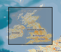
Geoelectric field maps of the UK from four large geomagnetic storms derived from thin-sheet model (NERC Grant NE/P017231/1)
This is a thin-sheet model of the regional geoelectric field covering the UK and Ireland, which is a combination of the response of the ground conductivity in a region with the spatial and temporal measurements of the rate of change of the horizontal components of the magnetic field. Output from the BGS Space Weather Impact on Ground-based Systems (SWIGS)
Default
Identification info
- Metadata Language
- English (en)
- Dataset Reference Date ()
- 2021-06-08
British Geological Survey
-
Enquiries
0115 936 3276
The Lyell Centre, Research Avenue South
,
EDINBURGH
,
LOTHIAN
,
EH14 4AP
,
United Kingdom
0115 936 3142
0115 936 3276
British Geological Survey
-
Enquiries
0115 936 3276
The Lyell Centre, Research Avenue South
,
EDINBURGH
,
LOTHIAN
,
EH14 4AP
,
United Kingdom
0115 936 3142
0115 936 3276
- Maintenance and update frequency
- notApplicable
- GEMET - INSPIRE themes, version 1.0
- BGS Thesaurus of Geosciences
-
- NGDC Deposited Data
- Conductivity
- Keywords ()
- Keywords
-
- NERC_DDC
- Limitations on Public Access
- otherRestrictions
- Other constraints
- licenceOGL
- Use constraints
- otherRestrictions
- Other constraints
- The copyright of materials derived from the British Geological Survey's work is vested in the Natural Environment Research Council [NERC]. No part of this work may be reproduced or transmitted in any form or by any means, or stored in a retrieval system of any nature, without the prior permission of the copyright holder, via the BGS Intellectual Property Rights Manager. Use by customers of information provided by the BGS, is at the customer's own risk. In view of the disparate sources of information at BGS's disposal, including such material donated to BGS, that BGS accepts in good faith as being accurate, the Natural Environment Research Council (NERC) gives no warranty, expressed or implied, as to the quality or accuracy of the information supplied, or to the information's suitability for any use. NERC/BGS accepts no liability whatever in respect of loss, damage, injury or other occurence however caused.
- Other constraints
- Available under the Open Government Licence subject to the following acknowledgement accompanying the reproduced NERC materials "Contains NERC materials ©NERC [year]"
- Spatial representation type
- textTable
- Topic category
-
- Geoscientific information
- Extent
-
EIRE [id=182000]
- Dataset Reference Date ()
- 1979
- Extent
-
GB
- Dataset Reference Date ()
- 2009
- Extent
-
UK [id=139300]
- Dataset Reference Date ()
- 1979
- Extent
-
UKM
- Dataset Reference Date ()
- 2009
N
S
E
W
))
- Begin date
- 1989-03-13
- End date
- 2017-09-08
- Code
- WGS 84 (EPSG::4326)
- Quality Scope
- dataset
- Other
- dataset
Report
- Dataset Reference Date ()
- 2011
- Explanation
- See the referenced specification
- Degree
Report
- Dataset Reference Date ()
- 2010-12-08
- Explanation
- See http://eur-lex.europa.eu/LexUriServ/LexUriServ.do?uri=OJ:L:2010:323:0011:0102:EN:PDF
- Degree
- Statement
- The modelling code is based upon the work of Vasseur and Weidelt (1977) which has been employed in previous studies. The code computes the surface electric field arising at a particular period (for example, 120 s or 2 min) from a 2-D conductivity model of the surface and a layered subsurface. The geoelectric fields are made by inputting the average rate-of-change of the horizontal magnetic field for a fixed period as an input. We adopt the rate of change of the horizontal components of the field (dBX/dt and dBY /dt), using a difference of 2 minutes which matches the available magnetic time-series of minute-mean values. The output is the real and imaginary parts of the geoelectric field.
Metadata
- File identifier
- c4cc72c2-0250-3192-e054-002128a47908 XML
- Metadata Language
- English (en)
- Resource type
- dataset
- Metadata Date
- 2024-07-25
- Metadata standard name
- UK GEMINI
- Metadata standard version
- 2.3
British Geological Survey
Environmental Science Centre,Keyworth
,
NOTTINGHAM
,
NOTTINGHAMSHIRE
,
NG12 5GG
,
United Kingdom
+44 115 936 3100