NERC Data Catalogue Service
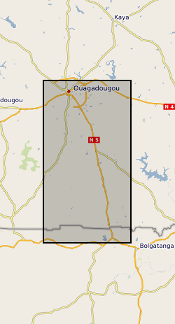
Physical measurements of soil moisture, river stage, and groundwater levels from Ghana and Burkina Faso 2016-2019 (NERC Grant NE/M008827/1, NE/M008983/1)
The datasets consist of soil moisture (hourly-weekly), river stage (1 min), and groundwater level (hourly) collected as part of the BRAVE project (NE/M008827/1 and NE/M008983/1) to understand the resilience of boreholes in low-yielding aquifers in the River Volta Basin to climate. The data were collected from physical observatories in Sanon (Burkina Faso) and Aniabisi (Ghana). Soil moisture data were logged hourly beneath contrasting land uses and roaming soil moisture surveys were also undertaken across a wider access tube array. River stage was monitored at the catchment outlet in Sanon and groundwater levels were measured in both catchments.
Default
Identification info
- Metadata Language
- English (en)
- Dataset Reference Date ()
- 2021-10-12
University of Reading
-
Professor Rosalind Cornforth
(
Department of Meteorology
)
Reading
,
RG6 6AR
,
British Geological Survey
-
Enquiries
01491 692345
Maclean Building, Crowmarsh Gifford
,
WALLINGFORD
,
OXON
,
OX10 8BB
,
United Kingdom
01491 838800
01491 692345
British Geological Survey
-
Enquiries
01491 692345
Maclean Building, Crowmarsh Gifford
,
WALLINGFORD
,
OXON
,
OX10 8BB
,
United Kingdom
01491 838800
01491 692345
British Geological Survey
-
Enquiries
01491 692345
Maclean Building, Crowmarsh Gifford
,
WALLINGFORD
,
OXON
,
OX10 8BB
,
United Kingdom
01491 838800
01491 692345
- Maintenance and update frequency
- notApplicable
- GEMET - INSPIRE themes, version 1.0
- BGS Thesaurus of Geosciences
-
- NGDC Deposited Data
- Rivers
- Groundwater
- Soil water
- Keywords ()
- Keywords
-
- NERC_DDC
- Limitations on Public Access
- otherRestrictions
- Other constraints
- licenceOGL
- Use constraints
- otherRestrictions
- Other constraints
- The copyright of materials derived from the British Geological Survey's work is vested in the Natural Environment Research Council [NERC]. No part of this work may be reproduced or transmitted in any form or by any means, or stored in a retrieval system of any nature, without the prior permission of the copyright holder, via the BGS Intellectual Property Rights Manager. Use by customers of information provided by the BGS, is at the customer's own risk. In view of the disparate sources of information at BGS's disposal, including such material donated to BGS, that BGS accepts in good faith as being accurate, the Natural Environment Research Council (NERC) gives no warranty, expressed or implied, as to the quality or accuracy of the information supplied, or to the information's suitability for any use. NERC/BGS accepts no liability whatever in respect of loss, damage, injury or other occurence however caused.
- Other constraints
- Available under the Open Government Licence subject to the following acknowledgement accompanying the reproduced NERC materials "Contains NERC materials ©NERC [year]"
- Spatial representation type
- vector
- Topic category
-
- Geoscientific information
- Extent
-
BF
- Dataset Reference Date ()
- 2009
- Extent
-
BFA
- Dataset Reference Date ()
- 2009
- Extent
-
BURKINA FASO [id=626000]
- Dataset Reference Date ()
- 1979
N
S
E
W
))
- Begin date
- 2016-01-01
- End date
- 2019-12-31
- Code
- WGS 84 (EPSG::4326)
- Quality Scope
- dataset
- Other
- dataset
Report
- Dataset Reference Date ()
- 2011
- Explanation
- See the referenced specification
- Degree
Report
- Dataset Reference Date ()
- 2010-12-08
- Explanation
- See http://eur-lex.europa.eu/LexUriServ/LexUriServ.do?uri=OJ:L:2010:323:0011:0102:EN:PDF
- Degree
- Statement
- Soil moisture data (m3/m3) were collected from 2m access tubes using Sentek logging EnviroSCAN probes or Diviner 2000 roaming surveys. River stage was monitoring in Sanon using an In-Situ Rugged Troll 100 in a stilling well logging at a 1 minute frequency. Groundwater levels were monitoring using In-Situ Rugged Troll 100s that were validated using manual dip measurements to convert them to metres below datum.
Metadata
- File identifier
- cf68557d-53a3-3a20-e054-002128a47908 XML
- Metadata Language
- English (en)
- Resource type
- dataset
- Metadata Date
- 2024-07-25
- Metadata standard name
- UK GEMINI
- Metadata standard version
- 2.3
British Geological Survey
Environmental Science Centre,Keyworth
,
NOTTINGHAM
,
NOTTINGHAMSHIRE
,
NG12 5GG
,
United Kingdom
+44 115 936 3100