NERC Data Catalogue Service
BGS GeoCoast GB version 1
The BGS GeoCoast Dataset is a Geographic Information System (GIS)-based analysis for indicating multi-hazards and interdependencies within the coastal zone of Great Britain (not including Orkney and Shetland). GeoCoast represents the natural geological coastline (around the mainland of Great Britain) as if no coastal defences or made ground are present. This will be of particular value in areas where coastal defences are no longer maintained. GeoCoast will offer anyone with assets, or an interest in the coastline around Great Britain, access to easy-to-use datasets linked to geohazard data. This will allow users to interpret potential interdependencies in terms of erosion, flooding, habitat and other vulnerabilities. These datasets are divided into two data packages: Premium and Open datasets, which include the following information: The data is delivered in GIS ESRI point, polyline and polygon format (other formats available on request).
Default
Identification info
- Metadata Language
- English (en)
- Dataset Reference Date ()
- 2022-03
British Geological Survey
-
Enquiries
0115 936 3276
Environmental Science Centre, Nicker Hill, Keyworth
,
NOTTINGHAM
,
NOTTINGHAMSHIRE
,
NG12 5GG
,
United Kingdom
0115 936 3143
0115 936 3276
British Geological Survey
-
Enquiries
0115 936 3276
Environmental Science Centre, Nicker Hill, Keyworth
,
NOTTINGHAM
,
NOTTINGHAMSHIRE
,
NG12 5GG
,
United Kingdom
0115 936 3143
0115 936 3276
- Maintenance and update frequency
- notPlanned
- GEMET - INSPIRE themes, version 1.0
- BGS Thesaurus of Geosciences
-
- Coastal management
- Coasts
- UK Location (INSPIRE)
- Engineering geology
- Keywords ()
- Keywords
-
- NERC_DDC
- Limitations on Public Access
- otherRestrictions
- Other constraints
- license
- Use constraints
- otherRestrictions
- Other constraints
- The copyright of materials derived from the British Geological Survey's work is vested in the Natural Environment Research Council [NERC]. No part of this work may be reproduced or transmitted in any form or by any means, or stored in a retrieval system of any nature, without the prior permission of the copyright holder, via the BGS Intellectual Property Rights Manager. Use by customers of information provided by the BGS, is at the customer's own risk. In view of the disparate sources of information at BGS's disposal, including such material donated to BGS, that BGS accepts in good faith as being accurate, the Natural Environment Research Council (NERC) gives no warranty, expressed or implied, as to the quality or accuracy of the information supplied, or to the information's suitability for any use. NERC/BGS accepts no liability whatever in respect of loss, damage, injury or other occurence however caused.
- Other constraints
- The dataset is made available to external clients under BGS Digital Data Licence terms and conditions. Revert to the IPR Section (iprdigital@bgs.ac.uk ) if further advice is required with regard to permitted usage.
- Spatial representation type
- vector
- Topic category
-
- Geoscientific information
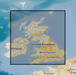
- Extent
-
GBN
- Dataset Reference Date ()
- 2009
- Extent
-
GREAT BRITAIN [id=139600]
- Dataset Reference Date ()
- 1979
N
S
E
W
))
- End date
- 2022
Distribution Information
- Data format
-
-
ESRI Shapefile
()
-
ESRI Shapefile
()
- Resource Locator
- GeoCoast Premium homepage
- Resource Locator
- GeoCoast open Homepage
- Resource Locator
- GeoCoast Premium homepage
- Resource Locator
- GeoCoast open Homepage
- Quality Scope
- dataset
- Other
- dataset
Report
- Dataset Reference Date ()
- 2011
- Explanation
- See the referenced specification
- Degree
Report
- Dataset Reference Date ()
- 2010-12-08
- Explanation
- See http://eur-lex.europa.eu/LexUriServ/LexUriServ.do?uri=OJ:L:2010:323:0011:0102:EN:PDF
- Degree
- Statement
- This dataset package was created using the following methodologies:
Metadata
- File identifier
- dc24a8ff-0859-0b3a-e053-0937940a96d4 XML
- Metadata Language
- English (en)
- Resource type
- dataset
- Metadata Date
- 2024-07-25
- Metadata standard name
- UK GEMINI
- Metadata standard version
- 2.3
British Geological Survey
Environmental Science Centre, Keyworth
,
NOTTINGHAM
,
NOTTINGHAMSHIRE
,
NG12 5GG
,
United Kingdom
+44 115 936 3100