NERC Data Catalogue Service
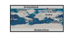
Random Forest model output prediction raster for the occurrence of Fe-Mn in the World Oceans
The raster provide the output of a machine-learning random forest algorithm modelling the occurrence of ferromanganese (Fe-Mn) crust deposits in the world ocean. This raster constitutes a data-driven approach for mineral prospectivity mapping of Fe-Mn crusts that should be used in conjunction with other expert-driven prospectivity analysis to guide the assessment of Fe-Mn crust coverage in the world ocean and potential mineral exploration. The raster contains values between 0.07 and 0.92. Any values outside of that range (e.g., 0) are outside of the model prediction and should not be displayed. To reproduce data as displayed in the forthcoming associated publication, it is recommended to apply a 'Percent Clip' stretched 'Viridis' colour scheme.
Default
Identification info
- Metadata Language
- English (en)
- Dataset Reference Date ()
- 2022-09-28
British Geological Survey
-
Enquiries
0115 936 3276
Environmental Science Centre, Nicker Hill, Keyworth
,
NOTTINGHAM
,
NOTTINGHAMSHIRE
,
NG12 5GG
,
United Kingdom
0115 936 3143
0115 936 3276
British Geological Survey
-
Enquiries
0115 936 3276
Environmental Science Centre, Nicker Hill, Keyworth
,
NOTTINGHAM
,
NOTTINGHAMSHIRE
,
NG12 5GG
,
United Kingdom
0115 936 3143
0115 936 3276
- Maintenance and update frequency
- notPlanned
- GEMET - INSPIRE themes, version 1.0
- BGS Thesaurus of Geosciences
-
- Mineral exploration
- Ferromanganese
- Submarine mineral deposits
- UK Location (INSPIRE)
- Earth crust
- Keywords ()
- Keywords
-
- NERC_DDC
- Limitations on Public Access
- otherRestrictions
- Other constraints
- restricted
- Use constraints
- otherRestrictions
- Other constraints
- The copyright of materials derived from the British Geological Survey's work is vested in the Natural Environment Research Council [NERC]. No part of this work may be reproduced or transmitted in any form or by any means, or stored in a retrieval system of any nature, without the prior permission of the copyright holder, via the BGS Intellectual Property Rights Manager. Use by customers of information provided by the BGS, is at the customer's own risk. In view of the disparate sources of information at BGS's disposal, including such material donated to BGS, that BGS accepts in good faith as being accurate, the Natural Environment Research Council (NERC) gives no warranty, expressed or implied, as to the quality or accuracy of the information supplied, or to the information's suitability for any use. NERC/BGS accepts no liability whatever in respect of loss, damage, injury or other occurence however caused.
- Other constraints
- Either: (i) the dataset is made freely available, e.g. via the Internet, for a restricted category of use (e.g. educational use only); or (ii) the dataset has not been formally approved by BGS for access and use by external clients under licence, but its use may be permitted under alternative formal arrangements; or (iii) the dataset contains 3rd party data or information obtained by BGS under terms and conditions that must be consulted in order to determine the permitted usage of the dataset. Refer to the BGS staff member responsible for the creation of the dataset if further advice is required. He / she should be familiar with the composition of the dataset, particularly with regard to 3rd party IPR contained in it, and any resultant use restrictions. This staff member should revert to the IPR Section (ipr@bgs.ac.uk ) for advice, should the position not be clear.
- Topic category
-
- Geoscientific information
- Begin date
- 2020
- End date
- 2022
Spatial Reference System
No information provided.
Distribution Information
- Data format
-
-
raster
()
-
raster
()
- Resource Locator
- Data
- Resource Locator
- Digital Object Identifier (DOI)
- Resource Locator
- Data
- Resource Locator
- Digital Object Identifier (DOI)
- Quality Scope
- nonGeographicDataset
- Other
- non geographic dataset
Report
- Dataset Reference Date ()
- 2011
- Explanation
- See the referenced specification
- Degree
Report
- Dataset Reference Date ()
- 2010-12-08
- Explanation
- See http://eur-lex.europa.eu/LexUriServ/LexUriServ.do?uri=OJ:L:2010:323:0011:0102:EN:PDF
- Degree
- Statement
- The raster dataset correspond to the output of a random-forest algorithm data classification. The model uses a set of known locations for deposit and non-deposit samples to fingerprint the geospatial signature of each class against a range of environmental and geological variables, also referred to as predictors. The multivariate geospatial signature of each pixel covered by all predictors is then used to predict the likelihood of occurrence of the target class. This prediction takes the form of a raster data set with value between 0 and 1 marking the confidence in the prediction of the target class.
Metadata
- File identifier
- eaec2401-f090-18e7-e053-0937940aa3f2 XML
- Metadata Language
- English (en)
- Resource type
- nonGeographicDataset
- Hierarchy level name
- non geographic dataset
- Metadata Date
- 2024-04-17
- Metadata standard name
- UK GEMINI
- Metadata standard version
- 2.3
British Geological Survey
Environmental Science Centre, Keyworth
,
NOTTINGHAM
,
NOTTINGHAMSHIRE
,
NG12 5GG
,
United Kingdom
+44 115 936 3100