 NERC Data Catalogue Service
2003
Type of resources
Topics
Keywords
Contact for the resource
Provided by
Years
Formats
Representation types
Update frequencies
Scale
-
Data were collected from the 30th of March 1999 to the 30th of March 2011 by the CAMRa (Chilbolton Advanced Meteorological Radar) at Chilbolton Observatory, Hampshire. The dataset contains measurements of radial component of wind velocity, radar frequency, differential phase shift and unfolded Doppler velocity. Plots are also available of differential phase shift, Doppler velocity, radar reflectivity factor, and linear depolarisation ratio.
-
Data were collected by Chilbolton Facility for Atmospheric and Radio Research (CFARR) Raingauges from 15th of March 2002 to the present at Sparsholt College, Hampshire. The dataset contains measurements of rainfall accumulation as measured by RAL Rapid Response Drop Counting rain gauges.
-
Data were collected by the Chilbolton Facility for Atmospheric and Radio Research (CFARR) Meteorological Sensor from 2003 to 2007 at Sparsholt College, Hampshire. The standard meteorological measurements were made in support of all experiments at the Chilbolton Observatory. The data are automatically recorded every 10 seconds from a range of different sensors. The dataset contains measurements including temperature, dew point, pressure, wind speed and wind direction.
-
HIRDLS was a mid-infrared limb-scanning radiometer (21 channels from 6.12 to 17.76 µm and provided sounding observations to observe the lower stratosphere with improved sensitivity and accuracy. HIRDLS was carried on the Aura mission, part of the A-train procession of polar orbiting satellites forming part of NASA's Earth Observing System (EOS). This dataset contains level 3 data of the global distributions of temperature, clouds, aerosols, and 10 trace species O3, H2O, CH4, N2O, NO2, HNO3, N2O5, CFC11, CFC12, and ClONO2 in the stratosphere and upper troposphere at high vertical and horizontal resolution in the Earth's atmosphere between about 8 and 100 km, from the High Resolution Dynamics Limb Sounder (HIRDLS) instrument.
-
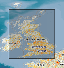
The Sparsholt College-South Wonston water station radio links data describe signal levels of several links at a frequency of 38 Ghz, which covered a path of 5km from the South Wonston water tower near the A34 to Sparsholt College. The data were collected between October 2002 and April 2005. The radio link between Sparsholt college and the Wonston water tower is used to investigate the effects of rain and sleet on radio signals.
-
Data were collected by the Chilbolton Facility for Atmospheric and Radio Research (CFARR) Disdrometer from the 1st of July 2004 to the present at Sparsholt College, Hampshire. The dataset contains measurements of the drop size distribution of rain.
-
The Sparsholt College-South Wonston water station radio links data describe signal levels of several links at a frequency of 54 Ghz, which covered a path of 5km from the South Wonston water tower near the A34 to Sparsholt College. The data were collected between October 2002 and April 2005. The radio link between Sparsholt college and the Wonston water tower is used to investigate the effects of rain and sleet on radio signals.
-
Data identifying landscape areas (shown as polygons) attributed with geological names and rock type descriptions. The scale of the data is 1:625 000 scale providing a simplified interpretation of the geology and may be used as a guide at a regional or national level, but should not be relied on for local geology. Onshore coverage is provided for all of England, Wales, Scotland, the Isle of Man and Northern Ireland. Superficial deposits are the youngest geological deposits formed during the most recent period of geological time, the Quaternary, which extends back about 2.58 million years from the present. They lie on top of older deposits or rocks referred to as bedrock. Superficial deposits were laid down by various natural processes such as action by ice, water, wind and weathering. As such, the deposits are denoted by their BGS Lexicon name, which classifies them on the basis of mode of origin (lithogenesis) with names such as, 'glacial deposits', 'river terrace deposits' or 'blown sand'; or on the basis of their composition such as 'peat'.Most of these superficial deposits are unconsolidated sediments such as gravel, sand, silt and clay. The digital data includes attribution to identify each deposit type (in varying levels of detail) as described in the BGS Rock Classification Scheme (volume 4). The data are available in vector format (containing the geometry of each feature linked to a database record describing their attributes) as ESRI shapefiles and are delivered free of charge under the terms of the Open Government Licence.
-
EU is required to reduce its CO2 emissions by 8% by 2008-2012, later deeper cuts are foreseen. CO2 underground storage is one of the few options that can meet these obligations. The present project investigates four new potential cases for CO2-reservoirs, mainly on land. It will continue reservoir simulations and study geochemical reactions to develop final-fate prediction models. This will be supported by new seismic observations. At the same time gravimetrics is introduced as a new method better suited on land. This proposal builds directly on the Thermie/5FP SACS2 project results, which involved monitoring and modelling the injection of CO2 into the Utsira Sand aquifer, at Sleipner gas field, offshore Norway.
-
Data were collected by Universities' Facility for Atmospheric Measurement's (UFAM) 1290mhz Degreane Mobile Wind Profiler, deployed at the Writtle Agriculture College, Essex, in August 2003 as part of the Tropospheric ORganic CHemistry Experiment Project (TORCH) 1 field campaign. During the field campaign the mobile wind profiler obtained vertical profiles of the horizontal and vertical wind components. For each signal beam profiles of the signal to noise (SNR) ratio and spectral widths were also taken. The data consist of files available in the NASA-AMES ASCII and netCDF binary formats and plots in PNG format. Data are available to all BADC registered users under the Government Open Data licence.