 NERC Data Catalogue Service
2023
Type of resources
Topics
Keywords
Contact for the resource
Provided by
Years
Formats
Representation types
Update frequencies
Resolution
-
The World Climate Research Program (WCRP) Coupled Model Intercomparison Project, Phase 6 (CMIP6) data from the the MIROC team MIROC-ES2L model output for the "pulse removal of 100 Gt carbon from pre-industrial atmosphere" (esm-pi-cdr-pulse) experiment. These are available at the following frequencies: Amon, Lmon and Omon. The runs included the ensemble member: r1i1p1f2. CMIP6 was a global climate model intercomparison project, coordinated by PCMDI (Program For Climate Model Diagnosis and Intercomparison) on behalf of the WCRP and provided input for the Intergovernmental Panel on Climate Change (IPCC) 6th Assessment Report (AR6). The official CMIP6 Citation, and its associated DOI, is provided as an online resource linked to this record. The the MIROC team team consisted of the following agencies: Atmosphere and Ocean Research Institute (AORI), Centre for Climate System Research - National Institute for Environmental Studies (CCSR-NIES) and Atmosphere and Ocean Research Institute (AORI).
-
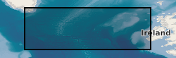
Radiocarbon measurements on planktic and benthic foraminifera from sediment cores in the North Atlantic: Ocean Drilling Program (ODP) 983, SU90-44, MD04-2829, MD01-2461, and EW9302-2JPC Site 983 is located on the Bjorn Drift in approximately 1650 m water depth on the eastern flank of the Reykjanes Ridge. Hole 983A Position: 60°24.200'N, 23°38.437'W. Sediment core SU90-44 collected from the north-eastern Atlantic basin, near the top of a small abyssal hill, southeast of the Rockall plateau, 50°01'N, 17°06'W, 4279 m. Sediment core MD04-2829 collected from Rosemary Bank in the Northern Rockall Trough 58º 56.93’ N; 09º 34.30’ W; 1743 m water depth. Sediment core MD01-2461 was collected from the north-western flank of the Porcupine Seabight approximately 550 km to the southwest, 51°45’N, 12°55’W; 1153 m water depth, recovered in 2001. Core EW9302-2JPC recovered from the Rockall Plateau and East Flank of Reykjanes Ridge from the Flemish Cap in the south- eastern Labrador Sea, 48°47.70′N, 45°05.09′W, taken at water depth 1251m.
-

Samples are dunites, harzburgites and pyroxenites with variable proportions of chromite from the Cabo Ortegal collection of the late Prof Hazel Prichard, that is held at Cardiff University. Data were acquired during 2021 and 2022. Folders include: reflected light microscopy images of various sulfide minerals and mineral textures in thin section; element maps and backscattered electron images of areas and selected complete thin sections; and metadata (time-resolved analysis spectral data) for laser ablation ICP-MS analysis of sulfide minerals. Petrographic assessment by element mapping used a Zeiss Sigma HD Field Emission Gun Analytical Scanning Electron Microscope (A-SEM) equipped with two Oxford Instruments 150 mm2 Energy Dispersive X-ray Spectrometry (EDS) detectors at the School of Earth and Environmental Sciences, Cardiff University. Operating conditions were set at 20kV and aperture size to 120 µm, with a nominal beam current of 4 nA and working distance of 8.9 mm. Using Aztec software, maps were acquired at 100 to 150 x magnifications, with resulting pixel sizes ranging from 10 to 22 µm, depending on the resolution of acquired spectral images. Laser-ablation ICPMS analyses were performed using a ESI UP213 laser system coupled to a Thermo iCAPRQ ICP-MS system at the School of Earth and Environmental Sciences, Cardiff University. The data were gathered to understand the concentrations of precious and semi-metal trace elements and their likely mineral forms in the various Fe-Ni-Cu sulfide minerals.
-
Mineralogical data relating to carbonate-bearing fluorapatite from the Bukusu, Catalao II, Sokli, Kovdor and Glenover carboantite complexes. Report on the data is here: Broom-Fendley, S., Siegfried, P.R., Wall, F. et al. The origin and composition of carbonatite-derived carbonate-bearing fluorapatite deposits. Miner Deposita 56, 863-884 (2021). https://doi.org/10.1007/s00126-020-01010-7.
-

**This dataset has been superseded** The newGeoSure Insurance Product (newGIP) provides the potential insurance risk due to natural ground movement. It incorporates the combined effects of the 6 GeoSure hazards on (low-rise) buildings: landslides, shrink-swell clays, soluble rocks, running sands, compressible ground, and collapsible deposits. These hazards are evaluated using a series of processes including statistical analyses and expert elicitation techniques to create a derived product that can be used for insurance purposes such as identifying and estimating risk and susceptibility. The evaluated hazards are then linked to a postcode database - the Derived Postcode Database (DPD), which is updated biannually with new releases of Ordnance Survey Code-Point® data (current version used: 2023.1). The newGIP is provided for national coverage across Great Britain (not including the Isle of Man). This product is available in a range of GIS formats including Access (*.dbf), ArcGIS (*.shp) or MapInfo (*.tab) on request. The newGIP is produced for use at 1:50 000 scale providing 50 m ground resolution.
-
The newGeoSure Insurance Product (newGIP) provides the potential insurance risk due to natural ground movement. It incorporates the combined effects of the 6 GeoSure hazards on (low-rise) buildings: landslides, shrink-swell clays, soluble rocks, running sands, compressible ground, and collapsible deposits. These hazards are evaluated using a series of processes including statistical analyses and expert elicitation techniques to create a derived product that can be used for insurance purposes such as identifying and estimating risk and susceptibility. The evaluated hazards are then linked to a postcode database - the Derived Postcode Database (DPD), which is updated biannually with new releases of Ordnance Survey Code-Point® data (current version used: 2023.1). The newGIP is provided for national coverage across Great Britain (not including the Isle of Man). This product is available in a range of GIS formats including Access (*.dbf), ArcGIS (*.shp) or MapInfo (*.tab) on request. The newGIP is produced for use at 1:50 000 scale providing 50 m ground resolution.
-

Concentrations of total organic carbon (TOC), total petroleum hydrocarbons, polycyclic aromatic hydrocarbons (PAHs) and polychlorinated biphenyls (PCBs) were determined in 84 near-surface soils (5-20 cm depth) taken from a 255 km2 area of Glasgow in the Clyde Basin, UK, during July 2011. Total petroleum hydrocarbon ranged from 79-2,505 mg kg-1 (mean 388 mg kg-1; median 272 mg kg-1) of which the aromatic fraction was 13-74 % (mean 44 %, median 43 %) and saturates were 28-87 % (mean 56 %, median 57 %). Σ16 PAH varied from 2-653 mg kg-1 (mean 32.4 mg kg-1; median 12.5mg kg-1) and Σ31 PAH range was 2.47-852 mg kg-1 (mean 45.4 mg kg-1; median 19.0 mg kg-1). PCB tri-hepta range was 2.2-1052 mg kg-1 (mean 32.4 mg kg-1; median 12.7 mg kg-1) and the ΣPCB7 was 0.3-344 mg kg-1 (mean 9.8 mg kg-1; median 2.7 mg kg-1). This data is associated with the published research paper https://doi.org/10.1017/S1755691018000324 Kim, A.W., Vane, C.H., Moss-Hayes, V. Berriro, D.B., Fordyce, F., Everrett, P. Nathanail, P.C. 2018. Polycyclic aromatic hydrocarbons (PAH) and polychlorinated biphenyls (PCB) in urban soils of Glasgow, UK. Earth and Environmental Science Transactions of the Royal Society of Edinburgh 108, 2-3, 231-248.
-
The World Climate Research Program (WCRP) Coupled Model Intercomparison Project, Phase 6 (CMIP6) data from the Met Office Hadley Centre (MOHC) HadGEM3-GC31-MM model output for the "Assimilation run paralleling the historical simulation, which may be used to generate hindcast initial conditions" (dcppA-assim) experiment. These are available at the following frequency: Omon. The runs included the ensemble members: r10i1p1f2, r1i1p1f2, r2i1p1f2, r3i1p1f2, r4i1p1f2, r5i1p1f2, r6i1p1f2, r7i1p1f2, r8i1p1f2 and r9i1p1f2. CMIP6 was a global climate model intercomparison project, coordinated by PCMDI (Program For Climate Model Diagnosis and Intercomparison) on behalf of the WCRP and provided input for the Intergovernmental Panel on Climate Change (IPCC) 6th Assessment Report (AR6). The official CMIP6 Citation, and its associated DOI, is provided as an online resource linked to this record.
-
This dataset contains point measurement of snow-air transition temperatures at 2 cm intervals on a 5 m thermistor chain installed spanning the snow-air transition at Summit Station, Greenland. Measurements were made using a Snow Ice Mass Balance Apparatus (SIMBA) with a bespoke 5 m chain. These data were collected as part of the joint Natural Environmental Research Council (NERC) and US National Science Foundation (NSF) -funded Integrated Characterisation of Energy, Clouds, Atmospheric state, and Precipitation at Summit - Aerosol Cloud Experiment (ICECAPS-ACE) project. These data were continued through the 3 year extension to the ICECAPS-ACE project called ICECAPS-MELT.
-

3D structured light surface scan of a fossil held within the BGS Type and Stratigraphical Reference Collection Sample number: BGS GSM 26215 Species: Lytoceras jurense (Ammonite) Age: Inferior Oolite Group, Jurassic Location: Quarry Hill, Chideock, Dorset