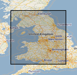
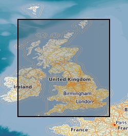
 NERC Data Catalogue Service
10000
Type of resources
Available actions
Topics
Keywords
Contact for the resource
Provided by
Years
Formats
Representation types
Update frequencies
Scale
Resolution
-
Primary Geological Data resulting from Open Cast Coal exploration. Collection of data includes reports, interpretations and records of research in British coalfield areas deposited by British Coal. Data for past and current collieries and for future prospects. The majority of the collection was deposited with the National Geological Records Centre by the Coal Authority in July 2001. The collection includes borehole site plans, borehole logs , analyses and geophysical data etc. BGS holdings of opencast data are to be integrated with these collections. New data from coal companies will be added as it is received.
-
The object of the scoping study was to assess the feasibility of creating a BGS International Minerals Data Library by first reviewing the nature and extent of minerals-related data holdings accumulated by BGS overseas projects in the last 35 years. Other important considerations such as data quality, utility and ownership are also addressed. Minerals-related information is regarded as geological, geochemical and geophysical data which have relevance in mineral exploration, prospect assessment, resource evaluation and ore deposit exploitation. This includes surveys and multidisciplinary studies on all scales and covering a wide range of disciplines/methodologies. The only aspects that are specifically excluded from the inventory are those projects that deal solely with hydrogeological investigations, development of hardware, software and laboratory techniques, training, institutional restructuring and management. This report lists the information holdings and their various formats summarised on a geographical basis and puts forward a proposal for the development of a digital BGS International Minerals Data Library for Industry and Government.
-
A collection of reference drawings relating to investigations carried out by Nirex, during the period from 1989 to 1997. The drawings summarise the status of the geological investigation at Sellafield and include borehole locations, geology (surface, structure, sections etc) and geophysics (seismic, airborne, etc). Sites near Sellafield, in Cumbria, and Dounreay, in Caithness. The Nirex (Nuclear Industry Radioactive Waste Executive) geological archive was transferred to the British Geological Survey during 2000/2001. The BGS has undertaken to retain the records for a minimum of 50 years as part of its national geological archive. The ownership of Nirex was transferred from the nuclear industry to the UK Government departments DEFRA and DTI in April 2005, and then to the UK's Nuclear Decommissioning Authority (NDA) in November 2006.
-
Collection of drillcore, bulk samples, unwashed cuttings and processed material from onshore boreholes drilled in the UK by BGS, commercial and public bodies. Developed as part of the BGS responsibility to establish and maintain a National Borehole collection. Details of the collection are held on the 'Borehole Materials Database', and may be accessed over the internet from the BGS internet site.
-
The dataset is a subset of the BGS borehole material database, created on August 1st 2015 covering only the Bowland-Hodder geological unit (as defined and mapped by Andrews et al., 2013). It shows all boreholes (name, location and registration details) for which BGS hold borehole material (drillcore, cuttings, samples and their depth ranges). This data will add value to existing NERC (Natural Environment Research Council) data by allowing a simple route for users to identify borehole material from the Bowland-Hodder interval.
-

Interrelated specimens and records compiled over 150 years of palaeontological collecting and research. All associated paper data (registers, indexes of locality and storage, reports of conclusions).
-
The collection comprises plans of mine workings for ironstone, fireclay, limestone, baryte and metalliferous minerals for Scotland dating from 1872 onwards deposited on abandonment of a mine in compliance with the coal and metalliferous mines regulation acts. The plans are held on behalf of the Health & Safety Executive (HSE) and total about 610 plans. Indexed in the BGS Plans Database Index. As the collection relates to plans of mines abandoned after the 1872 Act, the holdings are fairly complete after this date. The Metalliferous Mines Act originally applied only to mines employing more than 12 men, (eg. some limestone mines). Where non-coal minerals were worked with coal, the abandonment plans are retained by the Coal Authority. Coal Authority also holds exclusively non-coal mine plans not covered by Mine Abandonment Plan collection. All non-confidential data held by NGRC Edinburgh (National Geological Records Centre). Mainly coalfield areas of Central Scotland with large collection relating to the Leadhills-Wanlockhead mining district.
-
The dataset is based on a 1 hectare(ha) vector grid which covers the whole of Wales. It has been populated with a series of environmental and cultural assets, reflecting the presence or absence of an asset in an individual cell. The dataset has been designed to enable a single asset to be displayed in a generalised fomat; total numbers of assets within a given cell; or the opportunity to create in unique combination of the assets based on the generalised 1 ha data. The data is also available at 1km.
-

Records of all onshore (or near shore) boreholes, trial pits, shafts and wells held in the BGS archives in either paper, microfilm or digital format. The records range from simple single page lithological logs through to hydrocarbon completion reports. Spatial coverage will vary considerably depending on drilling activity, collecting activity and donations. The majority of new data is from site investigation reports with concentrations in urban areas and along transport routes. Current collection over 1million records covering the whole of Great Britain with 50,000 new records added per annum. Some records date back to 1600 but the majority date from 1900 onwards. Copies of records are available in hard copy or digital formats subject to confidentiality.
-

This dataset contains records of the BGS analytical chemistry laboratories prior to the year 2000. It is basically an archive of original records and includes card indexes, files and raw analytical data. Files may contain background detail on the samples themselves but coverage is variable; information has been collected over many years in different formats. Different analytical techniques have been used over the years; consequently data are of variable quality as systems have improved with time. Samples analysed could be from anywhere in the world and were usually analysed for internal BGS customers. These are paper records and are available for viewing or copying. Any constraints on data usage would be dependant on individual files. Anyone wishing to access the records would require assistance from staff familiar with the data.