 NERC Data Catalogue Service
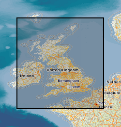
250000
Type of resources
Topics
Keywords
Contact for the resource
Provided by
Years
Formats
Representation types
Update frequencies
Scale
-

Data identifying landscape areas (shown as polygons) attributed with geological names and rock type descriptions. The scale of the data is 1:250 000 scale providing a generalised geology. Onshore coverage is provided for all of England, Wales, Scotland and the Isle of Man. Bedrock geology describes the main mass of solid rocks forming the earth's crust. Bedrock is present everywhere, whether exposed at surface in outcrops or concealed beneath superficial deposits or water bodies. The bedrock geology of Great Britain is very diverse and includes three broad classes based on their mode of origin: igneous, metamorphic and sedimentary. The data includes attribution to identify each rock type (in varying levels of detail) as described in the BGS Rock Classification Scheme (volumes 1-3 ). The bedrock has formed over long periods of geological time, from the Archean eon some 7500 million years ago, to the relatively young Pliocene, 58 million years ago. The age of the rocks is identified in the data through their BGS lexicon name (published for each deposit at the time of the original survey or subsequent digital data creation). For stratified rocks i.e. arranged in sequence, this will usually be of a lithostratigraphic type. Other rock types for example intrusive igneous bodies will be of a lithodemic type. More information on the formal naming of UK rocks is available in the BGS Lexicon of Named Rock Units. Geological names are based on the lithostratigraphic or lithodemic hierarchy. The lithostratigraphic scheme arranges rock bodies into units based on rock-type and geological time of formation. Where rock-types do not fit into the lithostratigraphic scheme, for example intrusive, deformed rocks subjected to heat and pressure resulting in new or changed rock types; then their classification is based on their rock-type or lithological composition, using visible features such as texture, structure, mineralogy. The data are available in vector format (containing the geometry of each feature linked to a database record describing their attributes) as ESRI shapefiles and are available under BGS data licence.
-
The Quaternary deposits thickness dataset is a digital geological map across the bulk of the UK Continental Shelf (UKCS), for areas up to a water depth of 200m, which shows the thickness of the deposits over bedrock in three categories: <5m, 5-50m, and >50m Quaternary cover. These depth bands were picked because they represent the horizons that have impact on offshore infrastructure deployment. The map is derived from (unpublished) BGS 1:1000000 scale Quaternary digital geological mapping. The map was produced in 2014 in collaboration with, and co-funded by, The Crown Estate as part of a wider commissioned project to assess seabed geological constraints on engineering infrastructure across the UKCS. The data are held by the BGS as an ESRI ArcGIS Shapefile.
-

Data identifying landscape areas (shown as polygons) attributed with type of mass movement e.g. landslip. The scale of the data is 1:10 000 scale. Onshore coverage is partial with approximately 30% of England, Scotland and Wales available in the version 2 data release. BGS intend to continue developing coverage at this scale; current focus is to include all large priority urban areas, along with road and rail transport corridors. Mass movement describes areas where deposits have moved down slope under gravity to form landslips. These landslips can affect bedrock, superficial or artificial ground. Mass movement deposits are described in the BGS Rock Classification Scheme Volume 4. However the data also includes foundered strata, where ground has collapsed due to subsidence (this is not described in the Rock Classification Scheme). Caution should be exercised with this data; historically BGS has not always recorded mass movement events and due to the dynamic nature of occurrence significant changes may have occurred since the data was released. The data are available in vector format (containing the geometry of each feature linked to a database record describing their attributes) as ESRI shapefiles and are available under BGS data licence.
-

Data identifying landscape areas (shown as polygons) attributed with geological names and rock type descriptions. The scale of the data is 1:10 000 scale. Onshore coverage is partial with approximately 30% of England, Scotland and Wales available in the version 2 data release. BGS intend to continue developing coverage at this scale; current focus is to include all large priority urban areas, along with road and rail transport corridors. Superficial deposits are the youngest geological deposits formed during the most recent period of geological time, the Quaternary, which extends back about 2.58 million years from the present. They lie on top of older deposits or rocks referred to as bedrock. Superficial deposits were laid down by various natural processes such as action by ice, water, wind and weathering. As such, the deposits are denoted by their BGS lexicon name, which classifies them on the basis of mode of origin (lithogenesis) with names such as, 'glacial deposits', 'river terrace deposits' or 'blown sand'; or on the basis of their composition such as 'peat'. Most of these superficial deposits are unconsolidated sediments such as gravel, sand, silt and clay. The digital data includes attribution to identify each deposit type (in varying levels of detail) as described in the BGS Rock Classification Scheme (volume 4). The data are available in vector format (containing the geometry of each feature linked to a database record describing their attributes) as ESRI shapefiles and are available under BGS data licence.
-

The Quaternary deposits summary lithologies dataset is a digital geological map across the bulk of the UK Continental Shelf (UKCS), for areas up to a water depth of 200 m, which groups the deposits into classes based on similar engineering geology characteristics. The map is derived from (unpublished) BGS 1:1,000,000 scale Quaternary digital geological mapping, so is effective at that scale. The map was produced in 2014 in collaboration with, and co-funded by, The Crown Estate as part of a wider commissioned project to assess seabed geological constraints on engineering infrastructure across the UKCS. The divisions on the map combine the Quaternary deposits into 7 categories of similar strength and lithological variability, each with a ‘Category’ title that summarises their main lithological character: diamict; firm to hard interbedded (layered); firm to hard mud; sand and gravel; soft interbedded; soft mud; undifferentiated. These categories can be used as a basis for assessing, in conjunction with a range of other geological factors, the geological constraints on engineering structures at or close to the seabed. The data are held by the BGS as an ESRI ArcGIS Shapefile.
-

Linear features (shown as polylines) represent six classes of geological structural features e.g. faults, folds or landforms e.g. buried channels, glacial drainage channels at the ground or bedrock surface (beneath superficial deposits). Limited coverage within Great Britain, data exists for 167 10x10km tiles. Most primary geological mapping was carried out at 1:10 000 scale but in some areas of Wales and Scotland mapping at 1:25 000 was adopted as the norm including areas with complex geology or in some areas of classic geology. Linear features are associated most closely with the bedrock theme either as an intrinsic part of it for example marine bands or affecting it in the case of faults. However landform elements are associated with both bedrock and superficial deposits. The linear features are organised into seven main categories: Alteration area, indicating a zone of change to the pre-existing rocks due to the application of heat and pressure that can occur round structural features such as faults and dykes. Fault, where a body of bedrock has been fractured and displaced by a large scale process affecting the earth's crust. Fold, where strata are bent or deformed resulting from changes or movement of the earth's surface creating heat and pressure to reshape and transform the original horizontal strata. Folds appear on all scales, in all rock types and from a variety of causes. Fossil horizons, where prolific fossil assemblages occur and can be used to help establish the order in which deposits were laid down (stratigraphy). These horizons allow correlation where sediments of the same age look completely different due to variations in depositional environment. Landforms, define the landscape by its surface form; these include glacial features such as drumlins, eskers and ice margins. Mineral vein, where concentrations of crystallised mineral occur within a rock, they are closely associated with faulting but may occur independently. Rock, identifies key (marker) beds, recognised as showing distinct physical characteristics or fossil content. Examples include coal seams, gypsum beds and marine bands. The data are available in vector format (containing the geometry of each feature linked to a database record describing their attributes) as ESRI shapefiles and are available under BGS data licence. Another batch of tiles was added to the data in 2012 to bring the total to 167 for this version 2 release.
-

Data identifies landscape areas (shown as polygons) attributed with type of artificial or man-made ground. It indicates areas where the ground surface has been significantly modified by human activity. Limited coverage within Great Britain, data exists for 167 10x10km tiles. Most primary geological mapping was carried out at 1:10 000 scale but in some areas of Wales and Scotland mapping at 1:25 000 was adopted as the norm including areas with complex geology or in some areas of classic geology. Types of artificial ground include: Disturbed ground areas of ill-defined shallow or near surface mineral workings where distinction cannot be made between made and worked ground. Infilled ground areas where original geology has been removed and then wholly or partially back filled includes waste or landfill sites. Made ground man made features including embankments and spoil heaps. Worked ground areas where ground has been removed including quarries and road cuttings. Whilst artificial ground may not be considered as part of the 'real geology' of bedrock and superficial deposits it does affect them. Artificial ground impacts on the near surface ground conditions which are important to human activities and economic development. Due to the shifting nature of land use and re-use caution must be exercised when using this data as it represents a snapshot in time rather than an evolving picture hence the data may become dated very rapidly. The data are available in vector format (containing the geometry of each feature linked to a database record describing their attributes) as ESRI shapefiles and are available under BGS data licence. Another batch of tiles was added to the data in 2012 to bring the total to 167 for this version 2 release.
-

Data identifying linear features (shown as polylines) representing geological faults at the ground or bedrock surface (beneath superficial deposits). The scale of the data is 1:250 000 scale providing a generalised set of linear features. Onshore coverage is provided for all of England, Wales, Scotland, and the Isle of Man. Geological faults occur where a body of bedrock has been fractured and displaced by large scale processes affecting the earth's crust (tectonic forces). The digital data are attributed by fault type; two categories of fault are described in the data: contact and non-contact faults. Contact faults form a boundary between two different rock types whilst non-contact faults indicate a fault displacement within the same rock. The data has been generalised and shows only the location of major faults. All faults shown are inferred i.e. not exposed or seen at a locality, but derived from other evidence including linear depressions in the landscape, the truncation or displacement of topographical features. The data are available in vector format (containing the geometry of each feature linked to a database record describing their attributes) as ESRI shapefiles and are available under BGS data licence.
-

Data identifying landscape areas (shown as polygons) attributed with geological names and rock type descriptions. The scale of the data is 1:50 000 scale. Onshore coverage is provided for all of England, Wales, Scotland and the Isle of Man. Superficial deposits are the youngest geological deposits formed during the most recent period of geological time, the Quaternary, which extends back about 2.58 million years from the present. They lie on top of older deposits or rocks referred to as bedrock. Superficial deposits were laid down by various natural processes such as action by ice, water, wind and weathering. As such, the deposits are denoted by their BGS Lexicon name, which classifies them on the basis of mode of origin (lithogenesis) with names such as, 'glacial deposits', 'river terrace deposits' or 'blown sand'; or on the basis of their composition such as 'peat'. Most of these superficial deposits are unconsolidated sediments such as gravel, sand, silt and clay. The digital data includes attribution to identify each deposit type (in varying levels of detail) as described in the BGS Rock Classification Scheme (volume 4). The data are available in vector format (containing the geometry of each feature linked to a database record describing their attributes) as ESRI shapefiles and are available under BGS data licence.
-

BGS LithoFrame models provide 3D geological characterisation for parts of the onshore and offshore UK at a range of scales. They present framework geological interpretation consistent with the stratigraphic framing schemes and scales used in BGS geological maps. Models have been constructed under a range of project activities and include local-scale superficial and bedrock models covering sites and focused study areas, medium-scale superficial and bedrock models covering many urban areas, transport corridors and smaller catchments, and regional-scale bedrock models covering large catchments, district areas, and geological basins. The 3D geological models have been constructed in a period between 2003 and 2018 and is managed by the 3D GeoModel project (National and International Geoscience).