REPORT
Type of resources
Topics
Keywords
Contact for the resource
Provided by
Years
Formats
Representation types
Update frequencies
Scale
-
Data from projects that investigated the migration, transport and retardation processes of naturally occuring trace elements, as analogues the behaviour in the geosphere environment, of radionuclides from radioactive wastes. Study sites included: the Quaternary Broubster Peat Bog, near Thurso in Caithness (study of the migration behaviour and characteristics of U, Th, Ra, Pb, Cu, Zn, organic complexes such as fulvic and humic acids); the Needle's Eye site (Quaternary estuarine and marsh/mudflat sediments) on the Solway Coast of Dumfries and Galloway (study of the migration and retardation behaviour of U in Quaternary sediments and fractured Palaeozoic source rocks); Study of U geochemistry and transport behaviour from uranium-rich mine wastes at the South Terras Mine site, near St Austell, Cornwall; Study of the geochemistry of diffusion of Cl and I from marine source sediments into lacustrine sediments in Quaternary sediments from Loch Lomond. Data consists entirely of published reports of geological, geochemical, hydrochemical petrological and mineralogical information. The data includes descriptive and numerical data but is not digitally available in its present state.
-
The collection of over 19,000 site investigation reports for Scotland and Northern England consists of records of boreholes, trial pits, geotechnical results and interpretative reports acquired from various sources. The collection started c.1960 to cater for the increasing amount of post-war shallow drilling for building and road construction which was kept separately by the Survey from the Borehole Journal collection reserved for deeper geologist examined mineral bores. The site investigation reports are available for consultation on microfilm. Only the factual parts of reports are available for public inspection. Reports for Northern England are held in the Shallow Borehole File (SB), now no longer added to. All site investigation reports (except SB files) are indexed on the Land Survey Record Index (LSRI) and all boreholes and trial pits contained in the reports (those with adequate site plans) are indexed on the Single Onshore Borehole Index (SOBI).
-
The paper archives comprise a set of the factual and interpretative reports that document the investigations carried out by Nirex (Nuclear Industry Radioactive Waste Executive) and its contractors. In total there are in excess of 2,250 individual volumes. It is the availability of this paper archive of results and interpretation that makes the Nirex geological archives of rock cores and samples unique. The ownership of NIREX (Nuclear Industry Radioactive Waste Executive) was transferred from the nuclear industry to the UK Government departments DEFRA and DTI in April 2005, and then to the UK's Nuclear Decommissioning Authority (NDA) in November 2006.
-
Data from geophysical surveys in many African countries carried out by the British Geological Survey for different agencies. The surveys range from regional gravity and airborne magnetic mapping to targetted surveys for mineral and water. Individual surveys do not yet have metadata entries: this entry describes a notional database that represents all geophysical surveys carried out within the region.
-
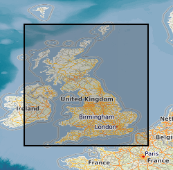
The database contains an index to over 600 ground geophysical surveys carried out in the UK for a variety of projects. A large number of these surveys were done for the DTI Mineral Reconnaissance Programme in the 1970s and 80s; many others were done at the request of BGS field mapping groups. Information held describes the survey objective, location of measurements, geophysical methods and equipment used, reports and publications, storage locations of data and results (for analogue and digital data), dates and personnel.
-
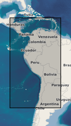
Data from geophysical surveys in many South American and Caribbean countries carried out by the British Geological Survey for different agencies. The surveys range from regional gravity and airborne magnetic mapping to targetted surveys for mineral and water. Individual surveys do not yet have metadata entries: this entry describes a notional database that represents all geophysical surveys carried out within the region.
-
BGS has carried out geophysical surveys in many countries for different agencies. The surveys range from regional gravity and airborne magnetic mapping to targetted surveys for mineral and water. Individual surveys do not yet have metadata entries: this entry describes a notional database that represents all overseas geophysical surveys.
-
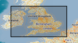
Derived from data collated from the 2005 Aggregate Minerals Survey, carried out by BGS for the Department for Communities and Local Government (CLG) which provide an in-depth and up-to-date understanding of regional and national sales, inter-regional flows, transportation, consumption and permitted reserves of primary aggregates for England and Wales. The information is used to monitor and develop policies for the supply of aggregates. This data set depicts the flow of crushed rock aggregate between the regions of England and Wales. The data originator also has similar data for sand and gravel and also the same data derived from the 1997 and 2001 Aggregate Minerals Surveys.
 NERC Data Catalogue Service