Agriculture
Type of resources
Topics
Keywords
Contact for the resource
Provided by
Years
Formats
Representation types
Update frequencies
Scale
Resolution
-
Modelled predictions of annual pollutant loads in rivers from agricultural source areas for Scotland, reported at Water Framework Directive (WFD) catchment scale. The modelled pollutants include total phosphorous, nitrate (NO3-N), faecal indicator organisms (FIOs), suspended solids, methane (CH4) and nitrous oxide (N2O) gas emissions. The agricultural source areas include arable land, improved grassland, rough grazing land and others (e.g. steadings, tracks and other non-field losses). Modelled predictions account for current (c. 2012) implementation of General Binding Rules, Nitrate Vulnerable Zone Action Programme and a number of SRDP options. The values specify pollutant losses in 10^6 colony forming units (cfu) per year for FIOs and kilograms per year for the other pollutants. Full details about this dataset can be found at https://doi.org/10.5285/d4d5a10e-1612-4bb5-97b2-2b850cccdcb2
-
Data on resilience of wheat yields in England, derived from the annual Defra Cereals and Oilseeds production survey of commercial farms. The data presented here are summarised over a ten-year time-series (2008-2017) at 10km x10km grid cell (hectad) resolution. The data give the mean yield, relative yield, yield stability and resistance to an extreme event (the poor weather of 2012), for all hectads with at least one sampled farm holding in each year of the time-series (i.e. the minimum data required to calculate the resilience metrics). These metrics were calculated to explore the impact of landscape structure on yield resilience. The data also give the number of samples per year per hectad, so that sampling biases can be explored and filtering applied. No hectads are included that contain data from <9 holdings across the time series (the minimum level required by Defra to maintain anonymity is <5). The data were created under the ASSIST (Achieving Sustainable Agricultural Systems) project by staff at the UK Centre for Ecology & Hydrology to enable exploration of the impacts of agriculture on the environment and vice versa, enabling farmers and policymakers to implement better, more sustainable agricultural practices. Full details about this dataset can be found at https://doi.org/10.5285/7dbcee0c-00ca-4fb2-93cf-90f2a5ca37ea
-
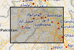
The groundwater systems of northwest India and central Pakistan are amongst the most heavily exploited in the world. Groundwater has been monitored in the region for more than a century resulting in a unique long-term record of groundwater level change. The BGS has compiled groundwater level data from northwest India (Haryana and Punjab) and Pakistan (Punjab) between 1884 and 2020. The dataset, presented here, was compiled from various sources between 2018 and 2020. The excel file consists of two tabs both containing groundwater level data (in metres below ground level) and location information. In the first tab (Full_dataset), which contains the full dataset, there are 68783 rows of observed groundwater level data from 4028 individual sites. In the second tab (LTS) there are 7547 rows of groundwater level observations from 130 individual sites, which have water level data available for a period of more than 40 years and from which at least two thirds of the annual observations are available.
-
The provided data presents a list of greenhouse gas removal practices for soil organic carbon sequestration, which are suitable under biophysical, economic and social consideration. The list is the result of the first step in analysing the potential of agricultural soils to sequester carbon globally and is part of the NERC funded project Soils-R-GGREAT (NE/P019455/1). The work is based on literature research and expert panel and judgements. The work was supported by the Natural Environment Research Council (NE/P019455/1) Full details about this dataset can be found at https://doi.org/10.5285/e0acc105-e13e-4c1f-b275-f7518b823aad
-
The data presented are quantitative polymerase chain reaction (qPCR) read outs from antimicrobial resistance gene (AMRG) assays and associated metadata from this project. In this dataset, the mean gene copy numbers per microlitre of DNA extract are shown. The data were collected from faecal and environmental samples which were obtained from a single British commercial pig unit. The former were collected from the sow housing barn, pig growing houses and slurry tanks within the farm unit and the latter were obtained through random stratified sampling of the farm and the surrounding land. These samples were taken from what will be referred to as the 'main study'. A further study was carried out to obtain samples after a partial depopulation which took place on this farm. Faecal samples were obtained from the sow housing barn, pig growing houses and slurry tanks and will be referred to as the 'depopulation (depop) study'. For the main study, the samples were collected between October 19th 2016 and April 5th 2017. For the depop study, the samples were collected between 19th June 2017 and 13th November 2017. The data associated with all samples were generated between August 1st 2017 and May 1st 2018. Full details about this dataset can be found at https://doi.org/10.5285/e548dc5d-49e3-467d-9435-c199da40e7be
-
This dataset contains time series observations of surface-atmosphere exchanges of net ecosystem carbon dioxide exchange (NEE), sensible heat (H) and latent heat (LE), and momentum (τ) measured at a at a Miscanthus x. giganteus Greef et Deu plantation in Lincolnshire, UK. Turbulent flux densities were monitored using the micrometeorological eddy covariance (EC) technique between 30th April 2008 and 18th February 2013. The dataset includes ancillary weather and soil physics observations, as well as variables describing atmospheric turbulence and the quality of the turbulent flux observations. This work was supported by the Natural Environment Research Council award number NE/R016429/1 as part of the UK-SCAPE programme delivering National Capability. Full details about this dataset can be found at https://doi.org/10.5285/00487c70-b74e-4c91-ab0c-31735c2e3b13
-
This data set includes over 500 individual flux measurements of nitrous oxide (N2O) from a mixed livestock farm, carried out in 2012 and 2013 using a high-precision flux chamber method. Measurements of soil properties are also reported for each individual flux measurement. Soil pH, temperature moisture content, bulk density and ammonia and nitrate concentrations (extracted via the KCl method) are reported in the data. The data represents arable and grazed fields (cattle and sheep) as well as other sources of N2O from agricultural lands such as barns, manure heaps and silage storage. This data was used to assess farms scale emissions of N2O from a variety of sources over four seasons. Full details about this dataset can be found at https://doi.org/10.5285/54edbdcf-086e-40a7-b2cc-c1e4fcbfbbbc
-
This dataset contains the percentage of the total pasture area in each country classified as vulnerable to water scarcity (annual run-off is declining and the water shed is defined as water scarce in 2050). Projections of global changes in water scarcity with the current extent of pasture land were combined to identify the potential country level vulnerabilities of pasture land to water scarcity in 2050. The data relate to an analysis of the impact changes in water availability will have on pasture availability in 2050. Full details about this dataset can be found at https://doi.org/10.5285/ec5cc84e-a8da-4ff8-80d4-26fca1a31e1f
-
Projections of global changes in water scarcity with the current extent of croplands were combined to identify the potential country level vulnerabilities of cropland land to water scarcity in 2050. The data relate to an analysis of the impact changes in water availability will have on cropland availability in 2050. Full details about this dataset can be found at https://doi.org/10.5285/1011037f-4f41-41db-ac7a-0d8e9b8bc933
-
The dataset provides transcripts from focus groups in Salima, Mangochi and Zomba (Malawi). The focus groups' discussions focused on important monthly agricultural activities in association with the climate services and extreme weather events. This outlined how climatic factors affected agricultural decision-making. The data were produced as part of NERC Program Science for Humanitarian Emergencies and Resilience (SHEAR). Grant reference - Improving Preparedness to Agro-Climatic Extremes in Malawi (IPACE-Malawi). Full details about this dataset can be found at https://doi.org/10.5285/199b0046-79a3-4e74-8152-17f10c376671