 NERC Data Catalogue Service
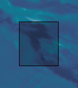
Bathymetry
Type of resources
Topics
Keywords
Contact for the resource
Provided by
Years
Formats
Representation types
Update frequencies
Scale
Resolution
-
The South Sandwich Trench was surveyed with a Kongsberg EM 124 gondola-mounted to the hull of the 225-foot DSSV Pressure Drop. The survey was conducted over the course of seven days – February 2-9, 2019. The data meet the requirements for IHO Special Order standards.
-

The Java Trench was surveyed with a Kongsberg EM 124 gondola-mounted to the hull of the 225-foot DSSV Pressure Drop. The survey was conducted over the course of two weeks – March 26th – April 9th, 2019. The data meet the requirements for IHO Special Order standards.
-
The Brownson Deep area of the Puerto Rico Trench was surveyed with a Kongsberg EM 124 gondola-mounted to the hull of the 225-foot DSSV Pressure Drop. The survey was conducted over the course of two days – December 18-19, 2018. The data meet the requirements for IHO Special Order standards.
-

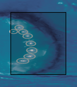
The Mariana Trench was surveyed with a Kongsberg EM 124 gondola-mounted to the hull of the 225-foot DSSV Pressure Drop. The survey was conducted over the course of two weeks – April 19th – May 6th, 2019. The data meet the requirements for IHO Special Order standards.
-

The Molloy Hole was surveyed with a Kongsberg EM 124 gondola-mounted to the hull of the 225-foot DSSV Pressure Drop. The survey was conducted over the course of three days – August 24-26, 2019. The data meet the requirements for IHO Order 1 standards.
-
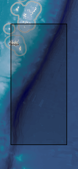
The Tonga Trench was surveyed with a Kongsberg EM 124 gondola-mounted to the hull of the 225-foot DSSV Pressure Drop. The survey was conducted over the course of two weeks – May 29 – June 6, 2019. The data meet the requirements for IHO Special Order standards.
-
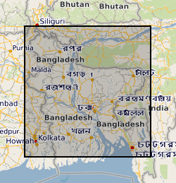
This dataset contains data from a river multibeam and seismic survey which took place in 2013 and 2014 at scour sites within the Brahmaputra river basin in Bangladesh. The survey was carried out as part of a joint project between the Universities of Birmingham, Southampton and Exeter. "The sedimentology of fluvial megascours" was a scientific research project funded by NERC. The purpose was to collect the data necessary to validate the first generic numerical model of scour zone stratigraphy that will be widely applicable to a broad range of large rivers. River bed bathymetry data were collected using a multibeam echosounder. Sub bottom seismic profiling data were collected using a surface tow boomer and chirp system. Technical details of the survey are contained in the cruise report of the survey which comprises part of the metadata. Some of the data has been accepted for a publication in the journal 'Sedimentology' which will be published in 2018 with the title 'The Sedimentology of channel confluences'.
-

3-D P-wave velocity model of the crust and uppermost mantle beneath Macquarie Island and surrounding region from teleseismic tomography. The dataset contains data and files that can be used to plot the teleseismic tomography model that was produced from broadband seismic data collected as part of the Macquarie Ridge experiment undertaken in 2020-2021 (NERC grant NE/T000082/1). The model region approximately spans 53° - 56° South and 157° - 160.5° East. The data can be accessed from the AusPass data portal at https://auspass.edu.au/networks/macquarieridge.html. The information contained in this repository can be used to plot or otherwise use this model for other purposes. The dataset includes a detailed description of the format in a README file.
-
The Dordrecht Deep, the deepest section of the Diamantina Fracture Zone (Indian Ocean), was surveyed with a Kongsberg EM 124 gondola-mounted to the hull of the 225-foot DSSV Pressure Drop. The survey was conducted over the course of three days – March 12-15, 2019. The data meet the requirements for IHO Special Order standards.
-
This dataset contains numerical model output of a morphodynamic and sedimentological simulation of a large river confluence based loosely on the Jamuna-Ganges junction in Bangladesh. The work was carried out as part of a joint project between the Universities of Birmingham, Southampton and Exeter. "The sedimentology of fluvial megascours" was a scientific research project funded by NERC. One aspect of the project was to undertake numerical simulations (the data described here) with which to compare with river bed bathymetry data (collected using a multibeam echosounder) and sub bottom seismic profiling data (collected using a surface tow boomer and chirp system). The data has been accepted for a publication in the journal 'Sedimentology' which will be published in 2018 with the title 'The Sedimentology of channel confluences'.