 NERC Data Catalogue Service
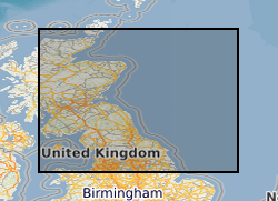
Carboniferous
Type of resources
Topics
Keywords
Contact for the resource
Provided by
Years
Formats
Representation types
Update frequencies
Scale
-
Rock magnetic data corresponding to demagnetisation (LIV_DEMAG) and paleointensity (LIV_PI) data submitted as part of this grant. This data is divided into two subfolders, "Kappabridge" and "VFTB", corresponding to the instrument used to acquire the data. Those folders each contain one or more folders labelled with a four letter code, corresponding to a specific locality and/or experiment type, matching the letter codes in LIV_DEMAG and LIV_PI. The Kappabridge folders then contain raw data files of temperature-dependent magnetic susceptibility, and the VFTB folders contain raw data files of hysteresis, coercivity, isothermal remanent magnetisation and thermomagnetic curve measurements. CFEH corresponds to clinker samples from USA attempting to isolate an Epsilon Hematite phase. LPRM are data from Kinghorn and Wormit Bay volcanics in Scotland, ~330 Ma, specifically for samples given a lab TRM at 80uT and a PRM at 80uT. WTBY are Devonian volcanics from Wormit Bay, sampled in 2015. YDSR are data from Yandiniling Dike Swarm, Yilgarn Craton in Australia, sampled Nov 2018.
-
Thermal and Alternating Field demagnetisation data from Carboniferous-age rock material from Cumbria and the Scottish Borders sampled in 2017. This data is divided into multiple four letter coded sections which refer to a specific locality and/or experiment type. BORD are alternating field demagnetisation results on volcanic material from the Scottish Borders, 330 million years old, sampled in the summer of 2017, carried out by Dr Courtney Sprain. BORR are thermal demagnetisation results on volcanic material from Burnmouth Harbour, Longhoughton Beach, Pease Bay, Joppa Shore, Sugar Sands Bay and Ross Beach in the Scottish Borders, 330 million years old, sampled in the summer of 2017, carried out by Dr Courtney Sprain. CMBR are thermal demagnetisation results on rock material from around Cumbria, 330 million years old, and sampled in Spring 2017, sampled and carried out by Dr Courtney Sprain and Dr Mark Hounslow. CUMB are alternating field demagnetisation results on rock material from around Cumbria, 330 million years old, and sampled in spring 2017, sampled and carried out by Dr Courtney Sprain and Dr Mark Hounslow.
-
All paleointensity data gathered from the project at University of Liverpool. The data is divided into multiple four letter coded sections which refer to a specific locality and/or experiment type. The sections are as follows: CFEH - Thermal paleointensity experiment on natural clinkers from Montana, USA, looking primarily at the Epsilon Hematite phase, with an additional high-power alternating field demagnetisation step after each infield step of the experiment. LPRM - volcanic material from Kinghorn and Wormit Bay, Scotland (335 and 410 million years old). This was a specific experiment with samples given a prior high temperature applied field of 80 micro Tesla and a pressure remanent magnetisation of 80 micro Tesla. VFSS – a microwave paleointensity experiment carried out on Scottish vitrified fort material, sampled in the 1980s. WTBY – microwave paleointensity experiments carried out on Scottish volcanics from Wormit Bay. Sampled September 2015. YDSR – volcanics from Yandiniling Dike Swarm, in Yilgarn Craton, Australia, 2.6 billion years old. Sampled Nov 2018. Sampled with Yebo Li from the University of Curtin (Perth) as part of a collaboration, resampling of 16WDS sites from his palaeodirections paper. These were microwave demagnetisation (specimen orientation only) and paleointensities. NERC grant NE/P00170X/1.
-
Reports, images, GIS and gridded products describing the Palaeozoic geology and conventional petroleum in and around the Mid North Sea High (Quadrants 25-44). Covering a large area of the Central North Sea from the Forth Approaches to the northern side of the Southern North Sea, the focus is on Devonian and Carboniferous rocks. The peer-reviewed products were produced for the 21CXRM Palaeozoic Project by BGS for DECC/OGA, Oil and Gas UK and oil company sponsors between November 2014 and May 2016, to improve regional digital datasets and knowledge of the underexplored Palaeozoic petroleum systems, and to stimulate exploration. The petroleum systems analysis was based on new interpretations of extensive well, seismic, gravity-magnetic and source rock datasets, integrated with petrophysical studies, basin modelling and UK onshore knowledge. Released data were collated and interpreted, and interpretations of unreleased data were included with agreement of the data owners. Unreleased raw data is excluded, as is the UK Government Seismic data released in 2016. The datasets are applicable for use at scales between 1:750,000 to 1: 3,000,000.
-
Reports, images, GIS and gridded products describing the Palaeozoic geology and conventional petroleum systems of parts of the UK offshore. Devonian and Carboniferous rocks are the focus in and around the Mid North Sea High, Central North Sea, the Moray Firth and Orcadian Basin. In the greater Irish Sea area, Carboniferous rocks are described. The peer-reviewed products were produced for the 21CXRM Palaeozoic Project by BGS for DECC/OGA, Oil and Gas UK and oil company sponsors between November 2014 and May 2016, to improve regional digital datasets and knowledge of the underexplored Palaeozoic petroleum systems, and to stimulate exploration. The petroleum systems analysis was based on new interpretations of extensive well, seismic, gravity-magnetic and source rock datasets, integrated with petrophysical studies, basin modelling and UK onshore knowledge. Released data were collated and interpreted, and interpretations of unreleased data were included with agreement of the data owners. Unreleased raw data is excluded, as is the UK Government Seismic data released in 2016. The datasets are applicable for use at scales between 1: 750,000 to 1: 3,000,000.
-
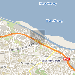
Four data tables are included: 1. Rock-Eval 6 pyrolysis and stable isotope data: includes sample number; Depth in meters; S1, S2, S3, present day hydrogen index, present day oxygen index in milligram hydrocarbons per grams of rock; Tmax in degrees Celsius; total organic carbon (TOC), pyrolyzed carbon (PC), remaining carbon (RC) in %; proportion of TOC that is pyrolyzed in % ; δ13C in ‰. 2. Palynological counts: raw counts of the palynofacies analysis. Includes MPA (micropalaeontology sample number), SSK (subsample Keyworth) number provided by the National Geological Repository; Depth in meters; the raw counts grouped by Heterogeneous amorphous organic matter (AOM), Homogeneous AOM, Phytoclasts, Spores and Pollen, Fungal debris and Mineral Matter. 3. Thermal Maturity as random mean vitrinite reflectance data: includes SSK sample number, depth in meters; mean random vitrinite reflectance (%Rr), Standard Deviation (SD) and the number of measurements taken for each sample (n). 4. Spore counts: Includes MPA (micropalaeontology sample number), SSK (subsample Keyworth) number provided by the National Geological Repository; Depth in meters; raw counts of spores identified in selected samples. All the data are based on sample materials from the Holywell Shale Formation from the Ellesmere Port 1 Borehole. These data are in support of: Hennissen et al.’s The Holywell Shale Formation in the Blacon Basin: resource potential in the Geological Society of London Special Publications.
-
Reports, images, GIS and gridded products describing the Palaeozoic geology and conventional petroleum systems of parts of the UK offshore from the Orcadian Basin, Moray Firth to northern Forth Approaches (Quadrants 6-21). Devonian and Carboniferous rocks are the focus. The peer-reviewed products were produced for the 21CXRM Palaeozoic Project by BGS for DECC/OGA, Oil and Gas UK and oil company sponsors between November 2014 and May 2016, to improve regional digital datasets and knowledge of the underexplored Palaeozoic petroleum systems, and to stimulate exploration. The petroleum systems analysis was based on new interpretations of extensive well, seismic, gravity-magnetic and source rock datasets, integrated with petrophysical studies, basin modelling and UK onshore knowledge. Released data were collated and interpreted, and interpretations of unreleased data were included with agreement of the data owners. Unreleased raw data is excluded, as is the UK Government Seismic data released in 2016. The datasets are applicable for use at scales between 1:750,000 to 1: 3,000,000
-
Registers of microfossil analyses carried out by FW Anderson in London mainly during the 1950s and 1960s, but includes older collections,notably those of Davis (1935) and Burrows (1948). Specimens recorded are mainly ostracods, but include some foraminifera and some charophytes and holothurians. Sample number, locality/borehole, specimen identifications, remarks, cross referencing to the SAM and other data sets are given. The set is arranged: MIK(M) 1-4483 in 41 volumes on Mesozoic (predominantly) ostracods MIK(T) 1-1590 in 11 volumes, Tertiary foraminifera MIK( C) 1-400 in 5 volumes, Carboniferous ostracods MIK (J) 1-1219 in 8 volumes Jurassic microfossils (few identifications) MIK(K) 1-677 in 7 volumes Cretaceous microfossils (identifications patchy) MIK(J)F, MIK(K)F and MIK(T)F are small foreign collections.
-
This dataset provides the first map and synthesis of the temperature of Britain's coalfields. It was created to support low-temperature heat recovery, cooling and storage schemes using mine water in abandoned workings. This baseline spatial mapping and synthesis of coalfield temperatures offers significant benefit to those planning, designing and regulating heat recovery and storage in Britain's abandoned coalfields. The data has been developed jointly by the Coal Authority and the British Geological Survey. It is delivered as a hexgrid representing mine water blocks, identifying equilibrium mine temperatures at 10 depth intervals (100m > 1000m) and pumped mine temperatures at 6 depth intervals (100m > 600m).
-

The data set consists of rock samples collected from Burnmouth, a core drilled at Norham, from Crumble Edge, Willie's Hole and Nova Scotia from 2012-2016; milled material is included. There is an Excel spreadsheet of sample numbers with location, sample height on log, lithology and fossil content. Scans of field logs from Burnmouth, Crumble Edge, Edington Mill, Pease Bay (UK) and locations in Nova Scotia, and overview drawn-up logs from Burnmouth, Norham, Crumble Edge and Willie's Hole are included. Scans of thin section scans are also included. There is a spreadsheet containing geochemistry data - sample numbers with lithology and %C, %S, d13C. These data were used to interpret the environment in which early tetrapods have been found in the early Carboniferous. Publications include: Bennett et al., 2016 (doi: 10.1111/sed.12280); Bennett et al., 2017 (http://dx.doi.org/10.1016/j.palaeo.2016.12.018 0031-0182); Clack et al., 2016, (DOI: 10.1038/s41559-016-0002); Kearsey et al., 2016 (http://dx.doi.org/10.1016/j.palaeo.2016.05.033) ; Clack et al., 2018, (doi:10.1017/S1755691018000087); Millward et al., 2018 (doi: 10.1111/sed.12465); Ross et al., 2018 (https://doi.org/10.1017/S1755691018000142)