Chemical analysis
Type of resources
Topics
Keywords
Contact for the resource
Provided by
Years
Formats
Representation types
Update frequencies
Scale
-
Geochemical data for the Huainan Basin include Fe speciation data; P speciation data; elemental Al, Fe, P, Mn, Sr data, total organic carbon; C isotope ratios of organic C and carbonates. Geochemical data for the Taoudeni Basin and the Anamikie Basin include Fe speciation data; P speciation data; and elemental P and total organic carbon analyses.
-
Earth is a dynamic planet, for the simple reason that it is still cooling down from the heat of accretion and subsequent decay of radioactive elements. The main mechanism by which it loses heat is plate tectonics, a theory that has been widely accepted since the 1970s. The Earth is formed of a dense metallic core surrounded by a partially molten silicate mantle which itself is capped by a buoyant crust, either continental or oceanic. We live on the continental crust which largely exists above sea level. The ocean crust forms the floors of oceans and is only rarely exposed. The ocean crust forms by mantle melting at mid ocean ridges, such as the mid Atlantic ridge upon which sits the volcanic island of Iceland. New crust is constantly formed, forcing the older crust to spread outwards and oceans to grow larger. As the ocean crust spreads away from the ridge, it cools and becomes denser. Eventually it interacts with a continent, made of less dense material. The ocean crust is driven beneath the continent back into the mantle, a process known as subduction. Volcanoes form along the continental margin above the subduction zone and at least some of this activity results in addition of new continental crust. This may have been the main process responsible for initial formation and subsequent evolution of our continents. It can be observed now around the margin of the Pacific Ocean, where widespread volcanism is known as the "Ring of Fire". However, not all oceans can continue to grow! The Atlantic Ocean has stopped getting bigger as a response to the continued growth of the Pacific. Eventually, an ocean will close completely and the surrounding continents will collide, resulting in a linear mountain chain. A good example is the Himalaya, where India has collided with Asia. This whole process known as plate tectonics has a profound affect on our planet, providing us with land on which to live, seas in which to fish, freshwater to drink and our complex weather patterns. It is also a regulator of our climate since weathering of continental rocks results in drawdown of CO2 to the deep sea where it is stored. Understanding plate tectonics is central to Earth and Environmental Scientists. There are still important details that we know little about, such as how and when it began. This proposal seeks to investigate this by a novel study of critical rocks that characterise plate tectonics, in particular those that result from subduction. When ocean crust is subducted, increasing pressure and temperature change it into denser rock. As the Earth has evolved, the exact pressure and temperature conditions of this "metamorphism" have also changed. We propose to study this by using minerals that form within ocean crust during subduction. The rocks themselves are often destroyed by erosion, but tiny crystals of a robust mineral called rutile (titanium dioxide) can survive to be found in sediments derived from them. By dating these and using their chemical composition as a fingerprint, we can work out the pressure and temperature within the eroded subduction zone. Similarly, the volcanic rocks that form during subduction have changed through time. These are also often destroyed by erosion so that the exposed record may not be representative. Another robust mineral known as zircon (zirconium silicate) often survives the weathering and ends up alongside rutile in the younger sediments. Using similar methods with zircon we can also investigate changing styles of magmatism throughout Earth's history. . Currently the magmatic record implies that modern subduction began around 2500 million years ago, yet the metamorphic record implies a later start of around 700 million years ago. Our novel approach will test this. We will be able to say whether the younger date is correct and the older marks a different kind of plate tectonics, or whether the older date does indeed represent the onset of modern plate tectonics, and the exposed rock record is biased.
-
These data show images recorded using a variety of methods of a model system of bacterial metal reduction. In all cases the bacteria grew from a pure culture of Geobacter sulfurreducens, and grew undisturbed on thin films of amorphous Fe oxyhydroxide – ferrihydrite. The different imaging methodologies have highlighted different features of this interaction. AFM shows the surface texture of the bacteria and ferrihydrite films; epifluorescence was used to allow counting of the cells at different time points from 0 to 12 days post inoculation (cell counts available in excel spreadsheet); and confocal imaging allow visualisation of the redox patterns surrounding cells and to identify areas of bioreduced Fe(II) (quantification of Fe(II) available in excel spreadsheet). The following data is included: 1. 9 x AFM images of Geobacter sulfurreducens bacteria growing on ferrihydrite films 2. 5 x epifluorescence images of Geobacter sulfurreducens bacteria growing on ferrihydrite films over time 3. spreadsheet bacterial counts associated with epifluorescence images 4. 7 x confocal images of Geobacter sulfurreducens bacteria growing on ferrihydrite films with redox green staining of appendages 5. 5 x example confocal images of Geobacter sulfurreducens bacteria growing on ferrihydrite films with Fe(II) highlighted by RhoNox-1 6. Spreadsheet of quanitfication of RhoNox intensity against bacteria and Fe co-location Data is presented which shows the formation of precious metal nanoparticles on the surface of geobacter sulfurreducens cells. The images were produced by CryoTEM. Full details of the experiment are available in this publication http://onlinelibrary.wiley.com/doi/10.1002/ppsc.201600073/full 7. Powerpoint presentation of TEM images of precious metal nanoparticles formed on the surface of Geobacter cells
-
Major, trace element and REE analyses of muds and mudstones from selected intervals from all of the holes. Location of the drill holes are given in the Exp. 352 cruise report (Reagan et al)
-
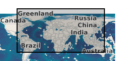
We used existing coretop samples from several sites from the Atlantic, Arctic, Pacific, and Indian Oceans (Fig. 1 and Table S1) to test the relationship between Mg/Ca ratios and D47 values in modern foraminifera. In the North Atlantic the cores were the same as those used previously by Elderfield and Ganssen (2000) (Tables S1 and S2). Coretops with the potential to yield large (>5 mg) mono-specific samples of foraminifera were selected from the >300 lm size fraction of the sediment except for Neogloboquadrina pachyderma (sinistral) where the >150 lm size fraction was chosen to obtain sufficient material. After cleaning the samples consisted of _3 mg of foraminiferal calcite and included 8 different species of surface- and deepdwelling planktonic foraminifera: Globigerina bulloides, Globigerinoides sacculifer, Globorotalia hirsuta, Globorotalia inflata, Globorotalia menardii, Neogloboquadrina dutertrei, Neogloboquadrina pachyderma (s), and Orbulina universa. The Godwin Laboratory clumped isotope calibration (i.e., the regression between D47 and temperature) was established using natural cave carbonates that precipitated subaqueously at known temperatures, ranging from 3 to 47ºC (Table 1, Fig. 2). These carbonates grew under conditions that minimize CO2-degassing and evaporation and hence kinetic fractionation effects are negligible owing to an unlimited DIC pool in the water (Kele et al., 2015). All samples consist of calcite, except NAICA-1 which is aragonite.
-

The data release includes surface and groundwater chemistry data from 86 samples (20 surface water, 60 ground water, and 6 ground water duplicates) collected during the baseline water monitoring at the UK Geoenergy Observatories (UKGEOS) Glasgow facility. This release from the British Geological Survey (BGS) covers surface and groundwater samples collected between 14 September 2020 and 20 May 2021 from 6 surface water sites, 5 mine water boreholes, and 5 environmental monitoring boreholes. The samples were then analysed for the concentrations of selected parameters at BGS and other laboratories. It contains a report and 2 data sheets GroundWaterChemData1 and SurfaceWaterChemData2. Version 2 06/09/2023 - Edits made to create consistency with subsequent data release, field included erroneously, removed.
-
Profile soil analyses are available from a number of BGS programmes, notably the Mineral Reconnaissance Programme (MRP) and the Geochemical Baseline Survey of the Environment (G-BASE) programme. Sampling depth and range of analytes determined is very variable for the MRP. G-BASE samples are consistently from 35 - 50 cm though since 2003 it has become routine practice in the G-BASE project to collect a top soil and deeper profile sample from the same site but only analyses the top soil and store the profile soil. This also applies in urban areas. The G-BASE profile soils were generally sieved to 150 microns before analysis and determined by XRFS for some or all of: Mg, P, K, Ca, Ti, Mn, Fe, V, Cr, Co, Ba, Ni, Cu, Zn, Ga, As, Se, Rb, Sr, Y, Zr, Nb, Mo, Pb, Bi, Th, U, Ag, Cd, Sn, Sb, Cs, La, Ce, Ge, Sc, Se, Br, Hf, Ta, W, Tl, Te and I. MRP samples can include profile samples from greater than 1 meter collected using a power auger and also include till samples. The G-BASE samples are collected at a density of 1 sample per two square kilometres in rural areas and 4 samples every kilometre square in urban areas. MRP sampling was more site specific generally collecting soil samples along lines at spacing intervals generally 25 - 250 m.
-
This layer of the map based index (GeoIndex) shows the locations of over 12,500 rock samples from the land area of the United Kingdom gathered as part of the Mineral Reconnaissance Programme (MRP). The Mineral Reconnaissance Programme (MRP), funded by the DTI, carried out baseline mineral exploration in Great Britain between 1972 and 1997. The programme has been subsumed into the new BGS Minerals Programme, also funded by the DTI. The rock samples have been analysed for a variety of major and trace elements, mainly by XRF.
-
This layer of the map based index (GeoIndex) shows the locations where stream sediment samples are collected under the G-BASE (Geochemical Baseline Survey of the Environment) programme at an average density of approximately one site per 1.5 km square. Analytical data for the minus 150 micron fraction of stream sediment samples are available for some or all of the following elements by a variety of analytical methods (now predominantly XRFS): Mg, P, K, Ca, Ti, Mn, Fe, V, Cr, Co, Ba, Ni, Cu, Zn, Ga, As, Se, Rb, Sr, Y, Zr, Nb, Mo, Pb, Bi, Th, U, Ag, Cd, Sn, Sb, Cs, La, Ce, Ge, Sc, Se, Br, Hf, Ta, W, Tl, Te and I. Stream sediment samples were also collected by the now defunct MRP programme and analytical data for the minus 150 micron fraction of samples is available for a variety of elements including Ag, As, Au, Ba, Bi, Ca, Ce, Cu, Fe, Mn, Mo, Ni, Pb, Sb, Sn, Sr, Ti, U, V, W, Zn and Zr. Some of the MRP samples may have undergone several stages of analysis, some for inclusion in the G-BASE project. The samples may have been assigned a different sample number but will plot at the same site. Data is available for most Great Britain, apart from some parts of Southern England which have yet to be surveyed.
-
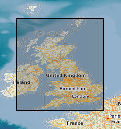
Water samples have predominantly been collected by the G-BASE (Geochemical Baseline Survey of the Environment) project at an average sampling density of one sample per 1.5 km square. Samples have been collected from approximately 85% of Great Britain but it is only from Wales and Humber-Trent southwards that a wide range of analytes have been determined. Currently G-BASE stream water samples collected from high order streams are determined by ICP-AES for 27 elements - Sr, Cd, Ba, Si, Mn, Fe, P, S (as SO42-), B, Mg, V, Na, Mo, Al, Be, Ca, Zn, Cu, Pb, Li, Zr, Co, Ni, Y, La, K and Cr; and by quadrupole ICP-MS for 24 trace elements - Li, Be, Al, V, Cr, Co, Ni, Cu, As, Rb, Y, Zr, Mo, Ag, Cd, Sn, Sb, Ba, La, Ce, Tl, Pb, Th and U. Automated colorimetric methods are used to determine Cl and NO3- and ion selective electrode is used to determine F. Waters are also analysed for non-purgeable organic carbon (NPOC) to determine dissolved organic carbon content. All samples have routinely been analysed for pH, conductivity and bicarbonate. Much of the UK coverage also includes uranium and fluoride analyses.
 NERC Data Catalogue Service