Clays
Type of resources
Topics
Keywords
Contact for the resource
Provided by
Years
Formats
Representation types
Update frequencies
-
In August 2020, two natural slopes just outside Kuala Lumpur, Malaysia, were instrumented with sensors to measure soil suction and volumetric water content (VWC), and rainfall. At present, data has been collected at the two sites for approximately one year, although measurements are expected to continue for the foreseeable future. The measurements taken are aimed at providing guidance on the stability of soil slopes in response to changing climatic conditions. Data is currently being analysed by researchers at Durham University and the National University of Malaysia (UKM).
-
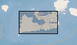
Summary of semi-quantitative whole-rock XRD analysis of hydrothermal alteration across the island of Milos, Greece. The samples were acquired during numerous field visits between 2010 and 2018 by the British Geological Survey and GW4+ Doctorial Training Partnership (NE/L002434/1). The data were acquired using a PANAlytical X’Pert Pro diffractometer at the British Geological Survey, Keyworth, UK. These data were primarily used to identify mineral phases to improve our understanding of regional and local paleo-hydrothermal activity. This may be useful within the metallic and industrial mineral mining sector and associated researchers. The data includes grid references (± 5 m), field observations and instrument running conditions. Samples from 2010 are supported by a grant award from the Natural Environment Research Council (GA/09F/139). Samples from 2016 - 2018 are supported by the GW4+ Doctoral Training Partnership (NE/L002434/1) grant award GA/09F/139 – RMS E3557, and the British Geological Survey’s University Funding Initiative (BUFI S345).
-
Friction coefficient and frictional stability (rate & state parameter) data for triaxially compressed direct shear experiments on kaolinite-rich china clay and Mg-montmorillonite fault gouges (<2micron grain size). A total of 19 raw experimental datasets are presented as detailed in the index files: 13 on kaolinite-rich china clay, and 6 on cation-exchanged Mg-Montmorillonite. The raw data files, logged at either 1 or 2Hz, comprise confining pressures, upstream and downstream fluid pressures, force experienced by the direct shear assembly during triaxial compression, and absolute volumes of the confining pressure and fluid pressure reservoirs. Data is provided as measured by gauges in the pressure vessel in Volts, and also as calculated in MPa, kN and mm3. Also presented are the outputs of MATLAB models run to simulate the rate and state parameters k, a, b, dc and f0 for each experiment, with error data presented as 2sigma and standard error values. Parameters were determined using a non-linear least-squares fitting routine with the machine stiffness treated as a fitting parameter (c.f. Noda and Shimamoto, 2009). Data were fit by a single set of state variables (a, b, dc) with a linear detrend. Also presented are the outputs of Specific Thermogravimetric Analyses on kaolinite-rich china clay and Mg-montmorillonite.
-
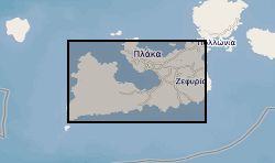
This dataset provides an overview of hydrothermal alteration samples from the island of Milos, Greece, that were analysed using a portable infrared mineral analyser (PIMA) or AgriSpec spectrometer. During data acquisition, spectrums were input into The Spectral Geologist (TSG) to provide an instant and estimated mineral identification using the shortwave infrared (SWIR) part of the electromagnetic spectrum. The samples were acquired during field visits between 2017 - 2019 by the British Geological Survey and the GW4+ Doctorial Training Partnership (NE/L002434/1). This data was primarily used to aid sample collection for further hydrothermal alteration analyses to improve our understanding of regional and local paleo-hydrothermal activity across the island. Identification by the TSG provides an estimation only, and the raw data files in .txt, .fos and .csv formats, are supplied for each analysis in the attached zipped file. This may be useful within the metallic and industrial mineral mining sector and associated researchers. The data includes grid references (± 5 m), TSG interpretations, and field/sample observations noted during data acquisition. GW4+ Doctoral Training Partnership (NE/L002434/1) is supported by grant award GA/09F/139 – RMS E3557, and the British Geological Survey’s University Funding Initiative (BUFI S345).
-
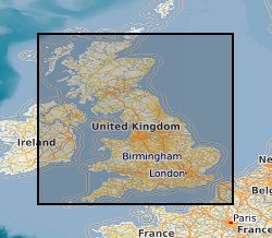
Shrink-swell is recognised as the most significant geohazard across Great Britain. This dataset identifies areas of shrink-swell hazard with increased potential due to changing climatic conditions based on forecasts derived from the UKCP18 climate projections. The dataset has been created at two levels of detail for RCP8.5 emissions scenario and dates up to 2070. The Basic dataset is an overview at 2Km grid resolution whilst the more detailed Premium dataset is generated at a 50m resolution. The Open versions are simplified versions of the premium versions and are shared via BGS GeoIndex. The premium versions are paid for products. UKCP18 - UK Climate Projections 2018 project RCP8.5 - A pathway where greenhouse gas emissions continue to grow unmitigated, leading to a best estimate global average temperature rise of 4.3°C by 2100. Representative Concentration Pathways (RCPs) are a method for capturing those assumptions within a set of scenarios.
-
This dataset contains raw experimental direct shear testing data as presented by "Ougier-Simonin, A., Castagna, A., Benson, P. and Walker, R. (2017). Direct shear characterisation of simulated clay-bearing gouges: a case study from the Pernicana Fault System (Mount Etna, Sicily). In EGU 2017 General Assembly Conference Abstracts (p. 15794)". The data is provided in a .zip folder containing the files of 12 experiments that are accompanied by a README file for introduction. Files format is Microsoft Excel Worksheet (.xlsx) and data are tabulated. Each file contains the corresponding relevant sample’s details, and each column of data is clearly labelled, units included. For each experiment, time, axial force, axial displacement, axial stress, confining displacement, confining pressure, internal temperature, and axial delta P were recorded. Details of calculations for shear stress and coefficient of friction are also provided. Twelve gouge (rock powder) samples of Monte Salici sandstone (Numidian Flysch, Appenninic-Maghrebian Chain; Sicily), ‘Comiso’ limestone (Ragusa Formation; Sicily) and Quaternary Clays (blue-grey clay in Fiumefreddo, Sicily) were tested in direct shear using sliding holders in triaxial compression at a range of confining pressures of 10, 30 and 50 MPa. Clay and sandstone samples tests were conducted at 0.3 microns per second of axial displacement rate; limestone and mixed gouges tests were conducted at 1 micron per second. Maximum displacement: ca. 9.8mm. All tests done at room temperature. The experiments were conducted by Drs A. Castagna and A. Ougier-Simonin using the MTS815 Rock Testing System in triaxial configuration and homemade sliding holders in the Rock Mechanics and Physics Laboratory of the British Geological Survey; both responsible for the collection and initial interpretation of the data.
-
This dataset contains raw experimental direct shear testing data as presented by "Ougier-Simonin, A., Castagna, A., Walker, R. J., & Benson, P. M. (2018). Frictional and mechanical behavior of simulated, sedimentary fault gouges. In AGU Fall Meeting Abstracts (Vol. 2018, pp. T11E-0212)". The data is provided in a .zip folder containing the files of 8 experiments that are accompanied by a README file for introduction. Files format is Microsoft Excel Worksheet (.xlsx) and data are tabulated. Each file contains the corresponding relevant sample’s details, and each column of data is clearly labelled, units included. For each experiment, time, axial force, axial displacement, axial stress, confining displacement, confining pressure, internal temperature, and axial delta P were recorded. Details of calculations for shear stress and coefficient of friction are also provided. Eight gouge (rock powder) samples of Monte Salici sandstone (Numidian Flysch, Appenninic-Maghrebian Chain; Sicily), ‘Comiso’ limestone (Ragusa Formation; Sicily) and Quaternary Clays (blue-grey clay in Fiumefreddo, Sicily) were tested in direct shear using sliding holders in triaxial compression at a confining pressure of 50 MPa. After 4 mm of axial (shear) displacement at 1 micron per second, variable rates of axial displacement were applied to induce velocity steps condition and measure rate-and-state parameters. Maximum displacement: ca. 9.8mm. All tests done at room temperature. The experiments were conducted by Drs A. Castagna and A. Ougier-Simonin using the MTS815 Rock Testing System in triaxial configuration and homemade sliding holders in the Rock Mechanics and Physics Laboratory of the British Geological Survey; both responsible for the collection and initial interpretation of the data. One test presented an issue on one of the signals recorded; the data are still shared for information purposes and the corresponding set of data is clearly named to indicate this fact.
-
A brief description of ten core plug samples collected from borehole GGC01 (Glasgow, United Kingdom) is provided, as well as for twelve 15-50 g cuttings samples from 1m intervals within borehole GGA08. Samples were also collected from borehole GGA02 but not used for further analyses. Data comprise results from geomechanical tests, permeability and porosity measurements, and X-Ray Diffraction analyses performed on drillcore samples of sandstones, siltstones, mudstones and coals from eleven depth intervals within the GGC01 borehole. Geomechanical data include triaxial compressional strength, tensile strength, and frictional strength. Frictional strength data was also collected for cuttings samples of sandstones, siltstones, mudstones and coals from the GGA08 borehole. In total twenty-three tensile strength tests were performed on ten sampled intervals, and seven porosity measurements pre-and post-failure were taken. Nine triaxial compressive strength tests and twenty-one frictional strength tests were performed, with permeability measured both before and after failure or shear respectively. From compressive strength tests we also determined the Young’s modulus and Poisson’s ratio. Samples and data are derived from the UK Geoenergy Observatories Programme funded by the UKRI Natural Environment Research Council and delivered by the British Geological Survey.
 NERC Data Catalogue Service