 NERC Data Catalogue Service
Climatology
Type of resources
Topics
Keywords
Contact for the resource
Provided by
Years
Formats
Representation types
Update frequencies
-
The project aim was to develop process-based computer simulations of the dispersal of Homo erectus out of Africa. This involved developing realistic constraints on the patterns of vegetation and the effects of changes in global sea level. It was assumed that this migration out of Africa could be investigated through the paradigm of a single migration event, starting around 2 millions of years ago and arriving in Dmanisi around 1.8 millions of years ago. The data archived here consists of the vegetation patterns used in constructing the simulations and the patterns of climate variability used to constrain the variations in sea level and vegetation change. From these data it is possible to reproduce the simulation results. Simulation results are available from J.K. Hughes, A. Haywood, S.J. Mithen, B.W. Sellwood, P.J. Valdes (In Press) Investigating Early Hominin Dispersal Patterns : developing a framework for climate data integration. Journal Of Human Evolution.
-
The International Satellite Land Surface Climatology Project (ISLSCP) has the lead role in addressing land-atmosphere interactions - process modelling, data retrieval algorithms, field experiment design and execution, and the development of global data sets. The ISLSCP II dataset contains comprehensive data over the 10 year period from 1986 to 1995, from the International Satellite Land Surface Climatology Project (ISLSCP). The ISLSCP II datasets are compiled in four key areas: land cover, hydrometeorlolgy, radiation and soils. They are mapped to consistent grids (0.5 x 0.5 degrees for topography, 1 x 1 degrees for meteorological parameters). Some data have a grid size of 0.25 x 0.25 degrees. The temporal resolution for most data sets is monthly (however a few are at finer resolution - 3 hourly). This dataset is public. ISLSCP is one of several projects of the Global Energy and Water Cycle Experiment (GEWEX), and has the lead role in addressing land-atmosphere interactions - process modelling, data retrieval algorithms, field experiment design and execution, and the development of global data sets. ISLSCP was established in 1983 under the United Nation's Environmental Programme to promote the use of satellite data for the global land surface data sets needed for climate studies. In 1994, ISLSCP produced a five-volume CD-ROM collection of global data sets to support energy, water and biogeochemical cycling studies, covering 1987 - 1988 - the ISLSCP I Initiative. The ISLSCP I data sets are available via the BADC ISLSCP I page. The ISLSCP working group meet regularly to assist Goddard Space Flight Center staff to coordinate production and publication of the various data sets in the data collection.
-
The International Satellite Land Surface Climatology Project was established in 1983 under the United Nation's Environmental Programme to promote the use of satellite data for the global land surface data sets needed for climate studies. This CD-ROM set contains the Initiative I data collection. The collection four areas : land cover, hydro-meteorology, radiation, and soils, spanning the 24 month period 1987-1988. All but one are mapped to a common spatial resolution and grid (1 degree x 1 degree). Temporal resolution for most datasets is monthly; however, a few are at a finer resolution (e.g., 6-hourly). The data within the four areas are organized into five groups within this collection: vegetation, Hydrology and Soils, Snow, Ice and Oceans, Radiation and Clouds, and Near-Surface Meteorology. This dataset collection is public. While ISLSCP Inititative I covers 2 years (1987 and 1988), ISLSCP Inititative II spans a 10-year period for 1986 to 1995.
-
The Coupled Ocean Atmosphere and European Climate (COAPEC) is a NERC thematic programme designed to examine the variability of the Earth's climate. The goal of COAPEC is to determine the impact on climate, especially European climate, of the coupling between the Atlantic Ocean and the atmosphere. The British Atmospheric Data Centre (BADC) is the primary distribution data centre for COAPEC. This dataset contains climatology data from the Southampton Oceanographic Centre (SOC).
-
The Coupled Ocean Atmosphere and European Climate (COAPEC) is a NERC thematic programme designed to examine the variability of the Earth's climate. The goal of COAPEC is to determine the impact on climate, especially European climate, of the coupling between the Atlantic Ocean and the atmosphere. The British Atmospheric Data Centre (BADC) is the primary distribution data centre for COAPEC. This dataset contains adjusted climatology data from the Southampton Oceanographic Centre (SOC).
-

Published papers for NERC grant NE/I020571/2. Grant award abstract: How does the Earth's climate recover from events of rapid and extreme global warming or cooling? Why have the huge fluctuations in atmospheric CO2 in the geological past not caused runaway climate effects, making the Earth become Venus- or Mars-like? Silicate weathering of the continents is the main CO2 removal process, and therefore a dominant long-term climate control mechanism. However the debate on what controls silicate weathering, and therefore atmospheric CO2, is still contentious and ongoing. A correct understanding of the controls on weathering, and its link to atmospheric CO2 levels is critical, because 1) it is possible that weathering is the process that has kept Earth's climate in the relatively narrow bounds required for life over the past several hundred million years; 2) it is impossible to decipher the causes and consequences of long-term climate variations through Earth's history without accurate weathering data, which in turn impacts on our understanding of current climate; 3) comprehension of climate systems leads to more accurate modelling of future climate change; 4) rapid global climate change inevitably leads to large mass extinctions. Therefore it is important to unravel the link between extinctions and the Earth's climate systems, including CO2 control. Lithium isotopes have gained much interest over the past few years because large variations in the Li isotope ratio in rivers and clays are caused by silicate weathering processes. Furthermore, unlike tracers of weathering used previously, Li isotopes also respond to the intensity of weathering, and therefore can be linked directly to weathering rates. This is critical, because for the first time is gives us a window into the variation of weathering rates through time, which in turn means we can use the Earth's past climate variations as a natural laboratory. Three of the largest climate fluctuations and mass extinctions in Earth's history will be examined and modelled, primarily using Li isotopes, but also several other tracers, which will serve to reveal information on marine and volcanic conditions at the time. These geological periods (the end-Ordovician glaciation (450 Ma (million years ago)), the Permo-Triassic event (251 Ma) and the Cenomanian-Turonian Ocean Anoxic Event (94 Ma)), represent times when rapid warming or cooling of Earth's climate occurred, resulting in the extinction of up to 90% of life on Earth. Samples from these time periods exist in the form of marine calcium carbonate. This was precipitated (either inorganically, or via various life forms) in the oceans at the time, and provides a record of ocean chemistry, which in turn is directly linked to the atmospheric conditions. Analysing Li isotopes is a complex procedure, and will be undertaken at Oxford University. Collaborations will exist with Prof. Jan Veizer (Ottawa University) and Dr. Christoph Korte (Copenhagen University), who are specialists in the studied time periods, with Prof. Andy Ridgwell (Bristol University), who is an expert climate modeller, and with Prof. David Harper, who is an expert in mass extinctions. By understanding weathering and climatic responses to periods of rapid global warming and cooling we will gain critical information on Earth's climate feedbacks, and on processes that led to the extinction of vast proportions of the biosphere.
-

Collection of North Pacific core-top foraminifera census data. Grant abstract: The geological record offers an invaluable window into the different ways earth's climate can operate. The most recent large-scale changes in earth's climate, prior to modern climate change, were the Pleistocene glacial cycles, which feature growth and disintegration of large ice sheets, rapid shifts in major rain belts, and abrupt changes in ocean circulation. Changes in atmospheric CO2 concentrations, reconstructed from air bubbles in ice cores, are intimately linked with these ice age climate events. Indeed the close coupling of CO2 and temperature over glacial-interglacial cycles has become an iconic image in climate science, a poster child for the importance of CO2 in climate, and the natural template against which to compare current man-made CO2 rise. However despite the high profile of glacial-interglacial CO2 change, we still don't fully understand its cause. The leading hypotheses for glacial CO2 change involve increased CO2 uptake by the ocean during ice ages, which is vented to the atmosphere during deglaciation. However despite decades of work these hypotheses have had few direct tests, due to a lack of data on CO2 storage in the glacial ocean. One of the most glaring holes in our understanding of ice age CO2 and climate change is the behaviour of the Pacific. This basin contains half of global ocean volume, and ~30 times more CO2 than the atmosphere, and so its behaviour will have global impact. It has also recently been suggested that the North Pacific may play an active role in deglacial CO2 rise, with local deep water formation helping to release CO2 from the deep ocean to the atmosphere. If correct, this hypothesis provides a new view of Earth's climate system, with deep water able to form in each high latitude basin in the recent past, and the North Pacific potentially playing a pivotal role in deglaciation. However few data exist to test either the long-standing ideas on the Pacific's role in glacial CO2 storage, nor the more recent hypothesis that North Pacific deep water contributed to rapid deglacial CO2 rise. Given the size of the Pacific CO2 reservoir, our lack of knowledge on its behaviour is a major barrier to a full understanding of glacial-interglacial CO2 change and the climate of the ice ages. This proposal aims to transform our understanding of ice age CO2 and climate change, by investigating how the deep North Pacific stored CO2 during ice ages, and released it back to the atmosphere during deglaciations. We will use cutting-edge geochemical measurements of boron isotopes in microfossil shells (which record the behaviour of CO2 in seawater) and radiocarbon (which records how recently deep waters left the surface ocean), on recently collected samples from deep ocean sediment cores. By comparing these new records to other published data, we will be able to distinguish between different mechanisms of CO2 storage in the deep Pacific, and to test the extent of North Pacific deep water formation and CO2 release during the last deglaciation. We will also improve the techniques used to make boron isotope measurements, and add new constraints on the relationship between boron isotopes and seawater CO2 chemistry, which will help other groups using this technique to study CO2 change. To help us understand more about the mechanisms of changes in CO2 and ocean circulation, and provide synergy with scientists in other related disciplines, we will compare our data to results from earth system models, and collaborate with experts on nutrient cycling and climate dynamics. Our project will ultimately improve understanding of CO2 exchange between the ocean and the atmosphere, which is an important factor for predicting the path of future climate change.
-
General circulation model (HadCM3) output of the study by Matero et al. (2017) “The 8.2 ka cooling event caused by Laurentide ice saddle collapse. Data has been processed into netCDF4 - timeseries, and includes the following variables at model resolution: ocean temperature, ocean salinity, precipitation, air temperature at 2m height, depth of the oceanic mixed layer, sea ice concentration and meridional overturning circulation strength. The atmosphere component of the model has a horizontal resolution of 2.5° x 3.75° with 19 unevenly spaced vertical layers. The ocean component has a horizontal resolution of 1.25° x 1.25° with 20 unevenly spaced vertical layers. For more information see published paper, https://doi.org/10.1016/j.epsl.2017.06.011
-
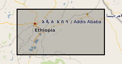
**THIS DATASET HAS BEEN WITHDRAWN** Ethiopia experienced severe drought in 2015-16. Many rural communities experienced declines in the performance of their water supply systems. As a result UNICEF commissioned a real-time monitoring and responsive operation and maintenance programme for point source rural water supplies across Central, Northern and Eastern Ethiopia. The water point monitoring survey was coordinated by UNICEF and conducted by World Vision Ethiopia and Oxfam Ethiopia. Data was collected between January and May 2016. Akvo Flow, a mobile survey tool, was used to collect data using questionnaires which were completed by enumerators and uploaded to central servers in near real time. The dataset includes data on functionality, access, usage and water quantity from 5196 rural water points. UNICEF provided the dataset to BGS. BGS reorganised, cleaned, and conducted quality control and analysis of the dataset. A companion paper has been published with more details of the methodology and results of the monitoring survey, https://doi.org/10.1038/s41467-020-14839-3
-
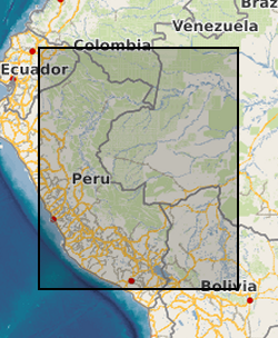
The dataset is the output of a NERC fellowship aimed to understand the long-term dynamics of tropical vegetation through palaeoecological analysis. For doing this, two sedimentary archives (Laguna Pindo and Laguna Baños) from Ecuador were radiocarbon dated and analysed for pollen, non-pollen palynomorphs, charcoal, chironomids, stable isotopes and XRF of tephra deposits. Each proxy was analysed at different resolution. Laguna Pindo is a mid-elevation lake (1250 m asl) that spans the last 50,000 years. Laguna Baños is an Andean lake located at 3800 m asl and contains sediments representative of the last 6500 years. Both water bodies are very shallow. The data is presented mainly in excel spreadsheets as raw data (except for radiocarbon dating data, which are the PDF files provided by NRCF), without any math treatment or conversion. Publication associated with NERC grant, Frazer Matthews-Bird, Stephen J. Brooks, Philip B. Holden, Encarni Montoya, and William D. Gosling (2016), Inferring late-Holocene climate in the Ecuadorian Andes using a chironomid-based temperature inference model. Clim. Past, 12, 1263-1280, 2016. doi:10.5194/cp-12-1263-2016