 NERC Data Catalogue Service
Dissolution
Type of resources
Topics
Keywords
Contact for the resource
Provided by
Years
Formats
Update frequencies
-
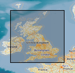
The 5km Hex GS Soluble Rocks dataset shows a generalised view of the GeoSure Soluble Rocks v7 dataset to a hexagonal grid resolution of 64.95km coverage area (side length of 5km). This dataset indicates areas of potential ground movement in a helpful and user-friendly format. The rating is based on a highest level of susceptibility identified within that Hex area: Low (1), Moderate (2), Significant (3). Areas of localised significant rating are also indicated. The summarising process via spatial statistics at this scale may lead to under or over estimation of the extent of a hazard. The supporting GeoSure reports can help inform planning decisions and indicate causes of subsidence. The Soluble Rocks methodology is based on the BGS Digital Map (DiGMapGB-50) and expert knowledge of the behaviour of the formations so defined. This dataset provides an assessment of the potential for dissolution within a geological deposit. Ground dissolution occurs when certain types of rock contain layers of material that may dissolve if they get wet. This can cause underground cavities to develop. These cavities reduce support to the ground above and can lead to a collapse of overlying rocks. Dissolution of soluble rocks produces landforms and features collectively known as 'karst'. Britain has four main types of soluble or 'karstic' rocks; limestone, chalk, gypsum and salt, each with a different character and associated potential hazards. Engineering problems associated with these karstic rocks include subsidence, sinkhole formation, uneven rock-head and reduced rock-mass strength. Sinkhole formation and subsidence has the potential to cause damage to buildings and infrastructure. Complete Great Britain national coverage is available.
-

The dataset gather data from a dual experiment conducted to the study (i) the stress dependence of ultrasonic (elastic) waves and permeability of salt rocks, and (ii) the monitoring of controlled dissolution in an intact halite sample and a cracked (fractured) one. The tests were run in the high-pressure room-temperature (20°C) experimental setup for flow-through tests at the National Oceanography Centre, Southampton (NOCS) (Falcon et al. 2016). The rig consists of a triaxial vessel equipped with (i) ultrasonic sensors that allow measuring P- and S-wave velocities and their attenuation factors using the pulse echo method (McCann and Sothcott, 1992), and (ii) two rigs of electrodes embedded into the rubber sleeve of the pressure vessel for collecting electrical resistivity data that can be used to build up an electrical tomography of the sample (North el al. 2013). The rig has automatic control of both confining and pore pressure (ISCO EX-100D system). For the operating conditions and in homogeneous samples, the bulk electrical resistivity error is <1% for bulk resistivities <100 Ω m, increasing up to 5% with the degree of heterogeneity and above this resistivity value, at frequencies 1–500 Hz (North et al., 2013). Regarding the ultrasonic data, the technique and instrumentation used in this experiment provide velocity precision of ± 0.1% and accuracy of ± 0.3% (95% confidence), and attenuation accuracy of ± 0.1 dB cm-1 within the frequency range 300-1000 kHz (Best, 1992). The dataset presented here show the ultrasonic data at a single frequency of 600 kHz, obtained from Fourier analysis of broadband signals. Permeability to water and to N2 can be both determined with the aid of integrated flowmeters and pore pressure sensors both up- and downstream of the rock sample. The rock samples include: Pre-Cambrian salt (unknown well, Pakistan (source: www.likit.co.uk/)), Cambrian salt (unknown well, Tunguska Basin, Russia), Triassic salt (Arm Hill #1 well, NW Lancashire, UK), and Messinian salt (3A GN3 S02 well, core # 19, near Marianopoli, Sicily). 2.5 cm length, 5 cm diameter core plugs were extracted from precursor rocks, composition estimated by X-ray diffraction analysis, and connected porosity by He-pycnometry. Falcon-Suarez, I., North, L., Amalokwu, K., Best, A., 2016. Integrated geophysical and hydromechanical assessment for CO2 storage: shallow low permeable reservoir sandstones. Geophysical Prospecting 64, 828-847, http://doi.org/10.1111/1365-2478.12396. McCann, C., Sothcott, J., 1992. Laboratory measurements of the seismic properties of sedimentary rocks. Geological Society, London, Special Publications 65, 285-297, https://doi.org/10.1144/gsl.sp.1992.065.01.22. North, L., Best, A.I., Sothcott, J., MacGregor, L., 2013. Laboratory determination of the full electrical resistivity tensor of heterogeneous carbonate rocks at elevated pressures. Geophysical Prospecting 61, 458-470, https://doi.org/10.1111/j.1365-2478.2012.01113.x.
-

The datasets contain FIB-SEM and X-ray micro-tomographic images of a wettability-altered carbonate rock sample before and after dissolution with reactive CO2-saturated brine at reservoir pressure and temperature conditions. The data were acquired with the aim of investigating CO2 storage in depleted oil fields that have oil-wet or mixed-wet conditions. Our novel procedure of injecting oil after reactive transport has revealed previously unidentified (ghost) regions of partially-dissolved rock grains that were difficult to identify in X-ray tomographic images after dissolution from single fluid phase experiments. The details of image files and imaging parameters are described in readme file.
-
The datasets contain 40 time-resolved segmented X-ray micro-tomographic images showing mineral dissolution of carbonate rock samples containing dolomite and calcite via CO2 acidified brine fluid flow at reservoir conditions. The tomographic images were acquired at a voxel-resolution of 5.2 µm and time-resolution of 33 minutes. The data were collected with lab based microCT, with an aim of investigating the influences of rock mineral and physical heterogeneity on dissolution patterns and changes to dynamic rock properties at the pore-scale. Further details of the experimental methodology can be found in Al-Khulaifi et al. (2019). These time-resolved tomographic images can be used to validate pore-scale multimineral reactive transport models.