 NERC Data Catalogue Service
Drawdown
Type of resources
Topics
Keywords
Contact for the resource
Provided by
Years
Formats
Representation types
Update frequencies
Scale
-
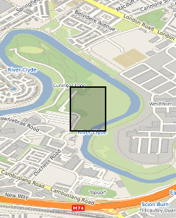
The data release includes initial interpretation from test pumping of boreholes at the UK Geoenergy Observatories (UKGEOS) Glasgow facility. This release from the British Geological Survey (BGS) covers a programme of test pumping carried out in ten boreholes in January and February 2020. It contains contractors reports and data sheets, BGS data sheets of data logger and manual dip data in the pumped borehole and in the observation boreholes. Step tests and five hour constant rate tests were performed in nine of the boreholes and a slug (falling/rising/head) test was performed in one borehole. Further details can be found in the accompanying report http://nora.nerc.ac.uk/id/eprint/530507
-
This layer of the Map based index (GeoIndex) shows where water wells exist with data available on transmissivity, storativity and discharge/drawdown. These parameters indicate the physical characteristics of the aquifer which can relate to factors such as possible storage capacities or rate of movement of water through the rock.