 NERC Data Catalogue Service
Earthquakes
Type of resources
Available actions
Topics
Keywords
Contact for the resource
Provided by
Years
Formats
Representation types
Update frequencies
Service types
Scale
-
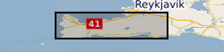
Contains location and associated parameter information for microseismicity detected in the Reykjanes peninsula between June 2020 and August 2021. Primary detection and location carried out using Quakemigrate. Template matching used to find very small magnitude events. GrowClust used to obtain accurate relative relocations. Local magnitudes of events also computed. Data from a total of 42 stations were used for the detection and location process. Repository also includes the 1-D velocity model used for the relocation.
-

Photos and videos collected during earthquake damage surveys of the village of Amatrice, central Italy. The earthquake struck on the 24th of August 2016 at 3:36 am local time, a Mw 6.2 earthquake struck a mountainous region of central Italy on the borders between Umbria, Marche, Lazio and Abruzzo. The Earthquake Engineering Field Investigation Team (EEFIT) mission ran from the 4th to the 15th of October 2016. The three main aspects investigated were the ground surface effects caused by the earthquake, the structural damage of masonry buildings and bridges and the effects of the earthquake on reinforced concrete structures and infrastructure.
-

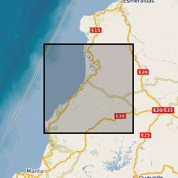
Ascii files and tables with earthquake source and model parameters for five events in the Azores archipelago.
-
Data collected as part of a UK/French/US collaborative effort to record aftershocks from the 2016 Pedernales Earthquake in Ecuador. The dataset comprises continuous seismic data recorded on broadband and short period instrumentation.
-

This is a collection of extracts from British newspapers describing earthquakes, mostly British. It contains original clippings, photocopies, and in a few cases manual transcriptions.
-
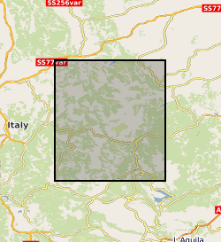
Terrestrial laser scanning datasets (including GPS data for georeferencing), structure from motion datasets, and field photographs collected during the 2016 Central Italian Earthquake sequence. Data were collected from multiple localities to capture the co- and post- seismic near-fault deformation along the earthquake surface ruptures. See the scan_data.xlsx for individual details of each laser scan location, and readme.txt for a complete description. In each scan site folder you can find the unprocessed raw files and processed ascii files. Note, not all processed files are georeferenced.This is due to time constraints on field data collection. Georeferencing for these data can be achieved by point cloud matching to other georeferenced scans. Photos for structure from motion (SfM) datasets were collected with a Nikon camera. All original photos are provided. Field photographs taken in the aftermath of the 2016 Norcia Earthquake (30th October 2016, Mw6.6) are also provided. Relevant references are: Wilkinson, MW, KJW McCaffrey, RR Jones, GP Roberts, RE Holdsworth, LC Gregory, RJ Walters, LNJ Wedmore, H Goodall, F Iezzi (2017). Near-field fault slip of the 2016 Vettore Mw 6.6 earthquake (Central Italy) measured using low-cost GNSS. Scientific Reports 7: 4612. Walters, RJ, LC Gregory, LNJ Wedmore, TJ Craig, K McCaffrey, M Wilkinson, J Chen, Z Li, JR Elliott, H Goodall, F Iezzi, F Livio, AM Michetti, G Roberts, E Vittori (2018). Dual control of fault intersections on stop-start rupture in the 2016 Central Italy seismic sequence. Earth and Planetary Science Letters 500, 1-14. Wedmore, LNJ, LC Gregory, KJW McCaffrey, H Goodall, RJ Walters (in review). Partitioned off-fault deformation in the 2016 Norcia earthquake captured by differential terrestrial laser scanning. Submitted to Geophysical Research Letters.
-
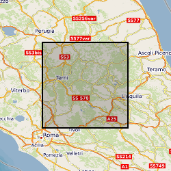
The data collection consists of 25 3-component broadband seismic station at 100sps (approx. 45mb per station, per day) located in the epicentral area of the 26th August 2016, M=6.0 Amatrice earthquake. The sequence evolved with strong mainshocks for over 6 months reaching a maximum magnitude of M=6.4 that struck Norcia town on October 30th, 2016. In line with SEIS-UK guidelines data was archived with the IRIS data management facility (https://ds.iris.edu/ds/nodes/dmc/) under the FDSN network code YR and using the network name “Amatrice Sequence International”. The project has the digital identifier https://doi.org/10.7914/SN/YR_2016.
-

The two earthquake scenario narratives are communications tools created to engage the local population and policy makers in Weinan city. They will be uploaded on the Overseas Development Institute website and be publicly accessible.
-
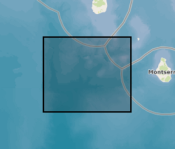
Earthquake hypocenters for all earthquakes detected on Montserrat by the Montserrat Volcano Observatory seismic network from July 1995 to February 2018 inclusive. Information includes: Origin Time, Latitude, Longitude, Depth, Hypocenter Errors, RMS and the number of stations used for each location.
-
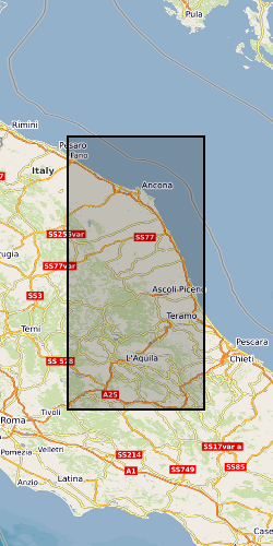
Single-frequency Global Navigation Satellite System (GNSS) observation data as daily files in compressed Hatanaka format. Near-field deployment of single-frequency receivers along the surface rupture of the 2016 Amatrice & Norcia earthquakes (Central Italy)