Geochemistry
Type of resources
Available actions
Topics
Keywords
Contact for the resource
Provided by
Years
Formats
Representation types
Update frequencies
Service types
Scale
Resolution
-
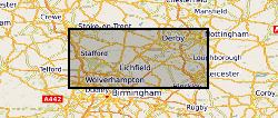
The full title of this project is" Studies into metal speciation and bioavailability to assist risk assessment and remediation of brownfield sites in urban areas" and is funded by NERC under the URGENT thematic programme form 1998-2001. The project is being undertaken by a consortium of workers from the Imperial College, University of Nottingham, and the British Geological Survey. Innovative collaborative and multi-disciplinary research will be applied to the interpretation of urban geochemical maps and associated meta-datasets to assist decision making by local authorities in the redevelopment of brownfield sites. Source apportionment, speciation and bioavailability of potentially toxic heavy metals will be studied at representative conurbations in the UK Midlands region. Scanning electron microscopy, chemical extractions and soil solution and vegetable analysis, will be integrated with high precision isotopic analyses of Pb and other potential toxic metals in this study. The results will be available as maps in GIS format to provide a generic decision support system for quantitative health risk assessment.
-
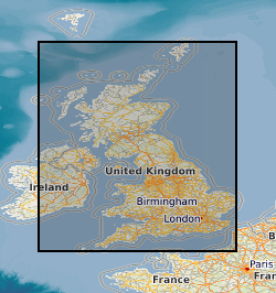
Data from projects that investigated the migration, transport and retardation processes of naturally occuring trace elements, as analogues the behaviour in the geosphere environment, of radionuclides from radioactive wastes. Study sites included: the Quaternary Broubster Peat Bog, near Thurso in Caithness (study of the migration behaviour and characteristics of U, Th, Ra, Pb, Cu, Zn, organic complexes such as fulvic and humic acids); the Needle's Eye site (Quaternary estuarine and marsh/mudflat sediments) on the Solway Coast of Dumfries and Galloway (study of the migration and retardation behaviour of U in Quaternary sediments and fractured Palaeozoic source rocks); Study of U geochemistry and transport behaviour from uranium-rich mine wastes at the South Terras Mine site, near St Austell, Cornwall; Study of the geochemistry of diffusion of Cl and I from marine source sediments into lacustrine sediments in Quaternary sediments from Loch Lomond. Data consists entirely of published reports of geological, geochemical, hydrochemical petrological and mineralogical information. The data includes descriptive and numerical data but is not digitally available in its present state.
-

Formation water geochemistry and gas geochemistry from 6 wells in the Olla Oil Field and 7 wells in the Nebo-Hemphill Oil Field Louisiana (Longitude range: -92.2297 to -92.1487, Latitude range: 31.83128 to 31.56586.), sampled in 2015. Formation water geochemistry for cation and anions and in mmol/l and ppm, these were measured at an internal ExxonMobil facility. Casing gases were used to make the remaining measurements. Stable noble gas isotopes (He, Ne, Ar, Kr, Xe) were measured at the University of Oxford Noble Lab for ratios and abundances (in cm3(STP)/cm3). Stable C isotopes of CO2 and CH4 and C2, C3 and C4 alkanes in ‰ VDPB as well as their mol% of the casing gas were measured by Isotech Inc.. Methane clumped isotopes are given as Δ12CH2D2 and Δ13CH3D and were measured at the California Institute of Technology. Where no data is present, no measurements were taken for that well. N.D. refers to not detectable.
-
Whole-rock geochemistry data of samples collected from Tindfjallajökull volcano, south Iceland. For further information, see Moles, J. D. (2018). Volcanic archives of past glacial environments: Tindfjallajökull volcano, Iceland. PhD thesis, The Open University. http://oro.open.ac.uk/id/eprint/62117. Geographical extent: Bounding box latitude and longitude: SW corner 63°42'N 19°46'W and NE corner 63°50'N 19°28'W.
-
Concentration data used to calculate sodium adsorption ratios for sediments collected from Tilling Farm and Warton sands saltmarshes. Extracts for cation analysis were prepared using methods highlighted in Rowell 1994 and Chirol 2021 (SAR = [Na+] /([Ca2+] + [Mg2+])0.5 with the concentration in mmol-1). Final cation conentrations and dilutions were calculated using sediment mass in 'mass for SAR calc'. Quality control (QC) for ICP analysis are also provided. SAmples were collected from varying depths and in triplicate.
-
Whole rock analyses (presented in parts per million, ppm) of volcanic samples from Mt. St Helens, Washington, USA. Detailed sample descriptions and given in Blundy et al. (2008) and references therein. All samples were analysed using solution ICP-MS at the Open University. Blundy, J., Cashman, K.V. and Berlo, K. (2008) Evolving magma storage conditions beneath Mount St. Helens inferred from chemical variations in melt inclusions from the 1980-1986 and current (2004-2006) eruptions, in: Sherrod, D.R., Scott, W.E., Stauffer, P.H. (Eds.), A volcano rekindled: the renewed eruption of Mount St. Helens, 2004-2006, Reston, VA, pp. 755-790.
-
Macrostrat.org is a live database project collecting geochemical, geospatial, and geochronological data associated with specific rock units within stratigraphic columns with a geographic footprint. The data in Macrostrat is an aggregate of previously reported measurements in the literature. The database is constantly updated, expanded, and improved. Hence, data are archived (5-2-23) in this file for posterity in support of the manuscript titled "Evolution of the crustal phosphorus reservoir" (Walton et al., 2023). In all measurements in the data file: ages are in millions of years (Ma) and elemental compositions are in wt%. Further details of all definitions and standards in Macrostrat data reporting are permanently available at https://macrostrat.org/api/defs. Macrostrat data are useful for weighting geochemical data by the relative areal and volume abundance of the rock units from which they derive, helping to address questions of (over/under) sampling-induced bias. Data in these files represent direct exports from Macrostrat.org via the API root, supplemented with data from Reinhard et al (2017). Unit areal extents for data from Reinhard et al 2017) are approximated with the relevant Eon average from Macrostrat.org. Macrostrat.org is maintained by Shanan Dr Peters, Dr Daven Quinn, and the hard work of many others (https://macrostrat.org/#people).
-
Soil samples collected in urban areas throughout the UK are analysed for their major and trace element geochemistry, their pH and organic matter content. Samples are collected at two depths; 0-15cm and 35-45cm at sites selected using a stratified, random design. The data can be used to identify and prioritize contaminated sites. In 1993, the Geochemical Baseline Survey Of The Environm (G-BASE) rural geochemical mapping programme was extended to include sampling in urban areas and to date around 22 urban centres have been sampled. Data is available on key inorganic contaminants including Cr, Cu, Cd, Ni, As, Pb, Zn, Sn and Sb. Results have been standardised to ensure seamless joins between geochemical sampling campaigns. Urban centres are selected in areas where rural sampling is undertaken or where the BGS urban programme is active. Urban centres will continue to be sampled until completion of the rural programme, scheduled for 2015.
-
The Mineral Reconnaissance Programme (MRP), funded by the DTI (Department of Trade and Industry) carried out baseline mineral exploration in Great Britain between 1972 and 1997. Its main aim was to stimulate private-sector exploration and the development of indigenous mineral resources. It has been subsumed into the new BGS Minerals Programme, also funded by the DTI. The Programme provides information and advice to industry, enables technology transfer and promotes wealth creation through the effective sustainable development of Britain's mineral resources. The database contains information from the MRP together with some from earlier programmes and the new Minerals Programme. Information from the early 1970s was largely concerned with the search for uranium and base-metals, while since the 1980s gold and platinum-group elements (PGEs) have dominated. A range of pathfinder elements have also been determined. Data is held on the geochemistry of drainage stream sediments, panned concentrates, soil, deep overburden, rock and drillcore samples. All geochemical results are used to populate corporate Geochemistry Database.
-
Radon is a natural radioactive gas, which enters buildings from the ground. The joint Public Health England (PHE) –British Geological Survey (BGS) digital dataset Radon Potential for Great Britain provides the current definitive map of radon Affected Areas in Great Britain. Exposure to high concentrations increases the risk of lung cancer. PHE (previously known as the Health Protection Agency or HPA) recommends that radon levels should be reduced in homes where the annual average is at or above 200 becquerels per cubic metre (200 Bq m-3). This is termed the Action Level. The PHE defines radon Affected Areas as those with 1% chance or more of a house having a radon concentration at or above the Action Level of 200 Bq m-3. The dataset allows an estimate to be made of the probability that an individual property is at or above the Action Level for radon. This information provides an answer to one of the standard legal enquiries on house purchase in England and Wales, known as CON29 standard Enquiry of Local Authority; 3.13 Radon Gas: Location of the Property in a Radon Affected Area. Radon Potential for Great Britain also provides information on the level of protection required for new buildings as described in the latest Building Research Establishment guidance on radon protective measures for new buildings (Radon: guidance on protective measures for new dwellings; BR 211, 2015 in Scotland, England, Wales and Northern Ireland). This radon potential hazard information for Great Britain is based on PHE indoor radon measurements and BGS digital geology information. This product was derived from BGS Geology 50 (formerly known as DigMap50 V3.14) and PHE in-house radon measurement data. The indoor radon data is used with the agreement of the PHE. Confidentiality of measurement locations is maintained through data management practices. Access to the data is under licence.
 NERC Data Catalogue Service