 NERC Data Catalogue Service
Geology
Type of resources
Available actions
Topics
Keywords
Contact for the resource
Provided by
Years
Formats
Representation types
Update frequencies
Service types
Scale
Resolution
-

This INSPIRE network service provides an Atom feed of predefined datasets that are available for download.
-
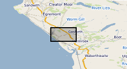
This is a spatial dataset containing polygons representing different geology types in the Moor House National Nature Reserve, northern Pennines, England. The survey was undertaken by G.A.L. Johnson under a grant by The Nature Conservancy in the 1950s and 1960s. Full details about this dataset can be found at https://doi.org/10.5285/0e3aefb2-ce86-4d09-8ff0-6d165dfd48db
-
A collection of reference drawings relating to investigations carried out by Nirex, during the period from 1989 to 1997. The drawings summarise the status of the geological investigation at Sellafield and include borehole locations, geology (surface, structure, sections etc) and geophysics (seismic, airborne, etc). Sites near Sellafield, in Cumbria, and Dounreay, in Caithness. The Nirex (Nuclear Industry Radioactive Waste Executive) geological archive was transferred to the British Geological Survey during 2000/2001. The BGS has undertaken to retain the records for a minimum of 50 years as part of its national geological archive. The ownership of Nirex was transferred from the nuclear industry to the UK Government departments DEFRA and DTI in April 2005, and then to the UK's Nuclear Decommissioning Authority (NDA) in November 2006.
-
Records of all onshore (or near shore) boreholes, trial pits, shafts and wells held in the BGS archives in either paper, microfilm or digital format. The records range from simple single page lithological logs through to hydrocarbon completion reports. Spatial coverage will vary considerably depending on drilling activity, collecting activity and donations. The majority of new data is from site investigation reports with concentrations in urban areas and along transport routes. Current collection over 1million records covering the whole of Great Britain with 50,000 new records added per annum. Some records date back to 1600 but the majority date from 1900 onwards. Copies of records are available in hard copy or digital formats subject to confidentiality.
-
The joint PHE-GSNI-BGS digital Radon Potential Dataset for Northern Ireland provides the current definitive map of radon Affected Areas in Northern Ireland. The Radon Potential map for Northern Ireland shows the estimated percentage of homes in an area exceeding the radon Action Level. This is the basic information to assigning the level of protection required for new buildings and extensions, as described in the Building Research Establishment guidance BR-413 Radon: Guidance on protective measures for new dwellings in Northern Ireland (2004). The Radon Potential map for Northern Ireland is based on PHE indoor radon measurements and 1:10 000 or 1: 250 000 scale digital geology information provided by the Geological Survey of Northern Ireland (GSNI). The indoor radon data is used with the agreement of the Northern Ireland Environment Agency and PHE. Confidentiality of measurement locations is maintained through data management practices. Access to the data is restricted. Radon is a natural radioactive gas, which enters buildings from the ground. Exposure to high concentrations increases the risk of lung cancer. Public Health England (PHE) recommends that radon levels should be reduced in homes where the annual average exceed 200 becquerels per cubic metre (200 Bq m-3), the Action Level. PHE defines radon Affected Areas as those with 1% chance or more of a house having a radon concentration at or above the Action Level. Further information on radon can be obtained from www.ukradon.org
-
Direct geological observations made during field work, tied to positional information collected by hand-held GPS.
-
Geological observations during field walks, with coordinates, photographs and descriptions of rocks/geological materials and features at the various stops.
-

The joint PHE-BGS digital Indicative Atlas of Radon in Great Britain presents an overview of the results of detailed mapping of radon potential, defined as the estimated percentage of homes in an area above the radon Action Level. The Indicative Atlas of Radon in Great Britain presents a simplified version of the Radon Potential Dataset for Great Britain with each 1-km grid square being classed according to the highest radon potential found within it, so is indicative rather than definitive. The joint PHE-BGS digital Radon Potential Dataset for Great Britain provides the current definitive map of radon Affected Areas in Great Britain.
-
The Land Survey Archives consists of records of the Geological Survey in Scotland for permanent retention dating from 1860s onwards. The collection comprises geologists' field notebooks, miscellaneous field observations and reports, historical and biographical material, correspondence files, photographs, etc. Includes archival material deposited by outside individuals and organisations, eg. NCB (National Coal Board) Bore Book Collection. Survey archival material for Northern England will be incorporated. Some 380 accessions held amounting to over 7,000 items. Indexed at collection level in Land Survey Record Index (LSRI). Plans abstracted and held separately in Land Survey Plans Collection.
-

Scanned images of the records of onshore Great Britain (or near shore) site investigation reports held in the BGS archives in paper, microfilm or digital format. The entire collections in BGS Edinburgh have been scanned, but in BGS Keyworth currently only new reports received since 2002. Scanning started in 2002 and is ongoing with new records being scanned and added to the collection. Images are stored in TIFF format (Tagged Image File Format). Indexed on the site investigation database and the boreholes within the report, and their images, are associated via the borehole database.