 NERC Data Catalogue Service
Gravel
Type of resources
Topics
Keywords
Contact for the resource
Provided by
Years
Formats
Representation types
Update frequencies
Scale
-
'Archive' collection of c.3,000 records of the former Industrial Minerals Assessment Unit (IMAU) relating to sand and gravel assessment projects in Scotland, 1978-88. Includes borehole and trial pit records, grading and resource assessment data and aggregate tests.
-
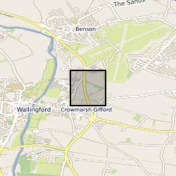
The borehole is located at the UK Centre for Ecology and Hydrology (UKCEH), screened between 2 and 4.5 m in the Thames gravels, and drilled to a total depth of 4.8m. It is located on an actively managed grass verge with popular and sycamore trees within 10 m. The stilling well is positioned 420 m west of the borehole in the River Thames. Both stage and groundwater level were monitored at 1-minutre frequency to investigate hydrological fractal scaling of high frequency data between 2012 and 2016. An automatic weather station is present between the borehole and stilling well and the data are available separately from UKCEH (stetur@ceh.ac.uk). Further site description is provided in: Habib, A. et al. 2017. Journal of Hydrology, 549, 715-730. Habib, A. et al. 2022. Hydrological Sciences Journal
-

The UK Sand and Gravel Database was compiled during the production of the Industrial Mineral Assessment Reports. The Department of the Environment commissioned this Report series from the British Geological Survey. Data collection extended from the first IMAU report in 1969 to the last report in 1990. The dataset is complete and is derived from reports with some additional boreholes that were never published. Standard procedures were adopted for whole project. Each report studied the sand and gravel resources of an area of between one hundred and two hundred square kilometres. Specially commissioned boreholes on a one kilometre grid basis were used in conjunction with existing geological knowledge to make a resource level assessment of the volume and quality of sand and gravel resource available. A total of 12,563 boreholes were drilled, 53,721 Lithological units described and 54,128 samples collected and graded. This information is presented in the appendixes of the individual reports and as a single database. Data collection is complete. Only factual corrections to the data are occasionally made. The dataset includes the borehole location, total depth, unit thickness, unit lithologies, and grading information.
-
This layer of the map based index (GeoIndex) shows the location of available Mineral Assessment Reports, the information for the index has been taken from the BGS UK Sand and Gravel Database. Each report studied the sand and gravel resources of an area of between one hundred and two hundred square kilometres. This layer shows individual polygons of the geographical areas covered by each report. Selecting the individual polygons via the map based index (GeoIndex) application gives details of the corresponding report title, number, author(s), subtitle and the date report was first published. The Department of the Environment commissioned this Report series from the British Geological Survey.