 NERC Data Catalogue Service
Lead
Type of resources
Topics
Keywords
Contact for the resource
Provided by
Years
Formats
Representation types
Update frequencies
Scale
-
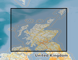
The BGS Estimated Ambient Background Soil Chemistry Scotland digital soil chemistry data indicates the estimated geometric mean topsoil concentrations (mg kg-1) of Arsenic (As), Cadmium (Cd), Chromium (Cr), Nickel (Ni) and Lead (Pb). The soil chemistry data is based on GBASE (Geochemical Baseline Survey of the Environment) stream sediment data converted to top soil equivalent potentially harmful element(PHE) concentrations. This dataset covers Scotland but data is available for the whole of Great Britain, with the exception of the London area where an inadequate number of geochemical samples are available at the moment.
-

This dataset has now been superseded, please see the Measured Urban Soil Chemistry dataset. The BGS digital point source urban soil chemistry data (GB_PointSourceUrbanSoilPHE_v1) comprises the locations and concentrations (mg kg-1) of Arsenic (As), Cadmium (Cd), Chromium (Cr), Nickel (Ni) and Lead (Pb) in urban topsoil samples. The data is derived from the national, high resolution urban soil geochemical data from the BGS Geochemical Baseline Survey of the Environment (G-BASE) project. The information is relevant for the first stage of any assessment of risks to human health required by regulatory authorities in relation to land use and also for assessing ecological risk. Although point source PHE (Potentially Harmful Element) concentrations above respective SGVs (Soil Guideline Value) do not necessarily imply a significant health risk, they do highlight the need to consider whether or not there may be a risk. The urban soil chemistry data can be used to assist Local Planning Authorities to identify those areas where a risk assessment may need to be carried out by developers. Comparison of this spatially referenced geochemical data with information on current or historic land use and geological information might help environmental professionals decide whether high PHE concentrations in topsoils can be attributed to geogenic or anthropogenic sources. The point source data is based on an interpretation of the records in the possession of the BGS at the time the dataset was created.
-
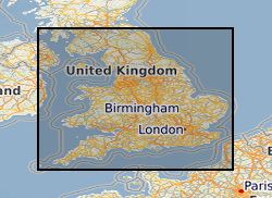
The Estimated Ambient Background Soil Chemistry England and Wales dataset indicates the estimated geometric mean topsoil Arsenic(As), Cadmium (Cd), Cr (Chromium), Nickel (Ni) and Lead (Pb) concentrations (mg kg-1). The soil chemistry data is based on GBASE (Geochemical Baseline Survey of the Environment) soil geochemical data where these are available. Elsewhere the stream sediment data are converted to surface soil equivalent potentially harmful element (PHE) concentrations. This dataset covers England and Wales but data is available for the whole of Great Britain, with the exception of the London area where an inadequate number of geochemical samples are available at the moment.
-

The Estimated Urban Soil Chemistry data are derived by spatial interpolation of the Measured Urban Soil Chemistry data. A unique feature of this dataset is the inclusion for the first time of estimated bioaccessible arsenic and lead data. The Estimated Urban Soil Chemistry data indicates the estimated geometric mean concentrations (mg kg-1) of Arsenic, Cadmium, Chromium, Nickel and Lead in topsoil derived by spatial interpolation of the Measured Urban Soil Chemistry data. Estimated bioaccessible As and Pb concentrations are derived using linear regression models of the relationship between total and bioaccessible concentrations. The Estimated Urban Soil Chemistry data can be used to assist Local Planning Authorities to identify those areas where a risk assessment may need to be carried out by developers. Comparison of this spatially referenced geochemical data with information on current or historic land use and geological information might help environmental professionals decide whether high potentially harmful element (PHE) concentrations in topsoils can be attributed to geogenic or anthropogenic sources. The dataset is based on, and limited to, an interpretation of the records in the possession of the BGS at the time the dataset was created. This dataset consists of two shape files Estimated Urban Soil Chemistry (As, Cr, Ni) and Estimated Urban Soil Chemistry (Cd, Pb).
-

A worldwide compilation of 189 analyses of U and Pb concentrations in olivine-hosted melt inclusions from ocean island magmas. These data were used in Delavault et al. (2016, Geology 44, 819-822) to calculate the present-day distribution of the U/Pb ratios in magmas generated in intraplate setting.
-

This dataset has now been superseded, please see the Estimated Urban Soil Chemistry dataset. There are two themes to BGS urban soil chemistry, the point source dataset and the estimated dataset. The point source urban soil chemistry data comprises the locations and concentrations (mg kg-1) of Arsenic (As). Cadmium (Cd), Chromium (Cr), Nickel (Ni) and Lead (Pb) in urban topsoil samples. The Estimated Urban Soil Chemistry data indicates the estimated geometric mean concentrations (mg kg-1) of As, Cd, Cr, Ni and Pb in topsoil derived by spatial interpolation of the Point Source Urban Soil Chemistry data. Both urban soil chemistry datasets are derived from high resolution urban soil geochemical data from the BGS Geochemical Baseline Survey of the Environment (G-BASE) project. The Urban Soil Chemistry data can be used to assist Local Planning Authorities to identify those areas where a risk assessment may need to be carried out by developers. Comparison of this spatially referenced geochemical data with information on current or historic land use and geological information might help environmental professionals decide whether high PHE concentrations in topsoils can be attributed to geogenic or anthropogenic sources. The dataset is based on, and limited to, an interpretation of the records in the possession of the BGS at the time the dataset was created.
-

Microscopy (Scanning Electron Microscopy, Cathodoluminescence Imaging) and U-Pb isotopic (Secondary Ionisation Mass Spectrometry) analyses of phosphate minerals in a suite of nine L chondrite meteorites (and one reference analysis of an LL chondrite). The dataset includes multiple SIMS spot analyses of phosphates in each meteorite, as well as images at multiple scales of all grains analysed. The data is reported and analysed in Walton et al., 2022 GCA.
-

The BGS digital estimated urban soil chemistry data (GB_EstimatedUrbanSoilChemistry_v3) indicates the estimated geometric mean concentrations (mg kg-1) of Arsenic (As), Cadmium (Cd), Chromium (Cr), Nickel (Ni) and Lead (Pb) in topsoil derived by spatial interpolation of the point source urban soil chemistry data. The information is relevant for the first stage of any assessment of risks to human health required by regulatory authorities in relation to land use and also assessing ecological risks. Estimated topsoil PHE (Potentially Harmful Element) concentrations above respective SGVs (Soil Guideline Value) do not necessarily imply a significant health risk but they do highlight the need to consider whether or not there may be a risk. Comparison of this spatially referenced geochemical data set with information on current or historic land use and geological information might help environmental professionals decide whether high PHE concentrations in topsoils can be attributed to geogenic or anthropogenic sources. The dataset is based on, and limited to, an interpretation of the records in the possession of the BGS at the time the dataset was created. An indication of high estimated PHE concentrations in soil does not necessarily mean that an individual site will have a high PHE concentration. Topsoil concentrations in urban areas are frequently characterised by strong spatial variation over short distances so this data should be interpreted and used with caution. The original urban topsoil samples were collected and analysed as part of the BGS Geochemical Baseline Survey of the Environment (G-BASE) project.
-
A worldwide compilation of 333 analyses of U and Pb concentrations in olivine-hosted melt inclusions from island arc magmas. These data were used in Delavault et al. (2016, Geology 44, 819-822) to calculate the present-day distribution of the U/Pb ratios in magmas generated in subduction setting.
-
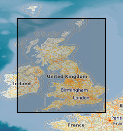
The BGS digital Measured Urban Soil Chemistry data comprises the locations and concentrations (mg kg-1) of Arsenic (As), Cadmium (Cd), Chromium (Cr), Nickel (Ni) and Lead (Pb) in urban topsoil samples. The data is derived from the national, high resolution urban soil geochemical data from the BGS Geochemical Baseline Survey of the Environment (G-BASE) project. The information is relevant for the first stage of any assessment of risks to human health required by regulatory authorities in relation to land use and also for assessing ecological risk. Although point source PHE (Potentially Harmful Element) concentrations above respective SGVs (Soil Guideline Value) do not necessarily imply a significant health risk, they do highlight the need to consider whether or not there may be a risk. The urban soil chemistry data can be used to assist Local Planning Authorities to identify those areas where a risk assessment may need to be carried out by developers. Comparison of this spatially referenced geochemical data with information on current or historic land use and geological information might help environmental professionals decide whether high PHE concentrations in topsoils can be attributed to geogenic or anthropogenic sources. The point source data is based on an interpretation of the records in the possession of the BGS at the time the dataset was created.